
Recommended
More Related Content
Similar to HYDROMETEOROLOGICAL HAZARDs and other related topics.pptx
Similar to HYDROMETEOROLOGICAL HAZARDs and other related topics.pptx (20)
Recently uploaded
Recently uploaded (20)
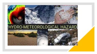
HYDROMETEOROLOGICAL HAZARDs and other related topics.pptx
- 5. HYDROMETEOROLOGICAL HAZARDS PHYNOTO is a low-pressure area, or a wide and violent tropical cyclone. It rotates in the counterclockwise direction, with warm air rising above Western Pacific Ocean warm water. TYPHOON
- 6. HYDROMETEOROLOGICAL HAZARDS LFODO - is characterized as superfluous water that swamps normally dry land and properties. FLOOD
- 7. HYDROMETEOROLOGICAL HAZARDS ANÑIAL represents periods of under-average sea surface temperatures across the Equatorial Pacific in the east-central. LA NIÑA
- 8. HYDROMETEOROLOGICAL HAZARDS MRSTO GRSUE is an abnormal rise in sea level during tropical cyclones or "bagyo". STORM SURGE
- 9. HYDROMETEOROLOGICAL HAZARDS MROTSREDNUHT – is local storm created by cumulonimbus clouds and are often accompanied by lightning and thunder, usually with strong wind gusts, heavy rain and occasionally hail and/or tornado. THUNDERSTORM
- 10. HYDROMETEOROLOGICAL HAZARDS ÑNOELI refers to the large-scale ocean-atmosphere climate interaction linked to a regular warming of sea surface temperatures around the Equatorial Pacific region and east-center EL NIÑO
- 11. HYDROMETEOROLOGICAL HAZARDS AFLSOHFLOD - is often caused by heavy rainfall in a short time span, typically less than 6 hours. FLASH FLOOD
- 12. National Disaster Management Plan of 2016 stated that HYDROMETEOROLOGICAL is a process or phenomenon of atmospheric, hydrological or oceanographic nature that may cause loss of life, injury or other health impacts, property damage, loss of livelihoods and services, social and economic disruption, or environmental damage.
- 13. Hydrometeorological hazards include: 1. Typhoon 2. Thunderstorm 3. Flood 4. Flashflood 5. Storm Surge 6. El Niño 7. La Niña
- 14. A. Tropical Cyclone also called typhoon or hurricane, an intense circular storm that originates over warm tropical oceans and is characterized by low atmospheric pressure, high winds, and heavy rain. SIGNS OF IMPENDING HYDRO-METEOROLOGICAL HAZARDS
- 15. (PAGASA)- Philippine Atmospheric Geophysical and Astronomical Services Administration WEATHER FORECAST is a scientific estimate of future weather condition, wherein a weather condition is a state of the atmosphere at a given time expressed in terms of the most significant variables.
- 16. How is a Weather Forecast Made? Weather forecasting is done by a Meteorologist; he/she must know about the existing weather condition over a large area. The accuracy of forecast decision is based on forecasting tools known as the Weather Map.
- 17. How is a Weather Forecast Made? 1st Step: Observation A meteorologist forecasts weather decision through surface observations at least every three hours over land and sea, and upper air stations at least every twelve hours. A NUMERICAL WEATHER PREDICTION is fed to the computer which analyzes data as programmed and makes a time integration of physical equations.
- 18. A NUMERICAL WEATHER PREDICTION is fed to the computer which analyzes data as programmed and makes a time integration of physical equations.
- 19. How is a Weather Forecast Made? 2nd Step: Collection and Transmission of Weather Data Collection and Transmission of Weather Data are condensed into coded figures, symbols and numerals are transmitted via radiophone, teletype, facsimile machine or telephone to designated collection centers for further transmission to the central forecasting station.
- 20. How is a Weather Forecast Made? 3rd Step: Plotting of Weather Data Observations on land and sea are plotted on charts of surface or mean sea level, which are prepared four times a day. Once the coded messages have been received, they are decoded, and each set of observations is plotted over the respective areas or regions in symbols or numbers on weather charts.
- 21. How is a Weather Forecast Made? 4th Step: Analysis of Weather Maps, Satellite and Radar Imageries and Other Data
- 22. How is a Weather Forecast Made? 5th Step: Formulation of the Forecast Upon completion of review of all available meteorological information / data, the preparation of forecasts follows. The first and one of the preliminary steps is to determine the position of the various weather systems and the actual weather over a given area as accurately as the data permits.
- 25. B. THUNDERSTORM This is a powerful, short-lived weather disturbance, almost always associated with lightning, thunder, dense clouds, heavy rain or hail, and fast, roaring winds. Thunderstorms occur when layers of dry, moist air rise to cooler regions of the atmosphere in a broad, rapid updraft.
- 26. B. THUNDERSTORM Thunderstorm forms through 3 stages: a) CUMULUS STAGE - Cumulus Stage where the sun heats the Earth's surface during the day and warms the air around it.
- 27. B. THUNDERSTORM b) MATURE STAGE - A cumulus cloud becomes very large, where the water therein becomes large and heavy, and raindrops begin to fall through the cloud when the rising air can no longer hold them up.
- 28. B. THUNDERSTORM b) MATURE STAGE - A cumulus cloud becomes very large, where the water therein becomes large and heavy, and raindrops begin to fall through the cloud when the rising air can no longer hold them up.
- 29. B. THUNDERSTORM c) DISSIPATING STAGE After 30 minutes, thunderstorm begins to dissipate, this occurs when the downdrafts in the cloud begins to dominate over the updraft.
- 30. C. FLOOD & FLASHFLOOD Flood is a high-water stage in which water overflows its natural or artificial banks onto normally dry land, such as a river inundating its floodplain.
- 31. C. FLOOD & FLASHFLOOD: TYPES OF FLOOD 1. Inland flooding is the technical name for ordinary flooding that occurs in inland areas, hundreds of miles from the coast. 2. Flash floods are caused by heavy rain or the sudden release of water over a short period of time. The name "flash" refers to their fast occurrence and also to their raging torrents of water that move with great speed. Flash floods are also caused by heavy precipitation in a short period of time, usually less than 6 hours.
- 32. C. FLOOD & FLASHFLOOD: TYPES OF FLOOD 3. River flooding occurs when water levels in rivers, lakes, and streams rise and overflow onto the surrounding banks, shores, and neighboring land. 4. Coastal flooding is the inundation of land areas along the coast by seawater. 5. Urban flooding occurs when there is a lack of drainage in an urban (city) area.
- 33. INLAND FLOOD
- 34. FLASH FLOOD
- 35. COASTAL FLOOD
- 36. URBAN FLOOD
- 37. RIVER FLOOD
- 38. D.STORM SURGE •Storm surge or "Daluyong ng Bagyo" in the Philippine system where the irregular sea- level rise during tropical cyclone or "bagyo" occurs. When the tropical cyclone reaches the coast, powerful winds force the ocean water over the coastal low-lying areas, which can lead to flooding.
- 41. E. EL NIÑO & LA NIÑA The term El Niño refers to the large-scale ocean- atmosphere climate interaction linked to a periodic warming in sea surface temperatures across the central and east-central Equatorial Pacific.
- 43. LA NIÑA La Niña episodes represent periods of below-average sea surface temperatures across the east-central Equatorial Pacific. Global climate La Niña impacts tend to be opposite those of El Niño impacts.
- 47. 1. Sinkholes are formed due to the gradual erosion of soluble rocks, such as limestone, over time. 2. Landslides can occur as a result of natural processes like heavy rainfall, earthquakes, or volcanic activity. 3. Sinkholes can be triggered by human activities, such as excessive groundwater extraction or improper construction practices. 4. Landslides can cause significant damage to infrastructure, including roads, buildings, and utilities. 5. Sinkholes can vary in size, from small depressions to large craters that can swallow entire buildings.
- 48. 6. Both sinkholes and landslides can pose risks to human lives and require appropriate precautions for safety. 7. Sinkholes can develop suddenly without any warning signs, making detection and prevention challenging. 8. Landslides can result in the blocking of rivers or streams, leading to the formation of natural dams. 9. Storm surge is local storm created by cumulonimbus clouds and are often accompanied by lightning and thunder, usually with strong wind gusts, heavy rain and occasionally hail and/or tornado. 10. Thunderstorm is a low-pressure area, or a wide and violent tropical cyclone. It rotates in the counterclockwise direction, with warm air rising above Western Pacific Ocean warm water.
Editor's Notes
- The Philippines being located in the Southeast Asia is considered very vulnerable to natural hazards and disasters, which include typhoons, earthquakes, floods, volcanic eruptions, landslides, and fires that affect the country and its inhabitants.
- The Philippines being located in the Southeast Asia is considered very vulnerable to natural hazards and disasters, which include typhoons, earthquakes, floods, volcanic eruptions, landslides, and fires that affect the country and its inhabitants.
- The Philippines being located in the Southeast Asia is considered very vulnerable to natural hazards and disasters, which include typhoons, earthquakes, floods, volcanic eruptions, landslides, and fires that affect the country and its inhabitants.
- The Philippines being located in the Southeast Asia is considered very vulnerable to natural hazards and disasters, which include typhoons, earthquakes, floods, volcanic eruptions, landslides, and fires that affect the country and its inhabitants.
- The Philippines being located in the Southeast Asia is considered very vulnerable to natural hazards and disasters, which include typhoons, earthquakes, floods, volcanic eruptions, landslides, and fires that affect the country and its inhabitants.
- The Philippines being located in the Southeast Asia is considered very vulnerable to natural hazards and disasters, which include typhoons, earthquakes, floods, volcanic eruptions, landslides, and fires that affect the country and its inhabitants.
- The Philippines being located in the Southeast Asia is considered very vulnerable to natural hazards and disasters, which include typhoons, earthquakes, floods, volcanic eruptions, landslides, and fires that affect the country and its inhabitants.
- The Philippines being located in the Southeast Asia is considered very vulnerable to natural hazards and disasters, which include typhoons, earthquakes, floods, volcanic eruptions, landslides, and fires that affect the country and its inhabitants.
- In the Philippines, cloudiness, rainfall and wind are the weather parameters with significant variation, and therefore of interest to the forecast users.
- The HIMAWARI 8/9 are geo-stationary weather satellites, successors to Japan Meteorological Agency's (JMA) Multi-functional Transport Satellite (MTSAT) series. Himawari 8 was launched by JMA in July 2015 and was installed at PAGASA last December 2015
- Meteorological satellites, geostationary and polar orbiting, take pictures of the cloud imagery of the atmosphere. These satellites take pictures of the cloud formations of the earth every hour, and continually, respectively.
- Since warm moist air can no longer rise, cloud droplets can no longer form.
- means The Little Girl in Spanish. La Niña is also sometimes called El Viejo, anti-El Niño, or simply "a cold event."