The new technological frontier in water resources management: the digital twin of the catchment area

ABSTRACT: How much water is there and when will it become available? These are the questions most water managers, like hydropower operators or water utilities, are asking to comply with water supply. The water discharge in a river is the result of a complex hydrological balance that starts in the upper part of the catchment and continues downstream: precipitation, snow melting, evapotranspiration, infiltration, and runoff are all processes that contribute to water availability. With climate change, current prediction procedures, often based purely on historical data, are incapable of following the new climatic trend. A new approach based on satellite imageries, physical models and machine learning is getting the edge in the market, with higher accuracy and a global reach: the Digital Twin aims to digitize processes in order to be replicated in a virtual concept, to better monitor water availability and forecast its evolution. BIO #1: Matteo Dall'Amico is the founder of MobyGIS. Management engineer by training, in 2010 he obtained a Ph.D. in Environmental Engineering with a specialization in hydrology and snow modeling. He is the author of publications in scientific journals and has contributed to the development of hydrological models in Italy and abroad. He has more than 15 years of experience in monitoring and forecasting services for water in favor of the hydroelectric sectors, municipal utilities of the water cycle, and civil protection. BIO #2: Stefano Tasin is an environmental engineer and is the CTO of MobyGIS. After graduating, he collaborated with the University of Trento in the development of hydrological models and the management of meteorological databases. He has solid skills in Python, R, C++, bash, awk, and in advanced management of structured and unstructured databases. Since 2017 he has been working at MobyGIS, where he is responsible for the IT infrastructure, model development, and data flow.

Recommended
Recommended
More Related Content
Similar to The new technological frontier in water resources management: the digital twin of the catchment area
Similar to The new technological frontier in water resources management: the digital twin of the catchment area (20)
More from Speck&Tech
More from Speck&Tech (20)
Recently uploaded
Recently uploaded (20)
The new technological frontier in water resources management: the digital twin of the catchment area
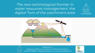
- 1. MobyGIS S.r.l. Registered office: via Guardini 24, 38122 Trento (Italy) | +39.0461.425806 | info@waterjade.com | www.waterjade.com The new technological frontier in water resources management: the digital Twin of the catchment area
- 2. Who we are by MobyGIS S.r.l. | www.waterjade.com
- 3. Water in industrial applications by MobyGIS S.r.l. | www.waterjade.com How much WATER is there And when will it become available? And how will it be?
- 4. State of the art by MobyGIS S.r.l. | www.waterjade.com Hydropower Water utilities historical data simplified models measurement campaigns
- 5. Climate change by MobyGIS S.r.l. | www.waterjade.com �� 𝞼
- 6. Impacts by MobyGIS S.r.l. | www.waterjade.com Service interruption Overflow Damages Penalties
- 7. Water cycle by MobyGIS S.r.l. | www.waterjade.com snow evapo-transpiration infiltration interaction with hydraulic works precipitation
- 8. Customer requirements by MobyGIS S.r.l. | www.waterjade.com Site-specific Accuracy Runoff decomposition Globally scalable Real time Granularity FLEXIBILITY TRACEABILITY REPRODUCIBILITY
- 9. Road map by MobyGIS S.r.l. | www.waterjade.com snow evapo-transpiration infiltration interaction with hydraulic works precipitation 2x accuracy Global reach Whatever climate
- 10. The Problem: model complex system by MobyGIS S.r.l. | www.waterjade.com Can we calibrate the model of this complex system? Can we optimize directly the level instead of water discharge? We need to couple hydrological and hydraulic models.
- 11. Digital Twin, what is it? by MobyGIS S.r.l. | www.waterjade.com A Digital Twin is a digital replica of an object, process or system that exists in the physical world, with a connection between the physical object and its virtual representation. Digital twins can be used to better understand the past, be used for real-time monitoring, remote control of systems and help predict or prevent future changes, through scenario-testing and strategic planning. What can we do with it? What is it?
- 12. Digital Twin components by MobyGIS S.r.l. | www.waterjade.com Reality Digital Sensors Actuators IT infrastructure Data Models Modeling framework
- 13. Data sources by MobyGIS S.r.l. | www.waterjade.com ● Different sources: ○ in-situ measurement ○ derived from model (NWP) ○ Earth Observation ● Different license: ○ proprietary ○ open data ● Different exchange protocol: ○ Rest API ○ ftp/sftp/scp ○ e-mail
- 14. Data structures by MobyGIS S.r.l. | www.waterjade.com ● Different data structures: ○ timeseries ○ raster ○ data cubes ○ unstructured ● Different format (NetCDF, grib, csv, SMET, Geotiff, …) ● Different Metadata Standard (CF Metadata Conventions) ● Different quality: raw or processed
- 15. Data management by MobyGIS S.r.l. | www.waterjade.com
- 16. Data management by MobyGIS S.r.l. | www.waterjade.com ElasticSearch Open-data hydrometers Observations Open-data meteo stations Meteo reanalysis Meteo forecast - GFS https:// https:// https:// FTP DB selector https:// Fetch and archive
- 17. Data management by MobyGIS S.r.l. | www.waterjade.com DB client DB client DAO DAO DAO Rest API Preprocessing: ● cleansing ● aggregate ● transform Downscaling Ensemble Quantile Seasonal forecast
- 18. Models by MobyGIS S.r.l. | www.waterjade.com Physical models ● simulate physics process with different level of complexity ● require deep domain knowledge ● need initial conditions and boundary conditions ● mass balance is preserved implicitly ● require less calibration data ● can be used to model other operational problems ● can be used to estimate unmeasured variables Statistical models ● does not require deep domain knowledge about physics ● can make use of all available sensor data ● low computational cost once trained ● not suitable with limited historic data ● problem specific and limited operational experience ● re-training required when operation condition changes
- 19. Physical Models for hydrology by MobyGIS S.r.l. | www.waterjade.com ● a simple calibration is needed ● no computational costs ● not very accurate Lumped ● more complex calibration is needed ● little computational costs ● can be very accurate ● it does not require calibration ● require a very good knowledge of the catchment ● large computational costs ● accurate for snow, but not for discharge ● they are often monolithic Distributed Semi-distributed
- 20. Generally used by us for: ● flood frequency analysis (Generalized Extreme Value distribution (GEV) ● weather generator implementation (synthetic precipitation time series) ● … Statistical models by MobyGIS S.r.l. | www.waterjade.com Classical models Thanks to their versatility, they are well suited for estimating the discharge or for forecasting the management of reservoirs and much more. ● Ridge Regression, Lasso Regression, Elastic-Net ● Artificial Neural Network (ANN) ● Recurrent Neural Network (RNN) ● Long Short Term Memory (LSTM) ● Facebook Prophet ● Computer Vision ● … Machine learning models
- 21. Runoff model Runoff/routing Model Linear reservoir Linear reservoir Linear reservoir Linear reservoir Infiltration model Discharge Quick Slow Rain Melting ET The runoff model can be implemented as a composition of other components: ● infiltration model; ● linear reservoir. by MobyGIS S.r.l. | www.waterjade.com Moore (1985)
- 22. Geomorphological response by MobyGIS S.r.l. | www.waterjade.com Direct Basin Connected Basin HRU HRU HRU HRU HRU HRU HRU HRU HRU HRU HRU HRU HRU HRU HRU Glacier Reservoir Pipe Intake
- 23. Next steps by MobyGIS S.r.l. | www.waterjade.com Data management Digital Twin Front-end interface
- 24. Next steps by MobyGIS S.r.l. | www.waterjade.com Are you a Computer scientist or a Data scientist? Send us your CV to careers@waterjade.com
- 25. 25 MobyGIS S.r.l. Registered office: via Guardini 24, 38122 Trento (Italy) | +39.0461.425806 | info@waterjade.com | www.waterjade.com Awards: THANKS FOR YOUR ATTENTION The Digital Twin of the catchment