
Recommended
Recommended
More Related Content
Similar to OpenStreetMap: State Of The Map New York 2015
Similar to OpenStreetMap: State Of The Map New York 2015 (20)
Recently uploaded
Recently uploaded (20)
OpenStreetMap: State Of The Map New York 2015
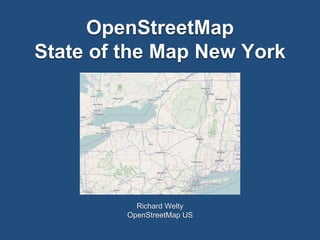
- 1. OpenStreetMap State of the Map New York Richard Welty OpenStreetMap US
- 2. Topics • Origins and current state of New York data in OSM • What needs to be fixed? • Opportunities for import from external data sources • Things to watch for when importing • NY in OpenHistorical Map (OHM) • NOT a tutorial
- 3. Current Data • Major Sources • TIGER • USGS • NYS DEC • National Hydrography Dataset • NYC DoIIT GIS Department • New York Public Library
- 4. TIGER • 2007 • OSM imported the 2005 TIGER road centerline data for most of the US • We have been dealing with the consequences of this ever since • Very early data import effort - we didn’t really know how to do imports well at the time • TIGER was in a state of transition at the time
- 6. TIGER Review • Even “good” TIGER data can use some care and attention • Review process consists of verifying name, connectivity, location, restrictions • persistent low level error rate in Capital District • often minor but still there
- 7. TIGER Review • Outside of well mapped areas, work needed • correcting poorly located roads in problem counties • County Routes in Western NY not correctly classified • long, slow process of TIGER review • New, better TIGER exists, but conflation is easier to say than it is to do
- 8. TIGER Review • “Old” (2007) TIGER in red • Newer (2012) TIGER in white • Sample from Schoharie County
- 9. TIGER Review
- 10. Administrative Boundaries • Original State & County boundaries in OSM came from USGS • quality not great • later import (2008) of City, Village, CDP boundaries from TIGER • not coordinated with previous USGS import, did not line up well • probably CDPs don’t actually belong in OSM
- 11. Administrative Boundaries • Effort over the past several years to clean up boundary mess using current TIGER boundaries • add Town boundaries • Hudson Valley complete • Some work done towards Western NY • NY/NJ borders substantially improved
- 12. Administrative Boundaries • NYS DEC boundaries • NHD - sporadically imported
- 13. NYC Buildings & Addresses
- 14. Opportunities • Big win if we can import building footprint and address data statewide • Needs to be done carefully, but the NYC import turned out beautifully, proving that it can be done well • Challenge: must be negotiated with individual data owners across the state • GIS Clearinghouse terms not compatible with OpenStreetMap license terms
- 15. Imports • Compatible license terms • Restrictions on redistribution are deadly • For example, CDTA bike racks can’t be imported due to redistribution restrictions in license • CC0 from Creative Commons works well • PD equivalent
- 16. Imports • Data quality • many of the existing data sets are excellent, but some are awful • Respect local mappers
- 17. Imports • Quality Control plan • Control for recognizing trouble • Plans for backing out if trouble happens • Consult with import committee
- 18. OpenHistoricalMap • Goal is to be the best completely out of date map in the world • OSM is trying to be current, OHM is a complement • Use OpenStreetMap tools and schemes as much as possible
- 19. OpenHistoricalMap • Lower Manhattan in 1854 • From New York Public Library
- 20. OpenHistoricalMap • NYPL looking at more complex historical GIS projects possibly involving OSM and OHM • Another potential NY project in OHM - historic wetlands
- 21. OpenHistoricalMap • Ghost Tracks • Documenting historic auto racing venues • Watkins Glen Circuits since 1948
- 22. Contact Info • rwelty@averillpark.net • @nfgusedautoparts • rwelty@albany.edu (second job)