
Recommended
More Related Content
Similar to Mapping the past of the Capital District
Similar to Mapping the past of the Capital District (10)
Recently uploaded
Recently uploaded (20)
Mapping the past of the Capital District
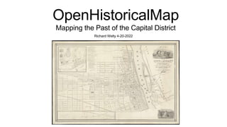
- 1. Richard Welty 4-20-2022 OpenHistoricalMap Mapping the Past of the Capital District
- 3. What is OpenHistoricalMap? •Derived from OpenStreetMap •OpenStreetMap is a free map of the world as it is •OpenHistoricalMap shares many tools and concepts, but is focused on the past •Goal is to be the most comprehensive, obsolete map of the world
- 4. What is OpenHistoricalMap? • Currently it’s mostly a blank canvas • People do projects in it of interest to them • City centers • Highway networks • Railways • Canals • I map defunct race tracks
- 7. The Albany Waterfront • Albany Waterfront • https://www.openstreetmap.org/#map=15/42.6500/-73.7464 • https://www.openhistoricalmap.org/#map=12/42.6447/-73.7420&layers=O&date=1815&daterange=1800,2022 • Sources • Albany Sanborn - https://mapwarper.net/layers/1237 • upstate 1952 - https://mapwarper.net/layers/1186 • Albany 1758 - https://mapwarper.net/maps/47466#Rectify_tab • Fort Orange archeological dig 1970 - https://mapwarper.net/maps/47601#Show_tab
- 8. The Albany Waterfront • Rapp Road • zoom into 1952 Aerial • https://www.openhistoricalmap.org/#map=17/42.69734/- 73.85087&layers=O&date=1900&daterange=1800,2022 • Erie Canal • 1834 Hutchinson Survey - https://mapwarper.net/layers/1421 • 1895 Schillner Survey - https://mapwarper.net/layers/1493 • NYS Canal System historical overview map - http://www.averillpark.net/Canal/Canal.html • Tour up the Hudson and over to the Mohawk - Erie Canal, Industrial revolution in Cohoes, changes to the Mohawk river when the Barge Canal was built