
Recommended
More Related Content
Similar to Making and Unmaking of Chandigarh - A City of Two Plans2-4-24.ppt
Similar to Making and Unmaking of Chandigarh - A City of Two Plans2-4-24.ppt (20)
More from JIT KUMAR GUPTA
More from JIT KUMAR GUPTA (20)
Recently uploaded
Recently uploaded (20)
Making and Unmaking of Chandigarh - A City of Two Plans2-4-24.ppt
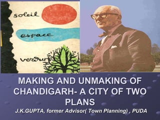
- 1. MAKING AND UNMAKING OF CHANDIGARH- A CITY OF TWO PLANS J.K.GUPTA, former Advisor( Town Planning) , PUDA
- 3. Lahore- capital of Punjab lost to Pakistan during Partition of India- 1947 locating capital in existing towns overruled for reasons of; Security, Centrality, Development & Ambiance of the capital Building new capital for East Punjab -- a necessity conceived in 1947. The capital city was supposed to: Create a center for state governance Rehabilitate refugees Recreate the rich legacy of Lahore Creating a symbol of the spirit and potential of independent India Establish a city with a vision of future- unfettered by traditions of the past.
- 4. For Selecting site-- State Government appointed a committee. Team zeroed on site in 1948, -- located in sub- mountanus region, --260 kms North of Delhi due to: Centrality-- Proximity- to National Capital. Sufficient water. Gentle gradient- for natural drainage. Absence of physical encumbrances mango groves/ temples marked site.
- 7. City -- planned for 0.5 million. Chandigarh-- to set an example in providing: - - Quality Urban planning& Development - generous infrastructure -- Best of support services, -Chandigarh first Indian city where ; - water, - drainage - electricity - would be available - even to “poorest of the poor”. - Vision -- a capital; - -- that would serve - as a role model for the nation - --in the art & science of city planning /architecture
- 8. Designing Chandigarh by Albert Mayer Near vacuum of local expertise made state to seek best of western skill to realize the dream of creating a beautiful city. Considering the financial other constraints and defined goals, the search was narrowed down to a good modern architect : capable of developing new concept suited to Indian climate, using locally available materials Meeting functions of the capital. Task assigned to ; American Planner Albert Mayer and associate Mathew Nowicki
- 9. First Master Plan- Albert Mayer
- 10. Designing Chandigarh by Albert Mayer Mayer defined Chandigarh in terms of: Fan shaped city. Curved and radial network of roads. Network of parkways. Super block- as the basic unit of residential planning first master plan decided Placing of Four major components of city including Capitol, University, City Center, Industrial Area, Capital occupying most prominent position City center - center of the city industrial area – South East position University- - North West position Neighborhood unit/ Super block- used in number of American projects -Baldwin Hills (1941) by Clarence Stein.
- 11. First Master Plan- Albert Mayer
- 12. ALBERT MAYER’S SUPER BLOCK • Super block measured 500 m x 1000 m in dimension Each super block consisted of three parts which contained housing, schools, shopping centers, others amenities. • 3 types of housing – Low, Middle and High income groups were inter-mixed.
- 13. Team – 2– Arrival of Le- Corbusier LE -CORBUSIER WITH BLUE PRINT OF MASTER PLAN OF CHANDIGARH
- 14. Re-designing Chandigarh by Le-Corbusier Sudden death of Nowicki-air crash in August 1950- changed destiny of Chandigarh. State Govt. approached Corbusier for completing city. Corbusier wrote in preparation of his first meeting with Mr. Thapar & Verma: It is the hour that I have been waiting for: India the humane and profound civilization. To construct a Capital. Urbanism is the activity of a society A capital is the spirit of a nation A set of tools It is a conjunction ….Le Corbusier is an optimist. His name is not mentioned but in 20 years of urbanism. L-C is in all the projects. It was indeed the hour Corbu waited for 24 years of frustrated efforts/ collapsed hopes From debacle of Palace of League of Nations competition in 1927 To his exclusion from final design of United Nations Head Quarters in 1947 With shelved Master Plans for half a dozen cities sudden arrival in summer of 1950 of two men from India was climax of Le Corbusier’s career.
- 15. In India Corbu was able to realize three of his continuing pre-occupations the city, the govt. complex and the cultural complex and had Museum of Knowledge been built in Capitol, he would have achieved his desire for fusion of the last two. Le-Corbusier appointed Architectural Advisor (two yearly visit of one month each) with Pierre Jeanerette, Maxwell Fry and Jane B Drew as members of the team. All four were members of the CIAM-The Congress Internationaux d’ Architecture Moderane-the ideology which played key role in designing the new city. Re-planning Chandigarh by Le-Corbusier
- 16. Agreement with second team included acceptance of Mayer’s Plan, designing capitol complex-- including buildings, Museum and implementing master plan prepared by Albert Mayer Team Corbusier had other ideas, told Fry and Drew: We will rectify the Master Plan . We must make a new beginning. In four days in February 1951 in Chandi Mandir, he redesigned the city. There was just sufficient overlap between two master plan for Mayer to sign the new one as co-author. The master plan of Chandigarh belongs to high tradition of modern architecture as represented by principles of CIAM. Re-planning Chandigarh by Le-Corbusier
- 17. LE CORBUSIER PIERRE JEANNERET JANE B(everly) DREW E(dwin) Maxwell Fry English Rendering Construction of a capital in Punjab-Chandigarh. Portrait of the Family which is responsible for the success of this undertaking DRAWING AND INSCRIPTION BY LE CORBUSIER French Original Construction d’ une capitale au Punjab Chandigarh Portrait de famille des responsables de la reussite de l’ entreprise. LE CORBUSIER’S TEAM
- 18. COLONIAL ARCHITECTURE VICTORIA HALL KOLKATA LE CORBUSIER’S MASTER PLAN – DESIGN APPROACH Critical factors impacting - architecture and urban form of Chandigarh were: Low budget for city($2.2m) Existence of plan prepared by Albert Mayer Strict adherence to budget /pre-conceived structure estimates prepared on Mayer’s Plan Large range of social services to be provided Which made Chandigarh A low density and A low rise city with Simple traffic system and sector layouts dictated by restricting cost of roads, service & infrastructures. Consideration of economy also dictated. choice of local bricks-- chief material for construction boulders/pebbles from rivers beds -- used in random patterns --creating a rich variety of surface texture.
- 19. COLONIAL ARCHITECTURE VICTORIA HALL KOLKATA LE CORBUSIER’S – DESIGN APPROACH Minimizing windows- sizes/glass-cost of wood work/glazing 7/ 11 times more than a brick wall. Standardizing- doors, window, sanitary fittings, ironmongery and Using pre-cost --roof battens to save on time and labour during construction. using manpower/not machinery for achieving economy. Chandigarh Architecture became product of: Protecting from sun/ dust laden winds of hot seasons discipline of cost, material, technology, climate created a box-like structures of bricks/ stone small windows protected by brise-soleil, jalis Which led to beginning of a style which Architects had not consciously sought became hallmark of Chandigarh architecture -Despite constraints,-- Corbusier promised a unique life to future inhabitants of capital city city.
- 20. LE CORBUSIER’S MASTER PLAN COBS WORKING LIVING CIRCULATION •The city plan based on four basic functions - Living - Working - Care of Body & Spirit-COBS - Circulation - - Re-siting Capitol - Reduced area to be acquired for city, •Mayer's fan shaped city with curved network of roads, changed adopting grid iron pattern of straight roads because: • - Circulation of traffic demands a straight line -The curve is ruinous, difficult and dangerous; -it is a paralyzing thing. -The straight line enters into all human history, -into all human aims, -into every human act. •Present urban form of Chandigarh is derived from: -Grid iron pattern with straight roads -Neighborhood units-sector. - circulation pattern based on 7vs (les sept voies) - grid of fast traffic with V3 roads defining edges
- 21. CO BS WO RKING LIVING CIRCULATIO N • The Radiant City •An organism capable of housing works of man of machine-age society. • placed under masterful government of natural conditions: •Sun •Space •Greenery • its mission is the service of mankind: •To live •To work •To cultivate body and spirit •To travel about (in this order and obeying this hierarchy)
- 22. COLONIAL ARCHITECTURE VICTORIA HALL KOLKATA •City planned for a population of 0.5 million to be realized in 3 stages. Stage-I (S1) Sector 1 to 30-- covering 3642 hectares for 150000 population a low density development of 41.12 persons per hectare(16ppa)with high order of infrastructure / amenities. Land to be allotted on free hold basis. Stage-II (S2) Sector 31 to 47- covering 2428 hectares for 350000 population, a high density development of 144.15 persons per hectare(56ppa) (3.5 times of stage 1). Land to be allotted on lease hold. • Stage-III (S3 ) • Re-densification of Stage-I -- to accommodate population exceeding 0.5 million without compromising with quality of life. S2 S1&S3
- 23. LE CORBUSIER’S MASTER PLAN Density of the sectors rising from north to south as social class of inhabitant becomes lower, city becomes a social map . Arrangement explained by Verma ; Le Corbusier wanted transition to more openness towards capitol and drainage system being more rational due to natural fall south-wards. Dry bed of subsidiary monsoon water-course made leisure valley meandering through town. Jane Drew called Master Plan-- a poetic significance, biological in context ,with Commanding head - Capitol Its heart -- commercial City Centre Its hand of productivity - Industrial area. Its hand of learning - University. Its brain and intellectual centers in Parkways where are located the museums, library etc. Roads as Arteries - carriers of Blood in shape of Traffic with Glass and Bricks as --Skin.
- 27. Sector Defined Sector-Container of basic human needs of: Living Working Care of Body and Spirits (COBS). Population varying between 5000-25000 Size 800mx1200m- based on human scale with 10 minutes walk to reach any activity/corner Sector planning based on principles of: Creating city within a city Making Chandigarh a 10 minutes walking city Self-contained / Self-sufficient Neighborhood unit. Safety from traffic- connecting man with nature Introvert in character no house opening on fast carrier of traffic bounded by fast traffic roads running on all four sides. With four entries, one from each side.
- 28. Sector Defined For linking with Greater Himalayas- a continuous green belt stretching North-East to South-West provided in centre of Sector. Green belt to house Education, Cultural, Religious and Community Buildings. All houses have setbacks(open area) in front and rear. Though plans of different Sectors not identical but they follow the same principles. Each Sector has a central green bisected by shopping street (V4). A loop road distributes the traffic in the interior (V5) intersecting the shopping street. Individual houses derive approach from roads- V6 & V7-branching out of loop road. Grouping of houses /density pattern derived on the basis of income. High income Sectors have low density and a pattern of detached houses.
- 29. Sector Defined For achieving higher densities, LIG Houses provided with terrace housing/built up houses on smaller plots. Sectors 7 & 8 are exception, planned on the Mayer’s concept of Super Blocks. Centre of focus -- V4 shopping street, V4-a curved road to slow down traffic with shops on one side (South-West) and verandah to provide shade to shoppers protection from sun/rain and to eliminate crossing of streets. Market linked with adjoining Sectors, forming a continuous ribbon. Variety of shops provided- from smaller booths to larger Shop-Cum-. flats Larger shops designed as three storyed buildings with shops on the ground floor and residence for owners on upper floors, Safe from traffic and in close proximity to the nature, sector constituted an attempt to create city within a city which provides for all the basic day to day material and social needs of the citizens in easy reach of the home, but at the same time linked to the larger scale of the city in terms of transport and services as well as architectural meaning.
- 31. LIVING- HOUSING
- 32. Housing focus of housing was: The Oxonian program comprised 13 categories of government housing Type 1 for Chief Minister to Type 13 for peons. Type 14 with minimum accommodation designed for poor- 2 rooms, a space for kitchen, bathroom and rear open space Three lowest categories of government housing subsidized to maintain minimum standards of amenities. Economy, Technology and Climate governed design /construction of houses. Architects bound to follow state directives regarding cost /type of accommodation. Type 7 designed as semi-detached --higher types fully detached with -- lower categories designed as terraced housing.
- 33. • Credit for designing Govt. housing goes to Pierre Jeanerette , Maxwell Fry and Jane Drew. • Pierre Jeanerette designed all 13 categories of government housing except type 3, 7 and 8. • House types named after initials of Architects. For example: 12F, 6J etc. • Indigenous devices - sun-breakers and jalis diffused the heat and provide sunlight and air. • Verandahs, courtyards and terraces for sleeping outside- included in most house types. • Locally made bricks used for load-bearing walls, parapets and sun-breakers. • Houses built mostly single-storyed or double- storyed. • Size of fenestration kept minimal to reduce cost • Number of innovations used to minimize cost / time for construction using pre-cast elements HOUSE TYPE 11-JC, CHANDIGARH
- 36. Type 9JA-a combination of exposed brick and plastered surfaces.
- 37. Le Corbusier, Croquis du complexe du Capitol, 12 avril 1952
- 38. Working- Capitol
- 39. Acropole d’Athènes, Le Corbusier
- 41. CAPITOL •City’s Focal Point - an admirable Park, Mountains, Trees, Flowers Architecture. •Its Architecture- most representative of Le Corbusier ’s work.Spread over100 hectares.Master plan asymmetrical Capitol consists of ; --four buildings (or “edifices”) -- six monuments --arranged in three interlocking squares. - Only three buildings realized- High Court, Legislative Assembly& Secretariat) - -- designed to represent 3 pillars democracy -Governor’s Palace, never built Chandigarh’s Capitol Complex was on Sunday, July 16,2016- declared by UNESCO as World Heritage -- at the 40th session of World Heritage Conference in Istanbul, Turkey.
- 42. Capitol Planned and developed to be pedestrian, man master of himself, on his own feet, walking and living free of fear, automobiles prohibited in park. • Clear segregation of pedestrian and vehicular movements with land arranged on two levels: a pedestrian plateau and 5 meters below -roads and parking. Length of Esplanade- a long, open, level area, typically beside the sea, along which people may walk for pleasure-- between High Court and Assembly -- distance 450 mt- -- Same between Hayward Gallery to Country Hall on London’s South Bank
- 43. Secretariat -- largest in Capitol Complex - Houses both state Govts. Of Haryana / Punjab. - - long / horizontal rough concrete structure - 254 meters (833 feet) long, 24 meters wide, and 42 meters (138 feet) high. - Defines western edge of Capitol Complex - -- building consists of eight floors - - with 6 blocks separated by expansion joints. - -Building bears close resemblance to Marseilles apartment - structure exteriors defined by exposed concrete ramps and small square windows. - building designed to manage sun - Green Roof minimizing heat transfer - -Positioned North- South, with central corridor - Minimising maintenance /promoting sustainability - -enhances splendor of Capitol Complex - - Project completed 1952
- 46. COLONIAL ARCHITECTURE VICTORIA HALL KOLKATA SECRETARIAT
- 48. COLONIAL ARCHITECTURE VICTORIA HALL KOLKATA STATE ASSEMBLY -- PARABOLIC AND TRIANGULAR ROOF
- 49. COLONIAL ARCHITECTURE VICTORIA HALL KOLKATA ASSEMBLY HALL Conceived as horizontal structure –square in plan Architecture not restricted to entrance,/ façade, but to functions of program/ spaces within the building itself.-- 300 ft. square, three sides – house offices and conference rooms fourth side -- enormous portico which ‘orients’ building towards High Court Centre-- is an interior court, 200 ft. across, -- ranging from 35 ft. to 45 ft. in height, -- located -- hyperbolic form of assembly chamber, Rectangle (surmounted by a skew pyramidal roof) of council chamber Louvers extensively used to manage sun / give distinct character to building Extraordinary collection of spaces, ramps / platform levels that make up forum.
- 52. COLONIAL ARCHITECTURE VICTORIA HALL KOLKATA INTERIOR- STATE ASSEMBLY Interior of dome painted in three horizontal bands-red, yellow and white to modulate height of
- 53. Ceremonial Door - 25 square foot door, with enameled panels-- airlifted from Paris. Door opened only on ceremonial occasion Door adorned with vibrant colours - divided into upper and lower halves. - upper half- depicts man's relationship with cosmos, includes -- imagery representing solstices, eclipse and Equinox, - Lower half -- house animals and natural forms. - desert depicts original order of Earth, - - greenery represents Garden Of Eden. - -- door also displays rivers, trees, bulls, turtles, and - -proverbial Tree of Knowledge in centre of door bears fruits of knowledge.
- 55. High Court • Designed as linear block facing piazza. Special entrance for judges created -- high portico resting on three giant pylons painted in bright colours- Using tradition of Buland Darwaza of Fatehpur-Sikri to manifest - Majesty of the Law to all who enter. Courtroom of Chief Justice / eight smaller courts, divided by a great entrance hall. Great portico symbolism "umbrella of shelter" of law to ordinary citizen visually punctuate otherwise rhythmic facade of High Court. Each courtroom provided with an independent entrance from piazza- Colourful tapestries-- one each courtroom, covering entire rear wall -- 12 /8metres square in main courtroom /smaller courtrooms. Symbols of man, earth, nature, emblems of India, scales of justice depicted in abstract, geometric patches. used for promoting acoustical reasons.
- 57. COLONIAL ARCHITECTURE VICTORIA HALL KOLKATA INTERIOR OF CHIEF JUSTICE COURT ROOM CHANDIGARH
- 60. COLONIAL ARCHITECTURE VICTORIA HALL KOLKATA GOVERNOR’S PALACE
- 61. MONUMENTS
- 64. TOWER OF SHADOWS
- 65. TOWER OF SHADOWS
- 68. City Centre
- 70. City Centre- Sector 17 Designated as civic/ commercial centre of city spread over 290 acres consists of three large plazas flanked by retail/ institutional buildings. commercial zone/ civic zone. Commercial zone -includes Shop-cum-office, five cinemas, Central Library, Town hall, Post & Telegraph Office, Bank Square, Petrol Pumps, Police Headquarter, Hotels, proposed Eleven Storeyed block . Civic zone includes Interstate Bus Terminus, Fire Station, Exhibition /Parade Ground, District Courts, Treasury Office, Police Station Police Housing, and Football Stadium “System of Construction /Architectural Treatment of Exterior Controls” four-story height for all commercial buildings, flanked by seven storied blocks. Max height restricted to 57’7”. With bay size (17’-3") / 11’10” feet wide compulsory verandah on ground floor and a unifying exterior pattern of columns and standardized concrete balustrades.
- 71. • A central piazza with two wide promenades running horizontally and vertically is the focus. • Like Capitol Complex - segregation of vehicular and pedestrian traffic • Vehicles confined on the periphery of the central place • Pedestrian Plaza surrounding by important public buildings. • Vehicular traffic cross the central plaza at raised level i.e. Over bridges. • Provision for parking made at both ground/underground level. • Eleven storyed tower planned to give a sense of urbanity
- 73. PARKING IN SECTOR 17 CITY CENTRE
- 75. SECTOR 17 PLAZA
- 77. VIEW OF PLAZA, SECTOR 17 AT NIGHT
- 83. Changing Context of Sector 17
- 85. Care of Body & Spirit (cobs) Caring for physical /meta- physical health of city/residents. Education--College of Arch. PEC, Punjab University; Colleges of men & women, Home Science, Polytechnic. Culture--College of Arts, museum, art gallery, Centre of performing arts, Tagore theatre, Leisure --Valley of leisure- transforming 6 meter deep seasonal rivulet-- width ranging from 100 to 300 meters depression-- into drainage channel for rainwater -- a linear park running full length of city vertically with undulating landscape, water features, host of trees, sports studio unifying sectors of different densities/characters. - seasonal river on eastern side dammed to create an artificial lake-Sukhna, lake club, golf club, Chandigarh club Rajindra park, Rose garden, Japanese Garden Golf course and golf club --,Sports complexes and sports stadiums . COBS WORKING LIVING CIRCULATION
- 86. Chandigarh Master Plan- Le Corbusier
- 97. Garden of Palms- Leisure Valley
- 99. • Manmade water feature • Conceived by Le Corbusier, • As a gift to city for; • modulating micro- climate • Recharging Ground Water • providing dramatic vistas of Capitol and Mountains. • 3-km long 14m high earthen dam created. • No vehicular movement permitted • Planned as Pedestrian Paradise • WHERE PEACE and TRANQUALITY ALWAYS PREVAILS
- 104. • Designed by Le Corbusier. • around a central Courtyard. • Simple structure. • Single-storyed bldg. sunk 3-M below road level --so that structure does not dominate
- 105. COLONIAL ARCHITECTURE VICTORIA HALL KOLKATA • CHANIGARH MUSEUM---SQUARE SPIRAL PLAN • BUILT ON COLUMNS HAVING ENTRANCE AT GROUND LEVEL
- 106. COLONIAL ARCHITECTURE VICTORIA HALL KOLKATA COLLEGE OF ARCHITECTURE FRONT FAÇADE ADORNED WITH DEEP SCREEN OF PRE- CAST CONCRETE, A SORT OF MINIATURE brise-soleil
- 107. COLONIAL ARCHITECTURE VICTORIA HALL KOLKATA GANDHI BHAWAN, PANJAB UNIVERSITYPLACED IN THE POOL OF WATER TO CREATE A QUIET, MEDITATIVE ATMOSPHERE
- 108. CIRCULATION SYSTEM - RULE OF 7Vs
- 109. CIRCULATION SYSTEM System of roads based on the system of 7Vs ( les sept voies) evolved for urban traffic by CIAM. Symbolizes-- structure and discipline of a tree. Describes hierarchy of roads. importance and speed. meets need of fastest / slowest traffic of bicycles/pedestrians. The role and function of 7Vs defined as under: V1: Arterial roads -bringing traffic from outside to city. V2: Major Avenue – most important streets in town - forming major axes of the city - connecting important nodes. V3: Sector-definer- for fast moving traffic V4: Shopping streets, V5: Distributor road V6: Smallest road leading to individual houses. V7 Pedestrian pathways running through open space . V8 bc: Bicycle tracks running through the green belt. Fast traffic absorbed by V2 & V3s whereas intra-sector traffic taken care by V4, V5 & V6 Network of 7Vs- most economical allowed slow moving traffic to reach every door with small area taken up by circulation leaving vast spaces free.
- 110. CIRCULATION SYSTEM For catering to growing traffic/ uninterrupted flow of traffic, inter- section of V3/V2 roads were planned for a four stage development first stage-- intersection to consist of a small roundabout. second stage- auxiliary turning lanes would be added. An underpass shall be added --in third stage and In final phase-- an overpass planned to meet final requirement of traffic. No road is to be named after any individual etc. Roads named according to direction, importance and attributes. All V2 roads -- called Margs (Avenue) and V3 called -- Paths (Street).
- 112. JAN MARG DURING THE DAY
- 113. A VIEW OF THE SHIVALIK HILLS AND JAN MARG LEADING TOWARDS CAPITOL COMPLEX
- 115. JAN MARG DURING THE DAY
- 118. Chandigarh Landscaping Chandigarh -- carefully planned, designed and planted city of India Blessed with sun, space & verdure as basic forces of town planning and Architecture -Chandigarh landscaping guided by: Marrying buildings with trees for harmony and linking man with nature. Linking mass of buildings and enhancing their architectural quality through textures, colours and contrast. Providing individuality to each element of city design. Bio-aesthetic planning based on selecting trees based on--colours, foliage, shape of crown, utilities aesthetic , architectural appeal and contrast Plan evolved based on planning principles adopted for city i.e. -- living, -- working , --cobs and circulation.
- 119. Chandigarh Landscaping Capitol/garden attached to governor’s palace to have variety of evergreen trees with colours in all seasons. All existing mango trees preserved. Geometric hill planted with evergreen trees . horizon to be shutoff with green wall of trees. . V2 / V3 (vertical) to have evergreen trees with large umbrella like crown to form tunnel for safety from glare of the sun. V2 and V3 (horizontal) to have trees of light foliage Pedestrian pathway to have deciduous trees to allow sun in winter and provide shade in summer. V4- to have distinct character by planting trees with mixture of foliage /colour like yellow, red and blue for entire row. All open spaces within Sectors planned and landscaped Major gardens to be developed along the leisure valley besides zoological gardens and botanical gardens.
- 121. ARIEL VIEW OF THE ROSE GARDEN
- 126. Industrial Area Industrial area Chandigarh conceived as administrative and not industrial city. 1262.78 Acs brought under industrial development in Phase-1&II 776.14 Acs of area on south-east periphery designated for industries located in close proximity of railway and highway connecting Delhi. For ensuring pollution free environments, no industry emitting smoke/pollution permitted. Industrial and residential area separated with a green belt of 150 meter width. Green belt to be planted with fruit bearing tree, to meet the food related needs of the residents.
- 127. Industrial Area Industrial area Additional 486.14 Acs developed as Phase-II , in continuation of Phase-I industrial Area. However, no green buffer left between residential / industrial area. Phase –III industrial Development proposed in an area of 153 Acs. I T park developed later in 352 Acs with proposed addition 0f 270 Acs. Industrial Plots permitted to be converted into commercial use leading to number of shopping malls and hotels coming in the area. Industrial area present a picture of chaos and anarchy violation of basic principles of pure land use planning including problems of parking and infrastructure.
- 130. Development Controls Developmental Controls Two sets of controls made applicable Within city Outside city Entire City subjected to Developmental Controls City Zoned -- used/developed for specific purpose. Built Environment under strict control comprising of : defining edges of buildings setbacks maximum height use of materials and Openings Different set of controls applicable to different area depending upon importance. All commercial areas under architectural control.
- 131. Development Controls Within City Zoning control Full architectural control System of construction & architectural treatment. Design control. Architectural controls Frame control. Gates and Boundary walls. Advertisement control. Tree preservation order. Outside city Periphery control
- 132. Development Controls – Within City Full architectural controls Applicable to all commercial buildings and Residential houses along shopping street V4 Controls related to houses include Defining building lines Height of buildings Building materials For commercial area Complete standard design provided including the detailed design. System of construction & architectural treatment. Applicable to all the buildings in city centre. All commercial buildings along V2 Avenues Control in city centre include A grid of columns Fixed floor height Shuttering pattern on concrete System of glazing/screen wall behind columns Interior left the discretion of the owner. For buildings along V2 in addition to the principles of city centre, the control includes façade treatment.
- 133. Development Controls Design control For special buildings in architectural controlled area, schematic design is prepared on the basis of which the architect evolves design in consultation with the Chief Architects. System applies to cinemas/petrol stations etc. Architectural controls Applicable to residential buildings along the important areas like Uttar Marg and along the leisure valley. Design is to be prepared by a qualified Architect in consultation with the Chief Architect to maintain architectural standard in the area. Frame controls Most important control followed in residential plots upto 250 sq. yards. Bulk of houses in smaller category of 250 sq. yards and below. Followed where the housing is to be terraced housing. Introduced due to lack of control which led to extremely poor/substandard kind of architects. No prediction of what neighbour would do. Achieving good street picture became impossible. Control comprises of Fixing the extent and height of the party walls. A top connecting course making the frame. Standards size of doors and windows. Harmony provided by the frame and variety by the individual treatment of building.
- 134. ARCHITECTURAL CONTROLS COMMERCIAL – SECTOR 17
- 135. ARCHITECTURAL CONTROLS COMMERCIAL – SECTOR 17
- 136. ARCHITECTURAL CONTROLS COMMERCIAL – V4
- 137. ARCHITECTURAL CONTROLS COMMERCIAL – V4
- 138. ARCHITECTURAL CONTROLS COMMERCIAL – V4
- 142. Development Controls Gates and Boundary walls All gates and building walls to conform to standard designs adding unity to the street picture. Advertisement control. Control to take care of visual pollution in the city To regulate display of advertisements on the building and in the city. To specify size, space, location and kind of display to be used in advertisement. Tree preservation order All existing trees to be treated as preserved. No removal of trees allowed without permission. Sanction granted for removal in rare cases of extreme hardship New trees to be planted in lieu of tree removed. No hopping, lopping and chopping of trees allowed without permission.
- 143. Developmental Controls – Outside City Periphery City and periphery two distinct related but inter- dependent entities, with different functions to perform city providing services and periphery providing daily needs. their functions must not inter-change attempt to interchange functions would lead to anarchy. The Punjab New Capital (Periphery) Control Act, 1952 aims at: Protecting Chandigarh against haphazard, unplanned development. providing area for future expansion eliminating growth of slums meeting daily needs of the residents. preserving the character of the area. Harmonizing development of the city and periphery. 8 km belt around Chandigarh reserved as periphery Extended to 16 km in 1962 considering the pressure of development.
- 144. PERIPHERY CONTROL The Punjab New Capital (Periphery) Control Act, 1952 aims at: providing area for future expansion eliminating growth of slums meeting daily needs of the residents. preserving the character of the area. Harmonizing development of the city and periphery.
- 146. Periphery Control Act of 1952 was established to regulate development within a 16 Km limit beyond the city. As per this act, “No person shall erect any building or lay out any means of access to a road, in the controlled area except such building as is required for purposes subservient to agriculture, poultry, dairy, etc. Periphery area around 1430 sq. km. largest part with state of Punjab (76%) Haryana 21% Chandigarh left with 3%,
- 147. SEWER MANHOLE
- 149. EDICT OF CHANDIGARH First City to have Edict in the country The object of this edict is to Enlighten the present and future citizens of Chandigarh about the basic concepts of planning of the city so that they become its guardians and save it from whims of individuals. This edict sets out the following basic ideas underlying the planning of the city. Human scale The city of Chandigarh is planned to human scale. It puts us in touch with the infinite cosmos and nature. It provides us with places and buildings for all human activities by which the citizens can live a full and harmonious life. Here the radiance of nature and heart are within our reach.
- 150. EDICT OF CHANDIGARH Sectors This city is composed of sectors. Each sector is 800 meters by 1,200 meters, enclosed by roads allocated to fast mechanised transport and sealed to direct access from the houses. Each sector caters to the daily needs of its inhabitants, which vary from 5,000 to 25,000 and has a green strip oriented longitudinally stretching centrally along the sector in the direction of the mountains. The green strip should stay uninterrupted and accommodate schools, sports fields, walkways and recreational facilities for the sector Vehicular traffic is completely forbidden in the green strips, where tranquility shall reign and the curse of noise shall not penetrate.
- 151. EDICT OF CHANDIGARH ROADS: The roads of the city are classified into seven categories, known as the system of 7 Vs, V-1 -- Fast roads connecting Chandigarh to other towns; V-2 -- arterial roads; V-3 -- Fast vehicular roads; V-4 -- Meandering shopping streets; V-5 -- Sector circulation roads; V-6 -- Access roads to houses; V-7 -- footpaths and cycle tracks Buses will ply only on V-1, V-2, V-3 and V-4 roads. A wall shall seal the V-3 roads from the sectors. Areas of Special Architectural Interest Certain areas of Chandigarh are of special architectural interest. Where harmonized and unified construction of buildings is aimed at, absolute architectural and zoning control should remain operative.
- 152. EDICT OF CHANDIGARH Along V-2 central, dual carriageways, Madhya Marg and Uttar Marg, where skyline, heights, character and architecture of buildings as planned shall not be altered. Along V-2 beyond dual carriageway areas are reserved for cultural institutions only and shall never have any residential buildings No building shall be constructed north of the Capitol Complex CITY CENTRE The central plaza in Sector 17 was designed as "Pedestrian's Paradise". No vehicular traffic will be permitted in the plaza.
- 153. EDICT OF CHANDIGARH Industrial area Only such industry as is powered by electricity would be permitted in the Industrial Area, so that atmosphere is saved from pollution. The Lake The Lake is a gift of the creators of Chandigarh to the citizens to be at one with the lake and its environments and its tranquility shall be guaranteed by banning noises.
- 154. EDICT OF CHANDIGARH LANDSCAPING The landscaping of this city is based on careful observation of the vegetation of India. Selected ornamental trees, shrubs and climbers have been planted according to colour schemes to beautify it. In future planting and replacements, these principles must be kept in view. There should be no haphazard replacements, so that the avenues retain their harmony and beauty. Leisure Valley, Rajendra Park and other parks shall be developed as parks only and no building other than already planned shall be permitted.
- 155. EDICT OF CHANDIGARH No Personal Statues Shall Be Erected The age of personal statues is gone. No personal statues shall be erected in the city or parks of Chandigarh. The city is planned to breathe the new sublimated spirit of art. Commemoration of persons shall be confined to suitably placed bronze plaques. Truthfulness of Building Materials To Be Maintained: The truthfulness of materials of constructions, concrete, bricks and stone, shall be maintained in all buildings constructed or to be constructed. The seed of Chandigarh is well sown. It is for the citizens to see that the tree flourishes.
- 157. CHANDIGARH CITY IN TRANSITION 72 years later, as Chandigarh expands inwards / onwards, horizontally/vertically, city faces numerous challenges due to: Change in administrative status. Enormous population growth. Proliferation of slums. Rapid growth of informal markets. High degree of Traffic congestion. Growth of urban/Rural villages. Changing character of city as Regional Centre. Change of land use-Industrial to Commercial Changing context of the periphery.
- 158. CHANGED STATUS OF CITY Chandigarh originally conceived as a capital of state of Punjab. In 1966 post re-organization, city became union territory and also capital of states of Punjab & Haryana. As a Union Territory Chandigarh headed by Chief Administrator. In 1984, disturbed condition placed Chandigarh under the Governor of Punjab as Administrator with advisor to administrator given the charge to run city on day to day basis 1. In 1994, Municipal Corporation Chandigarh setup under 74th Constitutional Amendment Act 1992.
- 159. CHANGED STATUS OF CITY Municipal Corporation looks after maintenance/upkeep of roads, open spaces, w/s, sewerage, swd, development in surrounding urban settlements. Duality of control caused numerous problems, lowering standard of maintenance & upkeep and development With three government located in , number of government employees have increased manifold. Population and physical growth became much faster. Large scale migration witnessed, mostly in the lower income categories. Demand on city infrastructure increased manifold-adversely impacting the quality of life. City continues under development pressure/ impact of the changed administrative status.
- 160. Population Initial fear of ever reaching its population target already gone - city achieved its planned population of 0.5m in 1991 within four decades. Chandigarh UT recorded a population of 10,54,686 in 2011--9,00,635 in 2001. Chandigarh UT now a conglomerate of 2 urban centres and 22 urban villages. High population density of 9252 in2011 as against 7900 persons per sq. km in 2001. Rural areas - witnessing faster growth rate indicating pressure on rural settlements. By 202i, Chandigarh projected population --1.35-1.45 million &1.5-1.6 m in 2031 need to address dimension of demography in future planning related to: Housing, Services, Traffic and Employment to ensure retention of its basic character.
- 161. Slums
- 162. SLUMS During last Seven decades, city has witnessed enormous population growth not only in planned sector but also as unplanned settlements. Nearly 1/10th of city population lives in unplanned settlements. Most slum dwellers are migrants, with poor economic conditions. During survey made in 2006 –slum population placed at 2,26,230 persons - 1,17,744 resettled in 19 colonies Still 18 unauthorized colonies with 23,974 household exist in city occupying prime land -- creating adverse environmental conditions. These colonies lack-- basic amenities -- impacting adversely quality of life. All these colonies -- located on Government land.
- 165. Commercial slums (informal market) Commercial slums- another major phenomenon of city growth and development . Lack of commercial space and late development of shopping areas led to mushroom growth of mobile / shanty shops selling day to day merchandise. Policy of disposal of commercial sites through auction lead to high land prices, eliminating small traders in the process. City had no provision for petty traders which lead to mushrooming of temporary shops. Lot of open spaces along commercial belt and residential sectors became easy target for encroachment leading to emergence of informal markets. Despite construction and allotting more than 3000 booths in day markets, pending demand is over 4000.
- 166. Commercial slums (informal market) Two sets of market i.e. planned / informal, present contrasting pictures of chaos in parking and sale of merchandise. Day markets more popular due to competitive pricing of goods. With certain markets becoming famous (sector 19 & 22), day markets are gaining currency with traders in the shape of more such illegal shops coming up in the city City needs to over come this problem by allocating --larger commercial areas component --providing more smaller shops. accommodating large number of traders. -Policy of disposal of commercial space needs - -Review to control land prices.
- 170. Commercial Space in Sector 22
- 173. Informal Market in a Formal Commercial Space- sector 22
- 174. Passenger Corridor - encroached
- 177. CHANGING CONTEXT OF PERIPHERY
- 178. Periphery-Approach & Development City and periphery went well till 1966 growth of population was slow developmental pressure had not built up. The existence of a single agency - Capital Project The development plan prepared for the periphery provided for freezing the area against urbanization; and maintaining its character - essentially agricultural. Role and functions of city and periphery clearly defined- the city providing basic/higher order services, infrastructures, and the periphery performing the role of a sustainer and provider daily needs ii) Post-Reorganization Scenario. Reorganization of Punjab in 1966 marks watershed in city development. It changed the context of periphery sub-division into three parts largest part going to Punjab (76%) and Haryana and Chandigarh left only with 21% and 3%, of the original area of around 1430 sq. km.
- 179. Periphery-Approach & Development States of Punjab and Haryana used periphery by creating S.A.S. Nagar (Mohali) and Panchkula, defeating the main objective of periphery. Since the establishment of S.A.S. Nagar (Mohali) and Panchkula from 1967, periphery never rested peripheral area witnessed rapid growth and development, faster than the core cities of Chandigarh, Panchkula and Mohali. By 2001, S.A.S. Nagar attained population of 1,46,213 and Panchkula 2,11,355. S.A.S. Nagar grown by more than 50% of its size. Panchkula has more than doubled.
- 181. Traffic congestion Planned for population of 0.5 million city has already achieved population figure of 0.75 million Nearly 1 million people live in planned/ unplanned settlements near Chandigarh-- Mohali, Panchkula, Zirakpur etc. Largely dependent on Chandigarh infrastructure , housing, education, healthcare etc. Large scale commuting between three cities Chandigarh, Mohali, Panchkula. City has 0.7 million vehicles for population of 1 million having highest density in the country with 2 vehicles for every 3 person. In the absence of means of effective mass transportation (except buses) the problem of vehicle movement increasing manifold. Lack of parking spaces within houses and commercial areas resulted in entire ground spaces/roads converted into parking. Static road capacity resulted in numerous traffic problems.
- 182. Traffic congestion Roundabouts in certain cases have emerged major bottleneck. City requires effective mass transportation system involving all major urban centres. Improving connectivity between different urban centres would help in rationalising traffic. Shifting of offices of states of Punjab/ Harayana to Mohali/ Punchkula would reduce pressure on Chandigarh. Need to create multi-level or underground parking in major commercial areas. Segregation of inter/intra city traffic critical to achieve smooth flow of traffic.
- 183. URBAN VILLAGES All 23 villages falling in phase 1 sectors were removed with population shifted to other areas. 4 villages were retained in the southern sectors in Phase 2- contrary to developmental philosophy of city. With agriculture land acquired, original inhabitants moved away and speculators entered villages with no development control , villages became hub of land speculation. villages witnessing high growth rate -- population and construction. construction largely haphazard and unplanned. Lot of commercial activities shifted to these villages due to low land prices and absence of development controls.
- 184. URBAN VILLAGES All villages merged into Chandigarh Corporation Urban villages emerged Islands of illegal and unauthorised construction with large population living without any supporting infrastructure, For supporting infrastructure Villagers depend on city/adjoining sectors- adversely impacting quality of life. Urban villages pose potent threat to city Urban Village development requires strict regulation/management for saving southern Chandigarh. Development controls needs to be framed immediately and implemented strictly. All unauthorized construction/ development / encroachments in villages would require removal. Urban village needs: - to be planned and - integrated with the sector planning - right at the inception of planning of sectors.
- 189. Changing Character of the city City made changes in bye-laws to accommodate commercial interests allowing more coverage. Allotted land on concessional rates to IT companies. Allowed change of land use from industrial to commercial in industrial area. Allowed all cinemas to convert into multiplexes with much higher FAR and commercial component. City attracting large FDI with many MNC/ IT majors locating their offices City fast emerging as commercial hub against administrative Centre City growth accelerated in recent part. Land prices have gone very high. More job opportunities attracting large number of migrants. Mushrooming of slums/unplanned development. Unauthorised additions/alterations in building taking place at rapid pace. present policies need critical review to save cities from being exploited commercially.
- 192. INTER STATE CHANDIGARH REGION STRUCTURE PLAN 2001
- 193. Rock Garden
- 197. CHANDIGARH- contributions Chandigarh remains a designed city ; not planned city --City framework prepared in 96 hours-- Chandigarh established- Cities could be developed without a master plan - Zoning Plan alone could leverage Planned development Chandigarh - first Indian city where --water, --drainage and electricity made available to even “poorest of the poor” of citizens - Chandigarh Served-- as a role model of city planning and architecture in country - Chandigarh --set a minimum standard of two rooms for EWS Housing - - Established Effectiveness and efficacy of--Grid- Iron Plan – Simple, cost-effective for urban planning - Established -Sector as a unit of Neighbourhood Planning - Established importance of manmade water body--Sukhna Lake –-using low lying area of the Sukhna Choe
- 198. LESSONS FROM CHANDIGARH Appropriate site, quality of initial planning team , for designing- constructing / managing city, Political support- most vital for success of project Bulk Acquisition of land- way to rational planning, designing and making provision of basic infrastructure/services in city Planning with nature- best option to design a sustainable cit – Sun , Space , Greenery Preserving existing flora/fauna, bio- diversity vital for creating a sustainable city Designing buildings with sun, climate ,culture , orientation- vital to make sustainable buildings Bureaucratic model of city management proved its efficacy Roads named after destination/direction- not after individual No Statue permitted on public place -Traffic round -about create a unique landscape area
- 199. LESSONS FROM CHANDIGARH Landscaping needs to be made integral part of city planning /development process Using local materials in natural form- offer best option for creating sustainable buildings Concept of Development Controls- fully leveraged for promoting architectural vocabulary of city Concept of City &Periphery - Regional Planning- best option for regulating peri-urban development Chandigarh provides simplest address- using house number/sector number– 344/40-A, Chandigarh-160036 Chandigarh – only city to have an Edict- defining basic framework- future options to preserve city Chandigarh – first city to give recognition to profession of Architecture/Planning