
Recommended
More Related Content
What's hot
What's hot (20)
Similar to Landforms associated with Glacier
Similar to Landforms associated with Glacier (20)
More from selman ulfaris
More from selman ulfaris (9)
Recently uploaded
Recently uploaded (20)
Landforms associated with Glacier
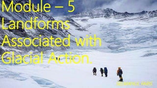
- 1. Module – 5 Landforms Associated with Glacial Action. SELMANUL FARIS
- 2. • Glacier Action. • Types of Glaciers. • Erosional and Depositional landforms
- 4. Glacier A glacier is a moving mass of ice. It can be considered a river of ice. But the velocity of movement in a glacier is lesser than in a river. The movement of glacier is very slow. The movement could be a few centimetres to a few metres a day or even less or more. Glaciers move basically because of the force of gravity. Movement in the ice is possible in relatively flat areas also.
- 5. In fact the glaciers can move even in an up-slope direction This is possible because the movement of ground ice is caused not only by the gravitational force but also by the compressive force of the overlying mass. Glaciers originate in areas where most of the precipitation occurs in the form of snowfall. Polar ice caps and high mountain areas are the major source regions of glaciers.
- 7. A lot of material is eroded and transported by glaciers. The erosional work is carried out through. * Abrasion(friction) * Plucking (breaking or digging out of rocks. . obstructing the passage of the Glaciers.)
- 10. Classification of Glaciers H.W. Ahlmann. has provided two types of glaciers classification 1) Morphological classification 2) Thermal classification
- 11. Morphological classification Generally glaciers originate in areas above the snow line (the lowest limit of the perpetual snows. a) Continental glaciers or ice –sheet covering large areas
- 15. • Ice caps are smaller than continenta l glaciers
- 16. c) Highland glaciers. Highland glaciers found in the high portions of the mountains
- 17. Cirque glaciers occupying valley heads or rock basins on mountain slope at high altitude
- 18. Valley glaciers or Alpine glaciers
- 19. The valley glaciers, also known as Alpine glaciers, are found in higher regions of the Himalayas in our country and all such high mountain ranges of the world. The largest of Indian glaciers occur in the Karakoram range, viz. Siachen (72 km),
- 22. Transection glaciers Transection glaciers covering a whole valley system
- 25. Thermal classification Temperate Glaciers Cold Glaciers
- 26. Temperate Glaciers These glaciers are characterised by presence of melt water. The melt water at the bed helps the ice slide over the wet rock floor Thus the rate of movement of these glaciers is generally more than that of the other glaciers.
- 27. Cold Glaciers Glaciers that are below the freezing point throughout the year. Two sub-types 1). High polar type. 2). Sub polar type High polar type the temperature is below the freezing point throughout the year. There is no melting on the surface even in summer
- 28. Sub –Polar type The material consists of crystalline down to a depth of 10 to 20 metrs. In summer the surface may melt and the water may be present The ice at the bottom in both sub types is frozen
- 30. U – Shaped valley The glacier being solid, it cannot adopt the shape of the valley through which it flows. Hence the sides of the glacial valley are steep and it is almost as wide at the base as at the top. Such valley is called a U – shaped valley. This type of valley is a result of the plucking and abrasion, both going together.
- 31. Its sides as well as the bottom are smoother than the v- shaped valley of river. glacial mass is heavy and slow moving, erosional activity is uniform – horizontally as well as vertically. A steep sided and flat bottomed valley results,
- 34. Hanging valleys A valley carved out by a small tributary glacier that joins with a valley carved out by a much larger glacier. The tributary valleys joining a major glacial valley. Such valleys of the tributary glaciers are called hanging valleys. Hanging valley
- 35. The erosional capacity of a glacier is propotional to the mass of ice involved in the movement. As a result major glacier deepen their valleys at a faster rate than the smaller tributaries that join the major glacial valley Forming waterfall
- 37. Cirque A Cirque is a semi –circular steep sided depression Formed through glacial erosion A cirque is formed at the head of a valley glacier where some snow accumulates and is compacted to form a cirque glacier. Ice moving down a steep slope causes headward erosion and the steep hill slope is cut in a concave form which is shaped like a deep seated armchair. It has steep sided slope on three sides, an open end on one side and a flat bottom.
- 40. They are also known as Corries in Scotland Cwm in wales Kar in Austria Nisch in sweden The term cirque is of French origin
- 41. Tarn lake or Cirque lake When the ice melts, the cirque may develop into a tarn lake. Lakes are generally found in the bottoms of the cirques.
- 43. Aretes When cirques are formed on two sides of a mountain range the mountain divide becomes narrow due to cutting backwards by the glaciers on the opposite sides. Such steep sharp edged ridges are called aretes (French), grat (German) Steep-sided, sharp-tipped
- 48. Horn A Horn results when glaciers erode three or more aretes, usually forming a sharp edged peak.. Horns are the unreduced portions of the mountain ridge. They appear like a pyramidal peaks with steep side slope. They are the characteristic of the high glaciated regions. Topography of such regions is called Serrated topography
- 51. Crag and tail A crag is a rocky hill or mountain, generally isolated from other high ground. Crags are formed when a glacier or ice sheet passes over an area that contains a particularly resistant rock formation (often a granite, volcanic structure). The force of the glacier erodes the surrounding softer material The crag is steep slope where the limited erosion of the harder rock has caused the steep slope The land behind the crag is protected and forms a long, gently sloping ridge called the tail.
- 53. Roches Moutonnees or Sheep rock roche moutonnée (or sheep rock) is a rock formation created by the passing of a glacier. roche moutonnée are formed when a glacier moves over an dome shaped area. The slope along which it climbs is abraded smoothly. As the glacier descends the slope of the dome on the opposite side The rocks are plucked to form a rough and steeper slope.
- 56. Fjord Some of the glaciers reach oceans and seas before they melt It happens often in the high latitude regions where the snow line reaches the sea level Some cases it joins the sea directly and it erodes the coastal part of the sea. Thus the erosion in the coastal area continues below the sea level. This produce submerged valleys with very steep sides due to sea level rise Steep-sided narrow entrance- These submeged U shape valley are called fiords
- 59. Glaciers hardly create any depositional features before they melt Most of the deposition by glaciers therefore occures in the zone of melting.
- 60. Moraines The loads carried by glaciers are called moraines. Moraine is material transported by a glacier and then deposited. General term applied to rock fragments, gravel, sand, etc. carried by a glacier. Moraines are classified into various categories on the basis of the part of the body of the glacier carrying the
- 61. Lateral Moraine Lateral moraine forms along the edges of the glacier. It is then carried along the sides of the glacier. When the ice melts it forms a ridge of material along the valley side.
- 64. Medial Moraine The rock debris being transported in the central or the middle part of the body of the glacier forms the medial moraine.
- 67. Ground Moraine Material is transported by the glaciers along the bottom of the their valleys.
- 69. Terminal Morine The glaciers push of a lot of rock debris in front of ground moraine
- 72. Recessional Moraine Recessional moraines form at the end of the glacier so they are found across the valley, not along it.
- 74. Till plains Till is a mixture of sand, silt,clay with some amount of pebbles and large boulders. A till plain is an extensive flat plain of glacial till
- 76. Drumlin Smooth, streamlined, oval,or elongated mounds or small rounded hills found in the till plains are called drumlins. As the glacier starts melting, large quantities of gravel material are deposited in the shape of inverted boats. The slope of this type of deposits is steep towards the snout (front portion )of the glacier and gentle in the down stream direction
- 77. They are elongated features that can reach a kilometer or more in length, 500m or so in width and over 50m in height.
- 80. Fluvio – Glacial Deposits The drumlins and the morains are almost completely glacial deposits in the sense that in their formation there is no role of melt water streams. The lower portion of the glacier starts melting due to frictional high temperature in the bottom and the water thus released flows under the ice in the form of a stream flowing through a tunnel. This water issuing from the tunnel below the glacier creates certain topographical features.. These features are called fluvio-glacial features.
- 81. Eskers Eskers are longitudinal deposits formed in the tunnel under the glacier. Eskers are produced as a result of running water in, on or under the glacier. They are linear mounds of sand and gravel that commonly snake their way across the landscape. They are like longitudinal ridges of the deposited materials having 60 to 90 metres hight Winding ridge of un-assorted depositions of rock, gravel, clay etc. The width of eskers is not uniform
- 84. Kames Broken ridges or un-assorted depositions looking like hump in a till plain. Kames are small dune –like formations that comprise smaller sized deposits near the snout of the glacier. They are found surrounded by terminal moraines They are rounded in shape
- 87. Outwash Plains When the glacier melts, the melt water accumulate near the terminal moraine . It flows in the form of a river transporting a lot of material deposited as terminal moraines. The water in this area spreads out over a broad area. These deposit is known as outwash plain
- 91. Kettle Holes Formed when the deposited material in a Outwash plain gets depressed locally and forms a basin. Kettles are depressions in the outwash plains. Kettles are formed due to melting of large blocks of ice
- 94. SELMANUL FARIS P