
Recommended
Recommended
More Related Content
What's hot
What's hot (20)
Similar to Excavation Methods in Archaeological Research & Studies
Similar to Excavation Methods in Archaeological Research & Studies (20)
More from Prachya Adhyayan
More from Prachya Adhyayan (18)
Recently uploaded
Recently uploaded (20)
Excavation Methods in Archaeological Research & Studies
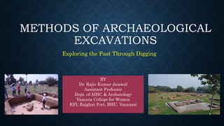
- 1. METHODS OF ARCHAEOLOGICAL EXCAVATIONS Exploring the Past Through Digging BY Dr. Rajiv Kumar Jaiswal Assistant Professor Dept. of AIHC & Archaeology Vasanta College for Women KFI, Rajghat Fort, BHU, Varanasi
- 2. INTRODUCTION • Excavation is the scientific way and method of removing objects and uncovering stationary features that have been concealed by later deposits. • In other words, excavation is the removal of the matrix in order to discover and retrieve archaeological data from beneath the ground, thereby revealing the three dimensional structure of the data and matrix both vertically and horizontally.
- 3. • An Archaeological excavation is usually complicated and painstaking process. There are many reasons for carrying out archaeological excavations and many ways to determine the appropriate techniques to apply in the field. • In this topic a wide range of excavation techniques are reviewed. Some are largely outdated and some have modified to suit the present need and become part of archaeology’s history. • It is very difficult to demarcate any specific techniques as the sites are formed in ecological, geological and geographical settings.
- 4. • Mortimer Wheeler said “The experienced excavator, who thinks before digs, succeeds in reaching his objective in a majority of cases”.
- 5. AIMS • The aim of excavation is to identify, define, uncover, date and interpret each archaeological context of a site by understanding the transformation process in a given environmental condition. The re-construction of the site usually goes in reverse order.
- 6. •Research oriented excavation •Rescue excavation OBJECTIVE
- 7. PRINCIPLES OF EXCAVATIONS • The following are some of the common rules complied in the excavation: Check the limit of the digging area. Ever watchfull changes in soil texture Always loosen a small amount of soil with a trowel/pickaxe or other appropriate tool Use soft hair brushes for cleaning the surface and use paint brushes to clean cavaties.
- 8. CONT….. When a change in soil texture, colour, pottery type and architectural feature are identified, stop the excavation. Clean the area again and record the new layer. Maintain the baulk and the section sharply Always scrap the section from top to bottom Do not trust your memory, write everything down on the field note book. Each pick of the earth, soil sample, potsherds or any other objects has to be properly recorded, documented and labelled.
- 9. CONT…. Potsherd has to be sent to the pottery yard with proper label where the pottery Carry the excavation till natural soil is identified. Every features has to be drawn on a graph sheet with clear scale and direction. Every features has to be photographed.
- 10. TYPES OF EXCAVATION • All excavation methods can be placed under two heads namely: 1. Vertical excavation 2. Horizontal excavation
- 11. VERTICAL EXCAVATION • Vertical excavation is primarily to reveal the vertical and temporal dimensions within archaeological deposits, the depth, the sequence and composition of burial data. In other words, vertical excavation is the one used to reveal the total cultural deposit of a site. • Unlike horizontal excavation, which focuses on uncovering a wide area at a single level, vertical excavation involves digging downward through the layers of the earth in a controlled and systematic manner
- 13. CONT…. • Vertical excavation allows researchers to uncover the stratigraphy of a site, revealing the sequence of deposition and the changes that have occurred over time. This method is particularly valuable for understanding the cultural, environmental, and geological history of a region and for reconstructing past landscapes, activities, and lifeways.
- 14. HORIZONTAL EXCAVATION • Horizontal excavation, also known as open-area excavation or broad-surface excavation, involves digging across a wide area at a single level rather than digging vertically through layers of sediment or soil. • Horizontal excavation is a type of clearing excavation of large squares to reveal the horizontal extent of the site while preserving a stratigraphic record in the Baulks left between trenches.
- 15. CONT…. • Horizontal excavation facilitates the systematic recovery of artifacts, ecofacts, and other archaeological materials distributed across a site. By excavating a wide area, researchers can collect a large quantity of data that provides insights into past human activities and behaviors. • While horizontal excavation does not involve digging through layers of sediment, it still requires careful recording and documentation of the spatial relationships between different features and deposits. This helps archaeologists and researchers reconstruct the site's history and interpret its significance. • Overall, horizontal excavation plays a crucial role in various fields by providing access to subsurface information, uncovering archaeological remains. Its importance lies in its ability to gather comprehensive data about the past
- 18. GRID EXCAVATION • Grid excavation is a methodical approach to excavation that involves dividing a site or area into a grid of smaller sections, typically squares or rectangles, and systematically excavating each section. The purpose of grid excavation is to ensure thorough coverage of the site while maintaining precise spatial control over the excavation process. This method is commonly used in archaeology, geology, and environmental sciences. • Grid excavation involves setting up a systematic grid pattern over the area to be excavated and then carrying out the excavation process according to this grid. • Recording finds and features within grid squares is a crucial aspect of grid excavation
- 19. Baulk
- 20. CONT…. • Datum Point: The datum point is a point established on an archaeological site from which all measurements of level and contour are taken • Datum Line: The north-south line/longitude line/ true meridian or x-axis • Base Line: East-west line/latitude line/ y-axis The Datum Line and the Base Line are the arbitrary lines intersecting each other at right angle on the ground from which all further measurements are taken
- 21. QUADRANT METHOD • The Quadrant method is the modified version of the grid system for excavating circular fatures like megalithic stone circles and stupas. • Small mounds or circular burials have been successfully excavated by this methods. • The Quadrant method involves of dividing the mounds into four segment and leaving baulksstanding between them. • The Baulk becomes a triangular wedge-shaped strip of earth. • It involves dividing the excavation area into smaller, manageable units called quadrants or grid squares, each of which is systematically excavated and documented.
- 22. TRIAL TRENCHES OR SONDAGES • Trial trenches, also known as evaluation trenches or test trenches, are a common technique used in archaeological fieldwork to assess the presence, nature, and extent of archaeological remains within a specific area or site. They are typically employed as a preliminary investigation before larger-scale excavations
- 23. THANK YOU