SlideShare a Scribd company logo
1 of 29
GIS
Introduction & Basics of Geoinformatics
Geography - Pattern and process of human and physical phenomena on
the surface of earth.
• What is where? (Spatial Distribution and Variations)
• Why is there? (Spatial Interactions)
• Why do we care? (Spatial Planning and Management)
Geographic
Information is processed data useful for problem solving.
• Data is basically the collection of facts and figures that pertain to places,
people, things, events, and concepts.
Spatial Data/ location
Also known as geospatial data or geographic information, it is the data or
information that identifies the geographic location of features and
boundaries on Earth, such as natural or constructed features, oceans, and
more
Information
A Geographic Information System (GIS) is a system that integrates
hardware, software, and data for capturing, managing, analyzing, and
displaying all forms of geographically referenced information
GIS - Definitions
Four main Functions
• Data capture (e.g. data entry, scanning, digitizing,)
• Data manipulation (e.g. editing, data conversion, data integration, etc.)
• Data analysis
• Data presentation and output (e.g. map making, printing, etc.)
Geo-Spatial Data
Two components of geospatial data: geographic position and attributes/
properties
• Geographic position answers “where is it” - referred as spatial data
 the location of a geographic feature or phenomenon (x, y, z)
• Attributes answers “what is it?” – attribute/non spatial data
• GIS stores geospatial data, with its attribute information in a GIS
database
• Provides link between the geographic position/spatial data and attribute
data/non-spatial data
Data Elements
 Points:
• Have no length or area at the given scale
• Usually have a single X, Y coordinate
• Represent a feature that is too small to be displayed as a line or area
 Arcs / Lines:
• Have length but no width
•Are accompanied by a set of coordinates
•Represent a geographical feature that is too narrow to have area, such
as a creek or road
 Polygons / Areas:
• Have an area that is given by the arcs/lines that make the boundary.
• Are used to represent features that have area (e.g. lakes, large cities
and islands)
Data Elements
• Polygone
• Lines
• Points
• Images
(pixels)
FUNCTIONS OF GIS
 Input
 Manipulation
 Management
 Query and Analysis
 Visualization
FUNCTIONS OF GIS
Data Input
• Converts existing data into GIS format
• Common sources of data include paper maps, tables of attributes, aerial
photos, and satellite imageries
• A major bottleneck in the implementation of GIS
FUNCTIONS OF GIS
Data Manipulation and Analysis
• Allows the user to define and execute spatial and attribute procedures to
generate derived information
• This subsystem is commonly thought of as the heart of a GIS, and
usually distinguishes it from other database information systems and
computer-aided drafting (CAD) systems.
FUNCTIONS OF GIS
Data Management and Storage
• Organizes the data, spatial and attribute, in a form which permits it to be
quickly retrieved by the user for analysis
• Permits rapid and accurate updates to be made to the database
• Involves use of a database management system (DBMS) for maintaining
attribute data
FUNCTIONS OF GIS
Query and analysis
• GIS provides both simple point-and-click query capabilities and
sophisticated analysis tools to provide timely information to managers
and analysts alike.
• GIS technology really comes into its own when used to analyze
geographic data to look for patterns and trends and to undertake "what if"
scenarios.
• Modern GISs have many powerful analytical tools
FUNCTIONS OF GIS
Visualization
• Presentation of outputs by maps and visualization tools (e.g. 3-D,
animation)
• Allows the user to generate graphic displays, normally maps, and tabular
reports representing derived information products.
???

More Related Content

Similar to 2043213190221_Lec 1 Basics of GISRS.pptx

GettingKnowTo ArcGIS10x
GettingKnowTo ArcGIS10xGettingKnowTo ArcGIS10x
GettingKnowTo ArcGIS10x
mukti subedi
 

Similar to 2043213190221_Lec 1 Basics of GISRS.pptx (20)

Geographical information system
Geographical information systemGeographical information system
Geographical information system
 
Introduction to GIS & Cartography.pdf
Introduction to GIS & Cartography.pdfIntroduction to GIS & Cartography.pdf
Introduction to GIS & Cartography.pdf
 
Rs unit iii-gis--- [repaired]
Rs unit iii-gis--- [repaired]Rs unit iii-gis--- [repaired]
Rs unit iii-gis--- [repaired]
 
Rs unit iii-gis--- [repaired]
Rs unit iii-gis--- [repaired]Rs unit iii-gis--- [repaired]
Rs unit iii-gis--- [repaired]
 
Lodha govardhan
Lodha govardhanLodha govardhan
Lodha govardhan
 
FINAL LESSON 3--GIS-Overview of GIS.pptx
FINAL LESSON 3--GIS-Overview of GIS.pptxFINAL LESSON 3--GIS-Overview of GIS.pptx
FINAL LESSON 3--GIS-Overview of GIS.pptx
 
EVS G.I.S CONCEPTS OF SCIENCE PPT.pptx
EVS  G.I.S CONCEPTS  OF SCIENCE PPT.pptxEVS  G.I.S CONCEPTS  OF SCIENCE PPT.pptx
EVS G.I.S CONCEPTS OF SCIENCE PPT.pptx
 
2-200305220204.pdf
2-200305220204.pdf2-200305220204.pdf
2-200305220204.pdf
 
Introduction to GIS
Introduction to GISIntroduction to GIS
Introduction to GIS
 
Gis fandamentals -1
Gis fandamentals -1Gis fandamentals -1
Gis fandamentals -1
 
Types of GIS Data
Types of GIS DataTypes of GIS Data
Types of GIS Data
 
GEOGRAPHICAL INFORMATION SYSTEMS
GEOGRAPHICALINFORMATIONSYSTEMSGEOGRAPHICALINFORMATIONSYSTEMS
GEOGRAPHICAL INFORMATION SYSTEMS
 
Introduction to gis and arc gis
Introduction to gis and arc gis Introduction to gis and arc gis
Introduction to gis and arc gis
 
Introduction to arc gis
Introduction to arc gisIntroduction to arc gis
Introduction to arc gis
 
GIS CONCEPTS & ASSORTED CONSPECTS .pptx
GIS CONCEPTS &  ASSORTED CONSPECTS .pptxGIS CONCEPTS &  ASSORTED CONSPECTS .pptx
GIS CONCEPTS & ASSORTED CONSPECTS .pptx
 
Data_Sources
Data_SourcesData_Sources
Data_Sources
 
What is Geography Information Systems (GIS)
What is Geography Information Systems (GIS)What is Geography Information Systems (GIS)
What is Geography Information Systems (GIS)
 
GettingKnowTo ArcGIS10x
GettingKnowTo ArcGIS10xGettingKnowTo ArcGIS10x
GettingKnowTo ArcGIS10x
 
What is gis
What is gisWhat is gis
What is gis
 
Geographic information system
Geographic information systemGeographic information system
Geographic information system
 

Recently uploaded

如何办理(WashU毕业证书)圣路易斯华盛顿大学毕业证成绩单本科硕士学位证留信学历认证
如何办理(WashU毕业证书)圣路易斯华盛顿大学毕业证成绩单本科硕士学位证留信学历认证如何办理(WashU毕业证书)圣路易斯华盛顿大学毕业证成绩单本科硕士学位证留信学历认证
如何办理(WashU毕业证书)圣路易斯华盛顿大学毕业证成绩单本科硕士学位证留信学历认证
acoha1
 
Abortion Clinic in Kempton Park +27791653574 WhatsApp Abortion Clinic Service...
Abortion Clinic in Kempton Park +27791653574 WhatsApp Abortion Clinic Service...Abortion Clinic in Kempton Park +27791653574 WhatsApp Abortion Clinic Service...
Abortion Clinic in Kempton Park +27791653574 WhatsApp Abortion Clinic Service...
mikehavy0
 
Audience Researchndfhcvnfgvgbhujhgfv.pptx
Audience Researchndfhcvnfgvgbhujhgfv.pptxAudience Researchndfhcvnfgvgbhujhgfv.pptx
Audience Researchndfhcvnfgvgbhujhgfv.pptx
Stephen266013
 
obat aborsi Tarakan wa 081336238223 jual obat aborsi cytotec asli di Tarakan9...
obat aborsi Tarakan wa 081336238223 jual obat aborsi cytotec asli di Tarakan9...obat aborsi Tarakan wa 081336238223 jual obat aborsi cytotec asli di Tarakan9...
obat aborsi Tarakan wa 081336238223 jual obat aborsi cytotec asli di Tarakan9...
yulianti213969
 
obat aborsi Banjarmasin wa 082135199655 jual obat aborsi cytotec asli di Ban...
obat aborsi Banjarmasin wa 082135199655 jual obat aborsi cytotec asli di  Ban...obat aborsi Banjarmasin wa 082135199655 jual obat aborsi cytotec asli di  Ban...
obat aborsi Banjarmasin wa 082135199655 jual obat aborsi cytotec asli di Ban...
siskavia95
 
一比一原版(ucla文凭证书)加州大学洛杉矶分校毕业证学历认证官方成绩单
一比一原版(ucla文凭证书)加州大学洛杉矶分校毕业证学历认证官方成绩单一比一原版(ucla文凭证书)加州大学洛杉矶分校毕业证学历认证官方成绩单
一比一原版(ucla文凭证书)加州大学洛杉矶分校毕业证学历认证官方成绩单
aqpto5bt
 
一比一原版(Monash毕业证书)莫纳什大学毕业证原件一模一样
一比一原版(Monash毕业证书)莫纳什大学毕业证原件一模一样一比一原版(Monash毕业证书)莫纳什大学毕业证原件一模一样
一比一原版(Monash毕业证书)莫纳什大学毕业证原件一模一样
yhavx
 
如何办理(Dalhousie毕业证书)达尔豪斯大学毕业证成绩单留信学历认证
如何办理(Dalhousie毕业证书)达尔豪斯大学毕业证成绩单留信学历认证如何办理(Dalhousie毕业证书)达尔豪斯大学毕业证成绩单留信学历认证
如何办理(Dalhousie毕业证书)达尔豪斯大学毕业证成绩单留信学历认证
zifhagzkk
 

Recently uploaded (20)

如何办理(WashU毕业证书)圣路易斯华盛顿大学毕业证成绩单本科硕士学位证留信学历认证
如何办理(WashU毕业证书)圣路易斯华盛顿大学毕业证成绩单本科硕士学位证留信学历认证如何办理(WashU毕业证书)圣路易斯华盛顿大学毕业证成绩单本科硕士学位证留信学历认证
如何办理(WashU毕业证书)圣路易斯华盛顿大学毕业证成绩单本科硕士学位证留信学历认证
 
Chapter 1 - Introduction to Data Mining Concepts and Techniques.pptx
Chapter 1 - Introduction to Data Mining Concepts and Techniques.pptxChapter 1 - Introduction to Data Mining Concepts and Techniques.pptx
Chapter 1 - Introduction to Data Mining Concepts and Techniques.pptx
 
Abortion Clinic in Kempton Park +27791653574 WhatsApp Abortion Clinic Service...
Abortion Clinic in Kempton Park +27791653574 WhatsApp Abortion Clinic Service...Abortion Clinic in Kempton Park +27791653574 WhatsApp Abortion Clinic Service...
Abortion Clinic in Kempton Park +27791653574 WhatsApp Abortion Clinic Service...
 
MATERI MANAJEMEN OF PENYAKIT TETANUS.ppt
MATERI  MANAJEMEN OF PENYAKIT TETANUS.pptMATERI  MANAJEMEN OF PENYAKIT TETANUS.ppt
MATERI MANAJEMEN OF PENYAKIT TETANUS.ppt
 
What is Insertion Sort. Its basic information
What is Insertion Sort. Its basic informationWhat is Insertion Sort. Its basic information
What is Insertion Sort. Its basic information
 
Aggregations - The Elasticsearch "GROUP BY"
Aggregations - The Elasticsearch "GROUP BY"Aggregations - The Elasticsearch "GROUP BY"
Aggregations - The Elasticsearch "GROUP BY"
 
RESEARCH-FINAL-DEFENSE-PPT-TEMPLATE.pptx
RESEARCH-FINAL-DEFENSE-PPT-TEMPLATE.pptxRESEARCH-FINAL-DEFENSE-PPT-TEMPLATE.pptx
RESEARCH-FINAL-DEFENSE-PPT-TEMPLATE.pptx
 
Audience Researchndfhcvnfgvgbhujhgfv.pptx
Audience Researchndfhcvnfgvgbhujhgfv.pptxAudience Researchndfhcvnfgvgbhujhgfv.pptx
Audience Researchndfhcvnfgvgbhujhgfv.pptx
 
Solution manual for managerial accounting 8th edition by john wild ken shaw b...
Solution manual for managerial accounting 8th edition by john wild ken shaw b...Solution manual for managerial accounting 8th edition by john wild ken shaw b...
Solution manual for managerial accounting 8th edition by john wild ken shaw b...
 
Credit Card Fraud Detection: Safeguarding Transactions in the Digital Age
Credit Card Fraud Detection: Safeguarding Transactions in the Digital AgeCredit Card Fraud Detection: Safeguarding Transactions in the Digital Age
Credit Card Fraud Detection: Safeguarding Transactions in the Digital Age
 
Jual Obat Aborsi Bandung (Asli No.1) Wa 082134680322 Klinik Obat Penggugur Ka...
Jual Obat Aborsi Bandung (Asli No.1) Wa 082134680322 Klinik Obat Penggugur Ka...Jual Obat Aborsi Bandung (Asli No.1) Wa 082134680322 Klinik Obat Penggugur Ka...
Jual Obat Aborsi Bandung (Asli No.1) Wa 082134680322 Klinik Obat Penggugur Ka...
 
Fuel Efficiency Forecast: Predictive Analytics for a Greener Automotive Future
Fuel Efficiency Forecast: Predictive Analytics for a Greener Automotive FutureFuel Efficiency Forecast: Predictive Analytics for a Greener Automotive Future
Fuel Efficiency Forecast: Predictive Analytics for a Greener Automotive Future
 
obat aborsi Tarakan wa 081336238223 jual obat aborsi cytotec asli di Tarakan9...
obat aborsi Tarakan wa 081336238223 jual obat aborsi cytotec asli di Tarakan9...obat aborsi Tarakan wa 081336238223 jual obat aborsi cytotec asli di Tarakan9...
obat aborsi Tarakan wa 081336238223 jual obat aborsi cytotec asli di Tarakan9...
 
社内勉強会資料_Object Recognition as Next Token Prediction
社内勉強会資料_Object Recognition as Next Token Prediction社内勉強会資料_Object Recognition as Next Token Prediction
社内勉強会資料_Object Recognition as Next Token Prediction
 
obat aborsi Banjarmasin wa 082135199655 jual obat aborsi cytotec asli di Ban...
obat aborsi Banjarmasin wa 082135199655 jual obat aborsi cytotec asli di  Ban...obat aborsi Banjarmasin wa 082135199655 jual obat aborsi cytotec asli di  Ban...
obat aborsi Banjarmasin wa 082135199655 jual obat aborsi cytotec asli di Ban...
 
一比一原版(ucla文凭证书)加州大学洛杉矶分校毕业证学历认证官方成绩单
一比一原版(ucla文凭证书)加州大学洛杉矶分校毕业证学历认证官方成绩单一比一原版(ucla文凭证书)加州大学洛杉矶分校毕业证学历认证官方成绩单
一比一原版(ucla文凭证书)加州大学洛杉矶分校毕业证学历认证官方成绩单
 
Statistics Informed Decisions Using Data 5th edition by Michael Sullivan solu...
Statistics Informed Decisions Using Data 5th edition by Michael Sullivan solu...Statistics Informed Decisions Using Data 5th edition by Michael Sullivan solu...
Statistics Informed Decisions Using Data 5th edition by Michael Sullivan solu...
 
一比一原版(Monash毕业证书)莫纳什大学毕业证原件一模一样
一比一原版(Monash毕业证书)莫纳什大学毕业证原件一模一样一比一原版(Monash毕业证书)莫纳什大学毕业证原件一模一样
一比一原版(Monash毕业证书)莫纳什大学毕业证原件一模一样
 
Seven tools of quality control.slideshare
Seven tools of quality control.slideshareSeven tools of quality control.slideshare
Seven tools of quality control.slideshare
 
如何办理(Dalhousie毕业证书)达尔豪斯大学毕业证成绩单留信学历认证
如何办理(Dalhousie毕业证书)达尔豪斯大学毕业证成绩单留信学历认证如何办理(Dalhousie毕业证书)达尔豪斯大学毕业证成绩单留信学历认证
如何办理(Dalhousie毕业证书)达尔豪斯大学毕业证成绩单留信学历认证
 

2043213190221_Lec 1 Basics of GISRS.pptx

  • 1. GIS Introduction & Basics of Geoinformatics
  • 2.
  • 3.
  • 4. Geography - Pattern and process of human and physical phenomena on the surface of earth. • What is where? (Spatial Distribution and Variations) • Why is there? (Spatial Interactions) • Why do we care? (Spatial Planning and Management) Geographic
  • 5.
  • 6.
  • 7. Information is processed data useful for problem solving. • Data is basically the collection of facts and figures that pertain to places, people, things, events, and concepts. Spatial Data/ location Also known as geospatial data or geographic information, it is the data or information that identifies the geographic location of features and boundaries on Earth, such as natural or constructed features, oceans, and more Information
  • 8.
  • 9.
  • 10.
  • 11.
  • 12.
  • 13.
  • 14.
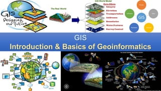
  • 15. A Geographic Information System (GIS) is a system that integrates hardware, software, and data for capturing, managing, analyzing, and displaying all forms of geographically referenced information GIS - Definitions Four main Functions • Data capture (e.g. data entry, scanning, digitizing,) • Data manipulation (e.g. editing, data conversion, data integration, etc.) • Data analysis • Data presentation and output (e.g. map making, printing, etc.)
  • 16. Geo-Spatial Data Two components of geospatial data: geographic position and attributes/ properties • Geographic position answers “where is it” - referred as spatial data  the location of a geographic feature or phenomenon (x, y, z) • Attributes answers “what is it?” – attribute/non spatial data • GIS stores geospatial data, with its attribute information in a GIS database • Provides link between the geographic position/spatial data and attribute data/non-spatial data
  • 17.
  • 18.
  • 19. Data Elements  Points: • Have no length or area at the given scale • Usually have a single X, Y coordinate • Represent a feature that is too small to be displayed as a line or area  Arcs / Lines: • Have length but no width •Are accompanied by a set of coordinates •Represent a geographical feature that is too narrow to have area, such as a creek or road  Polygons / Areas: • Have an area that is given by the arcs/lines that make the boundary. • Are used to represent features that have area (e.g. lakes, large cities and islands)
  • 21.
  • 22. • Polygone • Lines • Points • Images (pixels)
  • 23. FUNCTIONS OF GIS  Input  Manipulation  Management  Query and Analysis  Visualization
  • 24. FUNCTIONS OF GIS Data Input • Converts existing data into GIS format • Common sources of data include paper maps, tables of attributes, aerial photos, and satellite imageries • A major bottleneck in the implementation of GIS
  • 25. FUNCTIONS OF GIS Data Manipulation and Analysis • Allows the user to define and execute spatial and attribute procedures to generate derived information • This subsystem is commonly thought of as the heart of a GIS, and usually distinguishes it from other database information systems and computer-aided drafting (CAD) systems.
  • 26. FUNCTIONS OF GIS Data Management and Storage • Organizes the data, spatial and attribute, in a form which permits it to be quickly retrieved by the user for analysis • Permits rapid and accurate updates to be made to the database • Involves use of a database management system (DBMS) for maintaining attribute data
  • 27. FUNCTIONS OF GIS Query and analysis • GIS provides both simple point-and-click query capabilities and sophisticated analysis tools to provide timely information to managers and analysts alike. • GIS technology really comes into its own when used to analyze geographic data to look for patterns and trends and to undertake "what if" scenarios. • Modern GISs have many powerful analytical tools
  • 28. FUNCTIONS OF GIS Visualization • Presentation of outputs by maps and visualization tools (e.g. 3-D, animation) • Allows the user to generate graphic displays, normally maps, and tabular reports representing derived information products.
  • 29. ???