2. 1
What is open data ?
A piece of data is open if anyone is free to use, reuse, and
redistribute it — subject only, at most, to the requirement to
attribute and/or share-alike.
No discrimination against Persons or Groups, or Fields of
Endeavour
This approach brings at least public savings and allows a
fair competition between companies, what strengthen
economics.
3. 1
OpenStreetMap is a web project aiming at creating a world map of the entire world,
accessible free and downloadable for anyone. It has been started in 2004 by a student from
UK.
= +
www.osm.org
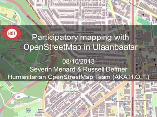
What is OpenStreetMap?
It is based on the joint action of thousands of contributors working voluntarily.
Anyone can participate!
4. OSM focuses on all the visible, physical objects like:
roads, buildings, land uses, facilities (health,
education..) shops, industries, water and sanitation,
natural spaces... but also not visible like administrative
boundaries or transportation lines.
OSM does not store information about populations.
1
www.osm.org
Mapping any feature existing in the field,
visible or not
5. 1
History and Stats
http://wiki.openstreetmap.org/wiki/History_of_OpenStreetMap
Since 2004 the project grew up
beyond 1,300,000 user accounts
and more than 2 billion nodes
created.
http://wiki.openstreetmap.org/wiki/Sta
The ongoing OSM contributions can be followed on
http://live.openstreetmap.fr/
One year of edits can be watched on
http://vimeo.com/56374742
6. 1
“Legal” Details
Was Licensed CC-BY-SA 2.0
Moved towards ODbL
Kate Chapman's article about OdbL:
http://www.maploser.com/2012/03/03/odbl-what-the-heck-can-you-do-with-it/
7. 1
OSM governance
The ecosystem of the OSM community
Citizens
Associations
Local governments
NGOs
International Organizations (UN, WB)
Academia
Private actors:
•
Microsoft, Foursquare
•
Cloudmade, Geofabrik, Camptocamp, MapBox
The growth of the OSM project is fostered by
•
OpenStreetMap Foundation & local Chapters (, )
•
Humanitarian OpenStreetMap Team () Hum/Dev contexts
8. 1
La cartographie Collaborative
Idea: A large number of
individuals contributing together
will tend to create high quality
data.
Different kind of practises and
tools strengthen this.
Free mapping and quality
17. 1
The analysis shows that, where OSM was
collected by several
users and benefited from some quality
assurance, the quality
of the data is comparable and can be fit for
many applications.
The positional accuracy is about 6 metres,
which is expected
for the data collection methods that are
used in OSM. The
comparison of motorways shows about
80% overlap between
OSM and Ordnance Survey .
Quality: Muki Aklay (UCL)
positional accuracy comparisons
United Kingdom: OSM -
Ordnance Survey Meridian II
database
Haiti: OSM - GoogleMapMaker
– MINUSTAH/CNIGS
The quality of OSM data
demonstrated by scientific researches
18. 1
OSM is a free map,
not submitted to political constraints
Example in China where OSM has no random offset
20. 1
OSM Data Structure
Based on the idea of key/value pairs
highway=primary
name=I66
building=yes
address=123 Main Street
city=Somewhere
amenity=hospital
name=Sacred Heart
21. 1
How tags/attributes are defined?
If the tagging system is fully flexible, allowing anyone to create new keys/values, it is
strongly recommended to use the already existing, debated, approved and described tags
so that the OSM data remains consolidated as much as possible.
The OSM tags can be found on the wiki : http://wiki.openstreetmap.org/wiki/Map_Features
22. 1
Contributing to OSM: mapping over Imagery
Bing allows the OpenStreetMap contributors to trace over all its imagery.
27. 1
Tools to contribute in OSM:
Walking of Field Papers
http://walking-papers.org/ or http://fieldpapers.org/
Printable Map
Collect Data by Writing
Scan and Upload
Edit for OpenStreetMap
34. 1
OpenStreetMap and humanitarian data
Interest for an open data, easily accessible for crisis response and quickly created by a
numerous community of contributors started with the earthquake that hit Haiti on
January 12, 2010.
This major disaster affected the Capital City, Port-au-Prince, and the towns on its west
side, causing maybe 200 000 casualties.
Within a few days, the response of the OSM community to map the affected areas has
been intensive.
https://www.youtube.com/watch?v=3XPvVcUNrjQ
35. 1
The OSM map after the Earthquake:
the best map of Port-au-Prince ever
Port-au-Prince on OSM,
January 12, 2010
Port-au-Prince on OSM,
28 days later