SlideShare a Scribd company logo
1 of 38
Maximize the Value of
                               Nov 15, 2012
Raster Data With FME


Exploring Raster Translation
and Transformation with FME
Who Are We?


 Today’s Presenters:


                 Dale Lutz
                 Co-Founder and
                 Vice President of Development
                 Safe Software

                 Dave Campanas
                 Product Specialist and
                 Raster Master
                 Safe Software
Questions are Encouraged!


 Today’s Q&A Support:
                Dean Hintz
                FME Product Specialist
                Safe Software


                Mark Stoakes
                Manager Professional Services
                (and FME Rockstar)
                Safe Software
Giveaway: FME Training Course


    Stay Tuned: 10 FREE seats up for grabs
        FME Online Training -- Any Session
Polls #1&2: Have you used FME?
Demo
FME 2011:
Makes you the Superhero!


    Achieve Total Spatial Data Mastery


Achieve Total Spatial Data Mastery
Proposed FME Banner Ad


              In 1981, Bill Gates said
              that "640K ought to be
                enough for anyone"


              He was wrong!
Proposed FME Banner Ad


                   In 1999 Dale Lutz
                     said “FME will
                   NEVER do raster”


          He was REALLY
             WRONG!
FME Capabilities


 Transform Data to Use and Share

                    Convertspatial data between
                     hundreds of formats

                    Transformspatial data into the
                     precise data model you need

                    Integratemultiple different data
                     types into a single data model

                    Sharespatial data with people
                     where, when and how they need it
FME Workbench:
Graphical Data Flow Authoring
Poll: Biggest Challenges?
Raster Scenario #1


              Translate
 More than 50 raster formats to choose from
     ArcSDE&GeoDatabase Raster
     CADRG
     MrSID*/ECW
     Geodatabase Raster
     GIF / PNG / JPEG / JPEG2000
     Oracle Spatial GeoRaster
     PostGIS 2.0 Raster (FME 2013)
     …
Raster Scenario #2


          Resample
Raster Scenario #3


          Reproject
Raster Scenario #4


             Mosaic
Raster Scenario #5


             Compress
 Output formats with compression:
     ECW
     JPEG / JPEG2000
     GeoTIFF / TIFF
     Oracle Spatial GeoRaster
     ArcSDE Raster
     Geodatabase Raster
     CADRG
Raster Scenario #6


                Clip
Raster Combo Scenario #7


           Mosaic
         Reproject
            Clip
          Catalog!
     (http://bit.ly/parkcat)
Raster Scenario #8


                Tile
Raster Scenario #9


         Web Tiling


    (http://bit.ly/fmetiles)
Raster Scenario #10


              Drape
Raster Scenario #11


                  Power
   Band Restructuring
   Extents Extraction
   Cell Value Calculation
   Palettes
   Expression Evaluation (pixel by pixel)
   …
FME Raster Transformer List

Clipper                       RasterCellCoercer             RasterPaletteInterpretation
*Reprojector (CSMAP,          RasterCellOriginSetter           Coercer
    ESRI,GTRANS,              RasterCellValueCalculator     RasterPaletteNodataSetter
    GridInQuest)              RasterCellValueReplacer       RasterPaletteRemover
ImageFetcher                  RasterCellValueRounder        RasterPaletteResolver
ImageRasterizer               RasterCheckpointer            RasterPropertiesExtractor
NumericRasterizer             RasterConsumer                RasterPyramider
PointOnRasterValueExtractor   RasterDEMGenerator            RasterRGBCreator
RasterBandAdder               RasterExpressionEvaluator     RasterReader
RasterBandCombiner            RasterExtentsCoercer          RasterReplacer
RasterBandInterpretation      RasterExtractor               RasterResampler
    Coercer                                                 RasterRotationApplier
                              RasterGCPExtractor
RasterBandKeeper                                            RasterSelector
                              RasterGCPSetter
RasterBandMinMaxExtractor                                   RasterSingularCellValue
                              RasterGeoreferencer
RasterBandNameSetter                                           Calculator
                              RasterInterpretationCoercer
RasterBandNodataRemover                                     RasterSubsetter
                              RasterMosaicker
RasterBandNodataSetter                                      RasterTiler
                              RasterNumericCreator
RasterBandOrderer                                           RasterToPolygonCoercer
                              RasterPaletteAdder
RasterBandProperties                                           (FME 2012)
    Extractor                 RasterPaletteExtractor
                                                            VectorOnRasterOverlayer
RasterBandRemover             RasterPaletteGenerator
                                                            WebMapTiler
RasterBandSeparator
Raster Scenario #11


Transform a Numeric Raster…
Raster Scenario #11


     …Into Vector Polygons
Raster Scenario #12


                  Niche
 Satellite, Statistics, Legacy, etc
     ASRP / CADRG
     HDF
     NetCDF
     NGRID
     NITF
     PLANET
     R
     …
Raster Scenario #13
(FME 2013 Sneak Peek)


       Hill Shading
Poll: What Are We Missing?
Share Today’s Webinar


 Today’s webinar was recorded
Learn More About FME


 Get Acquainted:
   Free trial of FME Desktop
   Personalized web demo
Learn More About FME


 Get Acquainted:
   Free trial of FME Desktop
   Personalized web demo
 Expand Your Knowledge:
   Upcoming webinars
     Turbocharging FME: How to Improve the
      Performance of Your FME Workspaces – Dec 12
     Introducing FME 2013 – Jan ???
   Upcoming Training (online & in person)
Summary


 What we’ve seen today:
   FME can help you Prepare and Share
    your raster data Quickly!
We’ll Be Following Up
Question & Answer
Thank You!


 For more information, contact:

   Sales:
      sales@safe.com
      (604)501-9985 ext. 287


   Support
      support@safe.com
      (604)501-9985 ext. 278

More Related Content

Similar to Maximize the Value of Raster Data Using FME

Sochi hexitex manchester 10 dec 2008 presentation
Sochi hexitex  manchester 10 dec 2008 presentationSochi hexitex  manchester 10 dec 2008 presentation
Sochi hexitex manchester 10 dec 2008 presentationTaha Sochi
 
What's New in ArcGIS 10.1 Data Interoperability Extension
What's New in ArcGIS 10.1 Data Interoperability ExtensionWhat's New in ArcGIS 10.1 Data Interoperability Extension
What's New in ArcGIS 10.1 Data Interoperability ExtensionSafe Software
 
Introduction to MapReduce Data Transformations
Introduction to MapReduce Data TransformationsIntroduction to MapReduce Data Transformations
Introduction to MapReduce Data Transformationsswooledge
 
Microsoft R - Data Science at Scale
Microsoft R - Data Science at ScaleMicrosoft R - Data Science at Scale
Microsoft R - Data Science at ScaleSascha Dittmann
 
RasterFrames + STAC
RasterFrames + STACRasterFrames + STAC
RasterFrames + STACSimeon Fitch
 
Easy edd phd talks 28 oct 2008
Easy edd phd talks 28 oct 2008Easy edd phd talks 28 oct 2008
Easy edd phd talks 28 oct 2008Taha Sochi
 
Advanced analytics with sap hana and r
Advanced analytics with sap hana and rAdvanced analytics with sap hana and r
Advanced analytics with sap hana and rSAP Technology
 
Building Reliable Cloud Storage with Riak and CloudStack - Andy Gross, Chief ...
Building Reliable Cloud Storage with Riak and CloudStack - Andy Gross, Chief ...Building Reliable Cloud Storage with Riak and CloudStack - Andy Gross, Chief ...
Building Reliable Cloud Storage with Riak and CloudStack - Andy Gross, Chief ...buildacloud
 
Tips And Tricks For Bioinformatics Software Engineering
Tips And Tricks For Bioinformatics Software EngineeringTips And Tricks For Bioinformatics Software Engineering
Tips And Tricks For Bioinformatics Software Engineeringjtdudley
 
String Comparison Surprises: Did Postgres lose my data?
String Comparison Surprises: Did Postgres lose my data?String Comparison Surprises: Did Postgres lose my data?
String Comparison Surprises: Did Postgres lose my data?Jeremy Schneider
 
TWDI Accelerate Seattle, Oct 16, 2017: Distributed and In-Database Analytics ...
TWDI Accelerate Seattle, Oct 16, 2017: Distributed and In-Database Analytics ...TWDI Accelerate Seattle, Oct 16, 2017: Distributed and In-Database Analytics ...
TWDI Accelerate Seattle, Oct 16, 2017: Distributed and In-Database Analytics ...Debraj GuhaThakurta
 
TDWI Accelerate, Seattle, Oct 16, 2017: Distributed and In-Database Analytics...
TDWI Accelerate, Seattle, Oct 16, 2017: Distributed and In-Database Analytics...TDWI Accelerate, Seattle, Oct 16, 2017: Distributed and In-Database Analytics...
TDWI Accelerate, Seattle, Oct 16, 2017: Distributed and In-Database Analytics...Debraj GuhaThakurta
 
Large Scale Data Analysis Tools
Large Scale Data Analysis ToolsLarge Scale Data Analysis Tools
Large Scale Data Analysis Toolsboorad
 
Whats New in FME Desktop 2010
Whats New in FME Desktop 2010Whats New in FME Desktop 2010
Whats New in FME Desktop 2010Safe Software
 
GraphFrames Access Methods in DSE Graph
GraphFrames Access Methods in DSE GraphGraphFrames Access Methods in DSE Graph
GraphFrames Access Methods in DSE GraphJim Hatcher
 
Launching Your First Big Data Project on AWS
Launching Your First Big Data Project on AWSLaunching Your First Big Data Project on AWS
Launching Your First Big Data Project on AWSAmazon Web Services
 
Lecture 13
Lecture 13Lecture 13
Lecture 13Shani729
 

Similar to Maximize the Value of Raster Data Using FME (20)

Sochi hexitex manchester 10 dec 2008 presentation
Sochi hexitex  manchester 10 dec 2008 presentationSochi hexitex  manchester 10 dec 2008 presentation
Sochi hexitex manchester 10 dec 2008 presentation
 
What's New in ArcGIS 10.1 Data Interoperability Extension
What's New in ArcGIS 10.1 Data Interoperability ExtensionWhat's New in ArcGIS 10.1 Data Interoperability Extension
What's New in ArcGIS 10.1 Data Interoperability Extension
 
Introduction to MapReduce Data Transformations
Introduction to MapReduce Data TransformationsIntroduction to MapReduce Data Transformations
Introduction to MapReduce Data Transformations
 
Microsoft R - Data Science at Scale
Microsoft R - Data Science at ScaleMicrosoft R - Data Science at Scale
Microsoft R - Data Science at Scale
 
RasterFrames + STAC
RasterFrames + STACRasterFrames + STAC
RasterFrames + STAC
 
Easy edd phd talks 28 oct 2008
Easy edd phd talks 28 oct 2008Easy edd phd talks 28 oct 2008
Easy edd phd talks 28 oct 2008
 
Introduction to R for Data Mining
Introduction to R for Data MiningIntroduction to R for Data Mining
Introduction to R for Data Mining
 
Advanced analytics with sap hana and r
Advanced analytics with sap hana and rAdvanced analytics with sap hana and r
Advanced analytics with sap hana and r
 
Building Reliable Cloud Storage with Riak and CloudStack - Andy Gross, Chief ...
Building Reliable Cloud Storage with Riak and CloudStack - Andy Gross, Chief ...Building Reliable Cloud Storage with Riak and CloudStack - Andy Gross, Chief ...
Building Reliable Cloud Storage with Riak and CloudStack - Andy Gross, Chief ...
 
Tips And Tricks For Bioinformatics Software Engineering
Tips And Tricks For Bioinformatics Software EngineeringTips And Tricks For Bioinformatics Software Engineering
Tips And Tricks For Bioinformatics Software Engineering
 
String Comparison Surprises: Did Postgres lose my data?
String Comparison Surprises: Did Postgres lose my data?String Comparison Surprises: Did Postgres lose my data?
String Comparison Surprises: Did Postgres lose my data?
 
TWDI Accelerate Seattle, Oct 16, 2017: Distributed and In-Database Analytics ...
TWDI Accelerate Seattle, Oct 16, 2017: Distributed and In-Database Analytics ...TWDI Accelerate Seattle, Oct 16, 2017: Distributed and In-Database Analytics ...
TWDI Accelerate Seattle, Oct 16, 2017: Distributed and In-Database Analytics ...
 
TDWI Accelerate, Seattle, Oct 16, 2017: Distributed and In-Database Analytics...
TDWI Accelerate, Seattle, Oct 16, 2017: Distributed and In-Database Analytics...TDWI Accelerate, Seattle, Oct 16, 2017: Distributed and In-Database Analytics...
TDWI Accelerate, Seattle, Oct 16, 2017: Distributed and In-Database Analytics...
 
DA_MAP
DA_MAPDA_MAP
DA_MAP
 
Large Scale Data Analysis Tools
Large Scale Data Analysis ToolsLarge Scale Data Analysis Tools
Large Scale Data Analysis Tools
 
Whats New in FME Desktop 2010
Whats New in FME Desktop 2010Whats New in FME Desktop 2010
Whats New in FME Desktop 2010
 
GraphFrames Access Methods in DSE Graph
GraphFrames Access Methods in DSE GraphGraphFrames Access Methods in DSE Graph
GraphFrames Access Methods in DSE Graph
 
Launching Your First Big Data Project on AWS
Launching Your First Big Data Project on AWSLaunching Your First Big Data Project on AWS
Launching Your First Big Data Project on AWS
 
Lecture 13
Lecture 13Lecture 13
Lecture 13
 
Unveiling FME 2013
Unveiling FME 2013Unveiling FME 2013
Unveiling FME 2013
 

More from Safe Software

Beyond Boundaries: Leveraging No-Code Solutions for Industry Innovation
Beyond Boundaries: Leveraging No-Code Solutions for Industry InnovationBeyond Boundaries: Leveraging No-Code Solutions for Industry Innovation
Beyond Boundaries: Leveraging No-Code Solutions for Industry InnovationSafe Software
 
Powering Real-Time Decisions with Continuous Data Streams
Powering Real-Time Decisions with Continuous Data StreamsPowering Real-Time Decisions with Continuous Data Streams
Powering Real-Time Decisions with Continuous Data StreamsSafe Software
 
The Critical Role of Spatial Data in Today's Data Ecosystem
The Critical Role of Spatial Data in Today's Data EcosystemThe Critical Role of Spatial Data in Today's Data Ecosystem
The Critical Role of Spatial Data in Today's Data EcosystemSafe Software
 
Cloud Revolution: Exploring the New Wave of Serverless Spatial Data
Cloud Revolution: Exploring the New Wave of Serverless Spatial DataCloud Revolution: Exploring the New Wave of Serverless Spatial Data
Cloud Revolution: Exploring the New Wave of Serverless Spatial DataSafe Software
 
Igniting Next Level Productivity with AI-Infused Data Integration Workflows
Igniting Next Level Productivity with AI-Infused Data Integration WorkflowsIgniting Next Level Productivity with AI-Infused Data Integration Workflows
Igniting Next Level Productivity with AI-Infused Data Integration WorkflowsSafe Software
 
The Zero-ETL Approach: Enhancing Data Agility and Insight
The Zero-ETL Approach: Enhancing Data Agility and InsightThe Zero-ETL Approach: Enhancing Data Agility and Insight
The Zero-ETL Approach: Enhancing Data Agility and InsightSafe Software
 
Mastering MicroStation DGN: How to Integrate CAD and GIS
Mastering MicroStation DGN: How to Integrate CAD and GISMastering MicroStation DGN: How to Integrate CAD and GIS
Mastering MicroStation DGN: How to Integrate CAD and GISSafe Software
 
Geospatial Synergy: Amplifying Efficiency with FME & Esri
Geospatial Synergy: Amplifying Efficiency with FME & EsriGeospatial Synergy: Amplifying Efficiency with FME & Esri
Geospatial Synergy: Amplifying Efficiency with FME & EsriSafe Software
 
Introducing the New FME Community Webinar - Feb 21, 2024 (2).pdf
Introducing the New FME Community Webinar - Feb 21, 2024 (2).pdfIntroducing the New FME Community Webinar - Feb 21, 2024 (2).pdf
Introducing the New FME Community Webinar - Feb 21, 2024 (2).pdfSafe Software
 
Breaking Barriers & Leveraging the Latest Developments in AI Technology
Breaking Barriers & Leveraging the Latest Developments in AI TechnologyBreaking Barriers & Leveraging the Latest Developments in AI Technology
Breaking Barriers & Leveraging the Latest Developments in AI TechnologySafe Software
 
Best Practices to Navigating Data and Application Integration for the Enterpr...
Best Practices to Navigating Data and Application Integration for the Enterpr...Best Practices to Navigating Data and Application Integration for the Enterpr...
Best Practices to Navigating Data and Application Integration for the Enterpr...Safe Software
 
Cloud Revolution: Exploring the New Wave of Serverless Spatial Data
Cloud Revolution: Exploring the New Wave of Serverless Spatial DataCloud Revolution: Exploring the New Wave of Serverless Spatial Data
Cloud Revolution: Exploring the New Wave of Serverless Spatial DataSafe Software
 
New Year's Fireside Chat with Safe Software’s Founders
New Year's Fireside Chat with Safe Software’s FoundersNew Year's Fireside Chat with Safe Software’s Founders
New Year's Fireside Chat with Safe Software’s FoundersSafe Software
 
Taking Off with FME: Elevating Airport Operations to New Heights
Taking Off with FME: Elevating Airport Operations to New HeightsTaking Off with FME: Elevating Airport Operations to New Heights
Taking Off with FME: Elevating Airport Operations to New HeightsSafe Software
 
Initiating and Advancing Your Strategic GIS Governance Strategy
Initiating and Advancing Your Strategic GIS Governance StrategyInitiating and Advancing Your Strategic GIS Governance Strategy
Initiating and Advancing Your Strategic GIS Governance StrategySafe Software
 
Igniting Next Level Productivity with AI-Infused Data Integration Workflows
Igniting Next Level Productivity with AI-Infused Data Integration Workflows Igniting Next Level Productivity with AI-Infused Data Integration Workflows
Igniting Next Level Productivity with AI-Infused Data Integration Workflows Safe Software
 
Geospatial Synergy: Amplifying Efficiency with FME & Esri ft. Peak Guest Spea...
Geospatial Synergy: Amplifying Efficiency with FME & Esri ft. Peak Guest Spea...Geospatial Synergy: Amplifying Efficiency with FME & Esri ft. Peak Guest Spea...
Geospatial Synergy: Amplifying Efficiency with FME & Esri ft. Peak Guest Spea...Safe Software
 
Mastering DevOps-Driven Data Integration with FME
Mastering DevOps-Driven Data Integration with FMEMastering DevOps-Driven Data Integration with FME
Mastering DevOps-Driven Data Integration with FMESafe Software
 
Identification of landscape features eligible for EU subsidy - Analysis of la...
Identification of landscape features eligible for EU subsidy - Analysis of la...Identification of landscape features eligible for EU subsidy - Analysis of la...
Identification of landscape features eligible for EU subsidy - Analysis of la...Safe Software
 
Utilizing FME as an API Test Framework
Utilizing FME as an API Test Framework Utilizing FME as an API Test Framework
Utilizing FME as an API Test Framework Safe Software
 

More from Safe Software (20)

Beyond Boundaries: Leveraging No-Code Solutions for Industry Innovation
Beyond Boundaries: Leveraging No-Code Solutions for Industry InnovationBeyond Boundaries: Leveraging No-Code Solutions for Industry Innovation
Beyond Boundaries: Leveraging No-Code Solutions for Industry Innovation
 
Powering Real-Time Decisions with Continuous Data Streams
Powering Real-Time Decisions with Continuous Data StreamsPowering Real-Time Decisions with Continuous Data Streams
Powering Real-Time Decisions with Continuous Data Streams
 
The Critical Role of Spatial Data in Today's Data Ecosystem
The Critical Role of Spatial Data in Today's Data EcosystemThe Critical Role of Spatial Data in Today's Data Ecosystem
The Critical Role of Spatial Data in Today's Data Ecosystem
 
Cloud Revolution: Exploring the New Wave of Serverless Spatial Data
Cloud Revolution: Exploring the New Wave of Serverless Spatial DataCloud Revolution: Exploring the New Wave of Serverless Spatial Data
Cloud Revolution: Exploring the New Wave of Serverless Spatial Data
 
Igniting Next Level Productivity with AI-Infused Data Integration Workflows
Igniting Next Level Productivity with AI-Infused Data Integration WorkflowsIgniting Next Level Productivity with AI-Infused Data Integration Workflows
Igniting Next Level Productivity with AI-Infused Data Integration Workflows
 
The Zero-ETL Approach: Enhancing Data Agility and Insight
The Zero-ETL Approach: Enhancing Data Agility and InsightThe Zero-ETL Approach: Enhancing Data Agility and Insight
The Zero-ETL Approach: Enhancing Data Agility and Insight
 
Mastering MicroStation DGN: How to Integrate CAD and GIS
Mastering MicroStation DGN: How to Integrate CAD and GISMastering MicroStation DGN: How to Integrate CAD and GIS
Mastering MicroStation DGN: How to Integrate CAD and GIS
 
Geospatial Synergy: Amplifying Efficiency with FME & Esri
Geospatial Synergy: Amplifying Efficiency with FME & EsriGeospatial Synergy: Amplifying Efficiency with FME & Esri
Geospatial Synergy: Amplifying Efficiency with FME & Esri
 
Introducing the New FME Community Webinar - Feb 21, 2024 (2).pdf
Introducing the New FME Community Webinar - Feb 21, 2024 (2).pdfIntroducing the New FME Community Webinar - Feb 21, 2024 (2).pdf
Introducing the New FME Community Webinar - Feb 21, 2024 (2).pdf
 
Breaking Barriers & Leveraging the Latest Developments in AI Technology
Breaking Barriers & Leveraging the Latest Developments in AI TechnologyBreaking Barriers & Leveraging the Latest Developments in AI Technology
Breaking Barriers & Leveraging the Latest Developments in AI Technology
 
Best Practices to Navigating Data and Application Integration for the Enterpr...
Best Practices to Navigating Data and Application Integration for the Enterpr...Best Practices to Navigating Data and Application Integration for the Enterpr...
Best Practices to Navigating Data and Application Integration for the Enterpr...
 
Cloud Revolution: Exploring the New Wave of Serverless Spatial Data
Cloud Revolution: Exploring the New Wave of Serverless Spatial DataCloud Revolution: Exploring the New Wave of Serverless Spatial Data
Cloud Revolution: Exploring the New Wave of Serverless Spatial Data
 
New Year's Fireside Chat with Safe Software’s Founders
New Year's Fireside Chat with Safe Software’s FoundersNew Year's Fireside Chat with Safe Software’s Founders
New Year's Fireside Chat with Safe Software’s Founders
 
Taking Off with FME: Elevating Airport Operations to New Heights
Taking Off with FME: Elevating Airport Operations to New HeightsTaking Off with FME: Elevating Airport Operations to New Heights
Taking Off with FME: Elevating Airport Operations to New Heights
 
Initiating and Advancing Your Strategic GIS Governance Strategy
Initiating and Advancing Your Strategic GIS Governance StrategyInitiating and Advancing Your Strategic GIS Governance Strategy
Initiating and Advancing Your Strategic GIS Governance Strategy
 
Igniting Next Level Productivity with AI-Infused Data Integration Workflows
Igniting Next Level Productivity with AI-Infused Data Integration Workflows Igniting Next Level Productivity with AI-Infused Data Integration Workflows
Igniting Next Level Productivity with AI-Infused Data Integration Workflows
 
Geospatial Synergy: Amplifying Efficiency with FME & Esri ft. Peak Guest Spea...
Geospatial Synergy: Amplifying Efficiency with FME & Esri ft. Peak Guest Spea...Geospatial Synergy: Amplifying Efficiency with FME & Esri ft. Peak Guest Spea...
Geospatial Synergy: Amplifying Efficiency with FME & Esri ft. Peak Guest Spea...
 
Mastering DevOps-Driven Data Integration with FME
Mastering DevOps-Driven Data Integration with FMEMastering DevOps-Driven Data Integration with FME
Mastering DevOps-Driven Data Integration with FME
 
Identification of landscape features eligible for EU subsidy - Analysis of la...
Identification of landscape features eligible for EU subsidy - Analysis of la...Identification of landscape features eligible for EU subsidy - Analysis of la...
Identification of landscape features eligible for EU subsidy - Analysis of la...
 
Utilizing FME as an API Test Framework
Utilizing FME as an API Test Framework Utilizing FME as an API Test Framework
Utilizing FME as an API Test Framework
 

Maximize the Value of Raster Data Using FME

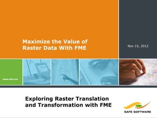
  • 1. Maximize the Value of Nov 15, 2012 Raster Data With FME Exploring Raster Translation and Transformation with FME
  • 2. Who Are We?  Today’s Presenters:  Dale Lutz Co-Founder and Vice President of Development Safe Software  Dave Campanas Product Specialist and Raster Master Safe Software
  • 3. Questions are Encouraged!  Today’s Q&A Support:  Dean Hintz FME Product Specialist Safe Software  Mark Stoakes Manager Professional Services (and FME Rockstar) Safe Software
  • 4. Giveaway: FME Training Course  Stay Tuned: 10 FREE seats up for grabs  FME Online Training -- Any Session
  • 5. Polls #1&2: Have you used FME?
  • 6.
  • 8. FME 2011: Makes you the Superhero! Achieve Total Spatial Data Mastery Achieve Total Spatial Data Mastery
  • 9. Proposed FME Banner Ad In 1981, Bill Gates said that "640K ought to be enough for anyone" He was wrong!
  • 10. Proposed FME Banner Ad In 1999 Dale Lutz said “FME will NEVER do raster” He was REALLY WRONG!
  • 11. FME Capabilities  Transform Data to Use and Share  Convertspatial data between hundreds of formats  Transformspatial data into the precise data model you need  Integratemultiple different data types into a single data model  Sharespatial data with people where, when and how they need it
  • 14. Raster Scenario #1 Translate  More than 50 raster formats to choose from  ArcSDE&GeoDatabase Raster  CADRG  MrSID*/ECW  Geodatabase Raster  GIF / PNG / JPEG / JPEG2000  Oracle Spatial GeoRaster  PostGIS 2.0 Raster (FME 2013)  …
  • 15. Raster Scenario #2 Resample
  • 16. Raster Scenario #3 Reproject
  • 18. Raster Scenario #5 Compress  Output formats with compression:  ECW  JPEG / JPEG2000  GeoTIFF / TIFF  Oracle Spatial GeoRaster  ArcSDE Raster  Geodatabase Raster  CADRG
  • 20. Raster Combo Scenario #7 Mosaic Reproject Clip Catalog! (http://bit.ly/parkcat)
  • 22. Raster Scenario #9 Web Tiling (http://bit.ly/fmetiles)
  • 24. Raster Scenario #11 Power  Band Restructuring  Extents Extraction  Cell Value Calculation  Palettes  Expression Evaluation (pixel by pixel)  …
  • 25. FME Raster Transformer List Clipper RasterCellCoercer RasterPaletteInterpretation *Reprojector (CSMAP, RasterCellOriginSetter Coercer ESRI,GTRANS, RasterCellValueCalculator RasterPaletteNodataSetter GridInQuest) RasterCellValueReplacer RasterPaletteRemover ImageFetcher RasterCellValueRounder RasterPaletteResolver ImageRasterizer RasterCheckpointer RasterPropertiesExtractor NumericRasterizer RasterConsumer RasterPyramider PointOnRasterValueExtractor RasterDEMGenerator RasterRGBCreator RasterBandAdder RasterExpressionEvaluator RasterReader RasterBandCombiner RasterExtentsCoercer RasterReplacer RasterBandInterpretation RasterExtractor RasterResampler Coercer RasterRotationApplier RasterGCPExtractor RasterBandKeeper RasterSelector RasterGCPSetter RasterBandMinMaxExtractor RasterSingularCellValue RasterGeoreferencer RasterBandNameSetter Calculator RasterInterpretationCoercer RasterBandNodataRemover RasterSubsetter RasterMosaicker RasterBandNodataSetter RasterTiler RasterNumericCreator RasterBandOrderer RasterToPolygonCoercer RasterPaletteAdder RasterBandProperties (FME 2012) Extractor RasterPaletteExtractor VectorOnRasterOverlayer RasterBandRemover RasterPaletteGenerator WebMapTiler RasterBandSeparator
  • 26. Raster Scenario #11 Transform a Numeric Raster…
  • 27. Raster Scenario #11 …Into Vector Polygons
  • 28. Raster Scenario #12 Niche  Satellite, Statistics, Legacy, etc  ASRP / CADRG  HDF  NetCDF  NGRID  NITF  PLANET  R  …
  • 29. Raster Scenario #13 (FME 2013 Sneak Peek) Hill Shading
  • 30. Poll: What Are We Missing?
  • 31. Share Today’s Webinar  Today’s webinar was recorded
  • 32. Learn More About FME  Get Acquainted:  Free trial of FME Desktop  Personalized web demo
  • 33. Learn More About FME  Get Acquainted:  Free trial of FME Desktop  Personalized web demo  Expand Your Knowledge:  Upcoming webinars  Turbocharging FME: How to Improve the Performance of Your FME Workspaces – Dec 12  Introducing FME 2013 – Jan ???  Upcoming Training (online & in person)
  • 34. Summary  What we’ve seen today:  FME can help you Prepare and Share your raster data Quickly!
  • 35.
  • 38. Thank You!  For more information, contact:  Sales:  sales@safe.com  (604)501-9985 ext. 287  Support  support@safe.com  (604)501-9985 ext. 278