
Recommended
More Related Content
What's hot
What's hot (20)
Similar to OpenStreetMap at Camp Roberts
Similar to OpenStreetMap at Camp Roberts (20)
More from mikel_maron
More from mikel_maron (20)
Recently uploaded
Recently uploaded (20)
OpenStreetMap at Camp Roberts
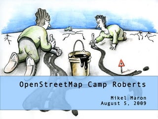
- 1. OpenStreetMap Camp Roberts Mikel Maron August 5, 2009
- 2. what is openstreetmap? the openstreetmap “one-liner” = +
- 3. GPS Surveying, Mapping Parties, Imagery Digitizing, Open Database
- 5. Maps and Data are Expensive, Wrong, Not Everywhere
- 6. OSM in Print, Offline, Mobile
- 7. Not Free (as in “Freedom”)
- 8. OSM in Govt & Corps
- 9. OSM in the Developing World and UN
- 10. Disasters
- 11. “Common Operating Picture” THE SOLUTION Collaborative Map Platform Online/Offline Bandwith Sensitive Sync-able Open Source – Field Hackable Remote Sensing Rapid Deploy P2P GeoRSS/KML Pre-Event Data Store Paper Maps SMS/Twitter Ham Radio
- 13. OpenPisteMap
- 14. OSM Cycle Map
- 15. Complete Roads and POI in West Bank and Gaza
- 18. Donated Data and Free Data
- 20. City of Merano
- 21. TIGER/Line
- 22. And more ... Afghanistan Imagery from NGA! Sudan from the UN, Canada, New Zealand, Falkland Islands...
- 23. Or just get on with it!
- 24. upcoming parties
- 25. TECH
- 26. RESTful API + simple data format + tagging for metadata + standard map tiles
- 27. = thriving ecosystem of tools, renderers, editors, routers, applications
- 28. Active Community! 130K+ registered 10K+ monthly editors Mailing lists wiki Parties
- 29. Rendering Architecture Editors Database Renderer Viewer Potlatch API tiles@ “Google” (Flash) (Rails) home tiles Slippy osmarender, Map JOSM pdfatlas, (Open (Java) MySQL ... Layers) ... Mapnik “Google” planet tiles dump
- 30. RESTful API http://api.openstreetmap.org/api/0.6/way/35 <way id='7972254' timestamp='2007-09-24T12:36:29+01:00' user='chippy' visible='true'> <nd ref='59608510' /> <nd ref='59608509' /> <nd ref='59608516' /> <nd ref='59608515' /> <nd ref='59608514' /> <nd ref='59608513' /> <nd ref='59608512' /> <nd ref='59608511' /> <nd ref='59608510' /> <tag k='created_by' v='JOSM' /> <tag k='building' v='retail' /> <tag k='name' v='White Rose Shopping Centre' /> <tag k='amenity' v='shopping_centre' /> <tag k='note' v='huge building' /> </way>
- 32. amenity = hospital Tags! name = Saint James POIs emergency = yes Ways highway = primary name = Otley Road ref = A660 Areas highway = residential name = Chestnut Lane oneway = true surface = flags leisure=nature_reserve http://wiki.openstreetmap.org/index.php/Map_features
- 35. Mapping Party, September 2006
- 36. OSM Brighton, December 2006
- 37. Winter 2007
- 38. Summer 2007 Today
- 39. Today
- 40. 1.0
- 41. My Process
- 42. Download existing data to GPS
- 43. Print Out Map for Notes, Bicycle
- 44. Network Diagram
- 45. Upload Tracks
- 46. Draw Over Them
- 47. OSM IN THE DEVELOPING WORLD
- 48. The Developing World (ala OSM)
- 50. “we feel that communities can harness the power of new geo-spatial imaging and mapping technologies to strengthen their demands for secure tenure and housing rights open and vibrant public spaces and ecological conservation and sustainable development in the mega-city.”
- 52. Our first edit war, Cyprus
- 54. Disputes
- 55. Disputes
- 56. OpenStreetMap database is fully localizable! We can represent multiple views of the world.
- 57. Myanmar Sudan Bolivia Baghdad North Korea Phillipines Southern Africa GPSTogo
- 58. The Possibilities & Applications
- 59. navigation (Bangalore Startups) urban planning, redevelopment, empowerment (CRIT/PUKAR) political participation agriculture (Trivandrum Agriculture Department) ecology (Biodiversity Survey, Madhav Gadgil) riverbank erosion in West Bengal (WBUT) humanitarian response
- 60. tracking taxis/safety data collection for rural development, and models for transitioning to open GIS data collection (professor shah's project) monitoring rainfall, collecting and disseminating data to forms, calculating land use unchecked mining operations in the north of West Bengal humanitarian response
- 61. WE WILL MAP CAMP ROBERTS!
- 62. WE WILL MAP AFGHANISTAN!
- 63. WE WILL MAP THE WORLD! THANK YOU! mikel@osmfoundation.org http://slideshare.net/mikel_maron/