FreeGIS.net, INSPIRE, Open Source Software and OGC standards
•Download as ODP, PDF•
1 like•4,431 views

SFScon Workshop 2013: How Open Source, Free Software and Open Standards complement each other in an SDI environment

Recommended
Recommended
More Related Content
Similar to FreeGIS.net, INSPIRE, Open Source Software and OGC standards
Similar to FreeGIS.net, INSPIRE, Open Source Software and OGC standards (20)
More from Arnulf Christl
More from Arnulf Christl (20)
Recently uploaded
Recently uploaded (16)
FreeGIS.net, INSPIRE, Open Source Software and OGC standards
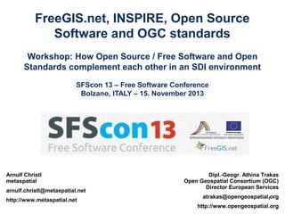
- 1. FreeGIS.net, INSPIRE, Open Source Software and OGC standards Workshop: How Open Source / Free Software and Open Standards complement each other in an SDI environment SFScon 13 – Free Software Conference Bolzano, ITALY – 15. November 2013 Arnulf Christl metaspatial arnulf.christl@metaspatial.net http://www.metaspatial.net Dipl.-Geogr. Athina Trakas Open Geospatial Consortium (OGC) Director European Services atrakas@opengeospatial.org 1 http://www.opengeospatial.org
- 2. Who is Athina ? http://www.opengeospatial.org/ogc/organization/staff/atrakas Athina works in the field of GIS since 1998 after finishing university with a diploma in Geography. She worked with CCGIS and WhereGroup being responsible for Business Development and International Outreach for Free and Open Source GIS and standards. Since 2009 she is OGC's Director for European Services. Athina is contact person for OGC in Europe, responsible for the Consortiums OGC activities and networking, like planning and managing of OGC recruitment, connecting with European stakeholder organisations and members. Athina is charter member of OSGeo since 2008. Additionally she is charter member of the Open Source Geospatial Foundation (OSGeo) since 2008. © 2013 Open Geospatial Consortium – 2
- 3. Introducing Arnulf Christl Arnulf Christl is an Open Source, Open Standards and Open Data advocate and promotes innovation at a sustainable pace. ● Metaspatial Systems Architect ● Founder of the metaspatial Institute ● Co-founder and Emeritus President of OSGeo ● OGC Architecture Board Member ● OpenStreetMap Advocate © 2013 Open Geospatial Consortium – 3
- 4. The workshop is about ... … open standards … open source GIS software … your questions © 2013 Open Geospatial Consortium – 4
- 5. Introduction
- 6. The OGC http://www.opengeospatial.org/ http://www.opengeospatial.org/ogc/programs © 2013 Open Geospatial Consortium – 6
- 7. How is an OGC standard developed? http://www.opengeospatial.org/ogc/process → Issue / problem © 2013 Open Geospatial Consortium – 7
- 8. How is an OGC standard developed? http://www.opengeospatial.org/ogc/process → Issue / problem © 2013 Open Geospatial Consortium – 8
- 9. How is an OGC standard developed? http://www.opengeospatial.org/ogc/process → Issue / problem → Tell the relevant working group → Send email to the TCmailing list → Talk to OGC members and/or staff Communicate! © 2013 Open Geospatial Consortium – 9
- 10. How is an OGC standard developed? http://www.opengeospatial.org/ogc/process Positive Feedback / Interest Initiate an Interoperability Program initiative: Special prerequirements needed ● Results: e.g. an Engineering Report ● With enough interest / support by OGC members, a working group can be established ● Start a Domain Working Group (DWG): Special prerequirements needed (a certain number of OGC members, email to the Technical Committee etc.) ● Results: charter, mailing list, Wiki, timeframe (e.g. for teleconferences, meetings, expected results etc.) ● © 2013 Open Geospatial Consortium – 10
- 11. How is an OGC standard developed? http://www.opengeospatial.org/ogc/process Results achieved in the DWG/SWG may be: ● ● A Discussion Paper or a Candidate Standard document is being developed It will be reviewed by the OGC Architecture Board (OAB) and the Technical Committee (TC). → Once an OGC document is published (by vote of the SWG), everyone who is interested can comment on it within a given period of time (usually 30 days): ● ● ● Requests to the document need to be answered by the relevant SWG Changes and comments need to be included (SWG works the comments) SWG votes to release to the TC for an adoption vote, vote happens → New approved standard published © 2013 Open Geospatial Consortium – 11
- 12. OGC Domain & Standards Working Groups Standards Program (SP): (i) Domain Working Groups: Forum for discussion and documentation of interoperability requirements for a given information or user community, Informal presentations and discussions about the market use of adopted OGC Standards (http://www.opengeospatial.org/projects/groups/wg) (ii) Standards Working Groups: Edit and approve a candidate standard for public comment, Consider official Change Request Proposals to an existing OGC Standard and make changes to the standard as necessary (http://www.opengeospatial.org/projects/groups/swg) © 2013 Open Geospatial Consortium – 12
- 13. OGC Standards in INSPIRE
- 14. OGC Open Geospatial Consortium, 2011 – Making Location Count...
- 15. OGC MetOceans DWG: example for cooperation (Cross Domain Modeling) The OGC MetOcean DWG provides the forum for development of a harmonized data model for meteorology. Main stakeholders in this activity comprise: WMO, INSPIRE (TWG Atmospheric Conditions & Meteorologica Features), aviation and earth science community. Slides from presentation given by Jeremy Tandy at the Toulouse OGC TC Meeting (Sept. 2010) © 2013 Open Geospatial Consortium – 15
- 16. INSPIRE technical architecture INSPIRE Discovery service: – OGC Catalogue Service for the Web (CSW) – Query language: OGC Filter Encoding INSPIRE View service: – ISO 19128 : WMS (Web Map Service) 1.3 (extensions) INSPIRE Download service: – Pre-defined data sets => standard Internet protocols (like FTP) – Direct access data with queries – Web Feature Service: OGC WFS / ISO 19142 – Filter Encoding: OGC Filter Encoding / ISO 19143 INSPIRE Coordinate Transformation service: – An Application Profile of the Web Processing service (WPS) based on OGC the Web Coordinate Transformation Service (WCTS) Open Geospatial Consortium, 2011 – Making Location Count...
- 17. INSPIRE and OGC Standards → Market Report on open Standards in INPSIRE provide examples activities underway around INSPIRE based on international standards, highlight overlap between OGC and ISO standards (e.g. ISO 19115) This purpose of this special OGC market report is to provide INSPIRE stakeholders with an overview of OGC, CEN and ISO standards in INSPIRE and to provide clarification of the Implementing Rules with respect to standards. The report highlights the fact that INSPIRE has some elements that are legally binding and other elements that are not. INSPIRE Implementing Rules are legally binding, but they do not specify particular standards or technologies. Technical Guidance documents accompanying the Implementing Rules provide the implementation details but they are not legally binding documents. Technical Guidance documents reference OGC, ISO and other standards. http://www.opengeospatial.org/pressroom/marketreport/inspire © 2013 Open Geospatial Consortium – 17
- 18. OGC and INSPIRE • We encourage members and the public to make suggestions for improving OGC standards, or for developing alternatives to better fit users’ application requirements, including to support INSPIRE. • Please note: existence of INSPIRE’s due date does not by itself speed up processing feature requests and change requests within OGC. It is up to the submitter to champion the requests or find proxies to champion the changes! – If you don’t shepherd your request, who will? – And if someone else does, are you sure they are looking out for your interests? © 2013 Open Geospatial Consortium – 18
- 19. OGC & the FreeGIS.net – multilingual FreeGIS.net enables public administrations to effectively publish geo information by providing Free Software applications, open data licenses and open standards https://freegis.net/ © 2013 Open Geospatial Consortium – 19
- 21. Technical Example This technical example will show how the OGC standard needs to be extended in order to address the requirements of the INSPIRE regulation. ● OGC standard ● INSPIRE View Service requirements ● MapServer technical implementation ● FreeGIS environment and collaborative approach: ● PostGIS ● MapServer ● GisClient ● FreeGIS.net Viewer ● PyWPS ● OpenLayers © 2013 Open Geospatial Consortium – 21
- 22. The OGC WMS Standard The OGC WMS Standard is used to disseminate map data. TO acces a service first the Online Resource URL must be made available. This URL is the parameterized with one of the two core calls: – GetCapabilities – GetMap They will return a map image for a specified coordinate area and selected map layers. There are also some optional additional calls to retrieve a legend (GetLegendGraphic) or the metadata of the layer or the full service... http://www.opengeospatial.org/standards/wms © 2013 Open Geospatial Consortium – 22
- 23. OGC WMS Capabilities Document GetCapabilities ...will return an XML document containing all the information need to make an educated GetMap request. Example: http://metaspatial.net/cgi-bin/ogc-wms.xml?REQUEST=GetCapabilities&... © 2013 Open Geospatial Consortium – 23
- 24. OGC WMS GetMap Request GetMap ...will return an map image Example: http://metaspatial.net/cgi-bin/ogc-wms.xml?REQUEST=GetMap&... http://metaspatial.net/cgi-bin/ogc-wms.xml? VERSION=1.3.0& REQUEST=GetMap& SERVICE=WMS& LAYERS=DTM,Overview,Raster_250K,Topography,n ationalparks,Infrastructure,Places& STYLES=,,,,,,& CRS=EPSG:27700& BBOX=424735.97883597884,96026.98412698413,46 7064.02116402116,127773.01587301587& WIDTH=400& HEIGHT=300& FORMAT=image/png& BGCOLOR=0xffffff& TRANSPARENT=TRUE& EXCEPTIONS=XML © 2013 Open Geospatial Consortium – 24
- 25. Changes to OGC WMS... Sometimes new requirements will arise, for example to satisfy INSPIRE regulations. As a quick fix these can be implemented in Open Source software. In the long run they should become part of the regular OGC WMS standard by requesting a change from the OGC working group. © 2013 Open Geospatial Consortium – 25
- 27. Submitting a Change Request to the OGC ● ● All technical development underlies a lot of changes. Standards rely heavily on dependencies. Instead of reinventing the wheel again and again, standards reference other standards. Therefore any change in a standard is bound to disrupt other development, especially in the underlying layers. Still, sometimes there is a need for changes, to make these known they have to be submitted as a Change Request. This section will highlight the steps involved. https://docs.google.com/document/d/1o2IjqNsnzWiTX_ECnnIMK52tQO3GQN2hX M8rllGXa9A/edit# © 2013 Open Geospatial Consortium – 27
- 28. Collaboration and Cooperation http://www.opengeospatial.org/pressroom/newsletters/201004/#C5 The CEN/TC 287 workshop on best practice for National Spatial Data Infrastructures (NSDIs) convened in Saint-Denis, Paris, France on 1 March 2010. This provided an excellent venue and opportunity for organizational representatives of CEN/TC 287, ISO/TC 211 and OGC to discuss ways in which coordination between these standards bodies can be improved to better address European and international standards requirements. Discussions also included representatives from participating user communities, and led to general agreement for closer, more formal cooperation between OGC and CEN/TC 287, as well as agreement to consider continued improvements in OGC and ISO/TC 211 coordination. Emphasis was also placed on the testing of standards for viability, fulfillment of purpose, ease of implementation and improvements in interoperability. The mantra "test early, test often" was reflective of this need. These three organizations will be cooperatively exploring the adoption of a common Change Request / Requirements registry, and will be examining ways in which adopted standards schema can be managed more effectively and efficiently across these organizations. The requirements process is also an effort to make the standards process more transparent and more responsive to community needs. All requirements and change requests will be gathered in an open forum visible to the public. All parties agreed that continued exploration of process improvements would be valuable to the community, with particular focus on improved coordination, reduction in duplication of effort, and streamlining of standards coordination processes. © 2013 Open Geospatial Consortium – 28
- 29. The Role of Open Source software for OGC Standards development
- 30. Free & Open Source Software and Standards ● Best practices ● Prototype development ● Reference Implementations © 2013 Open Geospatial Consortium – 30
- 31. How does an Open Source Project Work?
- 32. Participation, Collaboration and Funding ● How can you participate actively in an Open Source project? ● What does "Empowerment of the user" mean? ● How are Open Source Projects funded? © 2013 Open Geospatial Consortium – 32
- 33. OSGeo Incubation
- 34. OSGeo Incubation The Open Source Geospatial Foundation has setup a rigorous quality assessment. Any project wishing to become endorsed by OSGeo has to go through this process and prove that it follows the best practices laid out by OSGeo. This quality assurance ensures that projects are managed and run in a sustainable way and that users can rely on it's longevity. Find more information on the Web at: http://www.osgeo.org/incubator © 2013 Open Geospatial Consortium – 34
- 35. FreeGIS.net FreeGIS.net enables public administrations to effectively publish geo information by providing Free Software applications, open data licenses and open standards https://freegis.net/
- 36. Thank you for your attention! Grazie! Vielen Dank! Athina Trakas Director European Service, OGC eMail: atrakas@opengeospatial.org web: http://www.opengeospatial.org Arnulf Christl Metaspatial arnulf.christl@metaspatial.net http://www.metaspatial.net © 2013 Open Geospatial Consortium – 36
Editor's Notes
- Grazie, spasiba and Thank you very much for your attention.