its a Bagnoli PPT for class 10 student.
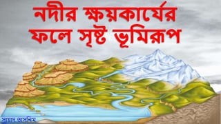
Erosional Landform # 1. River Valleys:
The valleys carved out by the rivers are significant erosional landforms. The shape and dimension of fluvially originated valleys change with the advancement of the stages of fluvial cycle of erosion. The valley formed in the youthful stage of fluvial cycle of erosion and in the initial stage of valley development is V-shaped having steep valley side slope of convex element.
The valley is very deep and narrow, both the valley sides meet together at the valley floor and thus water always touches the valley sides. Such type of V- shaped valleys are the result of accelerated rate of down-cutting (vertical erosion or valley deepening).
ADVERTISEMENTS:
The valleys are gradually widened due to lateral erosion with the advancement of the stage of cycle of erosion and they become quite broad with flat valley floor and uniform or rectilinear valley side slopes during mature stage or valley development and fluvial cycle of erosion.
They are further transformed into very broad and shallow valleys having concave valley side slope of very gentle gradient during old stage.
V- shaped valleys are divided into two types viz.:
(1) Gorges, and
(2) Canyons.
ADVERTISEMENTS:
(1) Gorges and canyons represent very deep and narrow valleys having very steep valley side slopes say wall-like steep valley sides. It is difficult to draw a line of distinction between these two types of valleys. Normally, a very deep and narrow valley is called a gorge and the extended form of a gorge is called a canyon
Erosional Landform # 2. Waterfalls:
Waterfalls or simply falls are caused because of sudden descents or abrupt breaks in the longitudinal course of the rivers due to a host of factors e.g., variation in the relative resistance of rocks, relative difference in topographic reliefs, fall in the sea level and related rejuvenation, earth movements etc. A waterfall may be defined as a vertical drop of water of enormous volume from a great height in the long profiles of the rivers. Rapids are of much smaller dimension than waterfalls.
Generally, they are found upstream from the main falls but they are also found independently. There is a chain of waterfalls along the junction of the Piedmont and Atlantic coastal plain from New England Region in the north-east to central Alabama in the south-west (USA) wherein all the Atlantic bound streams while descending through the Piedmont make numerous waterfalls.
This chain of water falls is called fall line in the USA. There is also a well-marked fall line in India. This Indian fall line extends between the Purwa or Tons falls on the Tons river (in the north-west part of the Rewa district of Madhya Pradesh) in the west and Sasaram (Bihar) in the east along the junction of the northern foreland of Peninsular India and the Ganga plains.
Hundreds of waterfalls ranging in height between 15m and 180m are found along this fall line as all the major streams