Marsabit County, Kenya is known for its diverse landscapes including volcanic craters, lakes, forests, and deserts. Some key features include Marsabit National Park which is a refuge for elephants and has Lake Paradise, popularized by its name given by explorers Osa and Martin Johnson. The county also contains Lake Turkana, the largest desert lake in the world, and the Chalbi Desert inhabited by nomadic peoples. A notable landmark is Ahmed, an elephant that was protected from poachers by presidential decree and is now displayed at the National Museum in Nairobi.
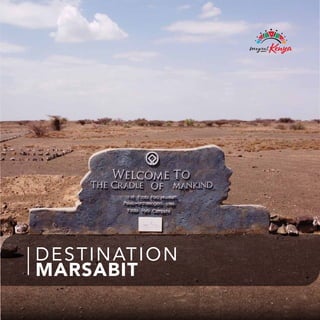
2. Marsabit, affectionately referred to as the Cradle of Mankind by
Anthropologists because of its prehistoric sites, is an adventure
lover’s paradise. The Koobi Fora deposits - rich in mammalian,
molluscan and other fossil remains - have contributed more to the
understanding of paleo-environments than any other site on the
continent. The county has diverse and unique attractions ranging
from the misty dense forest of Marsabit National Park, home of the
famous Ahmed the Elephant and a refuge for big-tusked bull
elephants to the iconic crater lake, Lake Paradise. Marsabit is a land
of craters and the only true desert in East Africa, the Chalbi. This
expanse of salt pans and undulating sand dunes is inhabited by the
nomadic Gabbra community who traverse it with their herds of
camels in the sweltering heat. Marsabit is home to the largest
desert lake in the world and a UNESCO World Heritage site, Lake
Turkana. It is also a haven for the largest Nile Crocodiles and Euro-
pean-migrant birds on the shores of the pristine South Island
National Park. Marsabit’s magnificent sceneries constitute the
renowned biosphere reserve, Mount Kulal, with its forested volcanic
flanks which offer exciting hiking possibilities. The rocky Ngurnit is
ideal for an epic rock-climbing experience for the most adventur-
ous traveler. Marsabit is a true melting pot of culture. It boasts
fourteen diverse and indigenous communities that religiously
celebrate their culture paying homage to the age-old customs of
their forefathers. This beautiful fusion of culture is also exemplified
in the Desert Museum and Gallery in Loiyangalani on the shores of
Lake Turkana which showcases a collection of the authentic
artefacts and traditional regalia of her people. Formerly referred to
as the Northern Frontier District by the colonialists as it shares a
five-hundred-kilometre border stretch with the heritage-rich Ethio-
pia, Marsabit is the new frontier for experiential and immersion
tourism.
INTRODUCTION
3. Marsabit, affectionately referred to as the Cradle of Mankind by
Anthropologists because of its prehistoric sites, is an adventure
lover’s paradise. The Koobi Fora deposits - rich in mammalian,
molluscan and other fossil remains - have contributed more to the
understanding of paleo-environments than any other site on the
continent. The county has diverse and unique attractions ranging
from the misty dense forest of Marsabit National Park, home of the
famous Ahmed the Elephant and a refuge for big-tusked bull
elephants to the iconic crater lake, Lake Paradise. Marsabit is a land
of craters and the only true desert in East Africa, the Chalbi. This
expanse of salt pans and undulating sand dunes is inhabited by the
nomadic Gabbra community who traverse it with their herds of
camels in the sweltering heat. Marsabit is home to the largest
desert lake in the world and a UNESCO World Heritage site, Lake
Turkana. It is also a haven for the largest Nile Crocodiles and Euro-
pean-migrant birds on the shores of the pristine South Island
National Park. Marsabit’s magnificent sceneries constitute the
renowned biosphere reserve, Mount Kulal, with its forested volcanic
flanks which offer exciting hiking possibilities. The rocky Ngurnit is
ideal for an epic rock-climbing experience for the most adventur-
ous traveler. Marsabit is a true melting pot of culture. It boasts
fourteen diverse and indigenous communities that religiously
celebrate their culture paying homage to the age-old customs of
their forefathers. This beautiful fusion of culture is also exemplified
in the Desert Museum and Gallery in Loiyangalani on the shores of
Lake Turkana which showcases a collection of the authentic
artefacts and traditional regalia of her people. Formerly referred to
as the Northern Frontier District by the colonialists as it shares a
five-hundred-kilometre border stretch with the heritage-rich Ethio-
pia, Marsabit is the new frontier for experiential and immersion
tourism.
INTRODUCTION
4. Inside Chalbi desert is a huge salt pan East of Lake Turkana where
there is no oasis. Amazingly, you might still come across an Oryx,
Ostrich or even the endangered Grevy Zebra galloping across the
great, shimmering whiteness. After the rains, the bone-dry land
turns into a shallow lake. On its northern fringes, where the wind
piles up sand dunes, a chain of oases nourishes vast palm grooves.
The precious greenery attracts flocks of Sandgrouse and Gabbra
pastoralists alike, who bring their camels in the hundreds to drink.
The colourful dresses, the singing and the dancing of their women
appear as a celebration of life in an otherwise hostile environment.
Further north rises the Huri Hills which comfort the sweating
traveler with moderate temperatures and distant views over a
boiling country.
Chalbi desert does not have distinct temperature conditions. It has
a semi-arid kind of climate. February is the warmest month in
Chalbi going past 36 degrees Celsius. July is the coldest month
with temperatures going as low as 18 degrees Celsius. Tempera-
tures drop sharply during the night. It can get chilly.
On the fringes of the desert, a number of basic camps and lodges
that provide modest accommodation and meals can be found.
Local tour guides provide guiding services at a fee.
CHALBI DESERT
5. Inside Chalbi desert is a huge salt pan East of Lake Turkana where
there is no oasis. Amazingly, you might still come across an Oryx,
Ostrich or even the endangered Grevy Zebra galloping across the
great, shimmering whiteness. After the rains, the bone-dry land
turns into a shallow lake. On its northern fringes, where the wind
piles up sand dunes, a chain of oases nourishes vast palm grooves.
The precious greenery attracts flocks of Sandgrouse and Gabbra
pastoralists alike, who bring their camels in the hundreds to drink.
The colourful dresses, the singing and the dancing of their women
appear as a celebration of life in an otherwise hostile environment.
Further north rises the Huri Hills which comfort the sweating
traveler with moderate temperatures and distant views over a
boiling country.
Chalbi desert does not have distinct temperature conditions. It has
a semi-arid kind of climate. February is the warmest month in
Chalbi going past 36 degrees Celsius. July is the coldest month
with temperatures going as low as 18 degrees Celsius. Tempera-
tures drop sharply during the night. It can get chilly.
On the fringes of the desert, a number of basic camps and lodges
that provide modest accommodation and meals can be found.
Local tour guides provide guiding services at a fee.
CHALBI DESERT
6. Goff Aretho crater
near Marsabit town
LAKE PARADISE
“The lake was shaped like a spoon, almost a quarter of a mile wide
and three-quarters of a mile long, and it sloped up into steep,
wooded banks two hundred feet high. A tangle of water-vines
and lilies—great African lilies—grew in the shallows at the water’s
edge. Wild ducks, cranes and egrets, circled and dipped. Animals,
more than we could count, stood quietly knee-deep in the water
and drank.
“It’s Paradise, Martin!” I said.
He nodded.
That was how Lake Paradise was given its name.”
~ Blaney Percival~
In 1921, Osa Johnson, and her husband Martin, both natives of
Kansas, took off for faraway East Africa determined to document
on film a land they knew almost nothing about. They stumbled
upon the iconic crater lake. The filmmaker and writer later wrote
a book called ‘’I Married Adventure’’ in which they document
their adventurous journey in the ‘wild’ North hence popularizing
Lake Paradise by giving it the name. It’s a drinking haven for the
big-tusked elephants of Marsabit and has a campsite hidden
deep in the steep crater.
MARSABIT NATIONAL PARK
The Park comprises of three crater lakes that are the only perma-
nent surfaces of water in the region, providing habitat for a variety
of bird life. Major wildlife attractions include the African elephant.
The Park is famous for its elephant named Ahmed that was
provided with 24-hr security surveillance by presidential decree
in the 1970’s, to demonstrate Kenya’s commitment to wildlife
conservation. Other wildlife species are the Buffalo, Greater/Less-
er Kudu, Hyena, Grevy’s Zebra, Kirk’s Dik-Dik, Lion, Leopard,
Baboons, among others.
The beautiful Marsabit National Park is a refuge for big-tusked
bull elephants, diverse birdlife, and reptiles. It also provides
opportunities for visits to the singing wells and hikes in the dense
forest wreathed in mist.
A volcanic crater is a circular depression in the ground caused by
volcanic activity. It is typically a basin, circular in form within
which occurs a vent (or vents) from which magma erupts as
gases, lava, and ejecta. A crater can be of large dimensions, and
sometimes of great depth. Marsabit County has five of such
craters!
7. Goff Aretho crater
near Marsabit town
LAKE PARADISE
“The lake was shaped like a spoon, almost a quarter of a mile wide
and three-quarters of a mile long, and it sloped up into steep,
wooded banks two hundred feet high. A tangle of water-vines
and lilies—great African lilies—grew in the shallows at the water’s
edge. Wild ducks, cranes and egrets, circled and dipped. Animals,
more than we could count, stood quietly knee-deep in the water
and drank.
“It’s Paradise, Martin!” I said.
He nodded.
That was how Lake Paradise was given its name.”
~ Blaney Percival~
In 1921, Osa Johnson, and her husband Martin, both natives of
Kansas, took off for faraway East Africa determined to document
on film a land they knew almost nothing about. They stumbled
upon the iconic crater lake. The filmmaker and writer later wrote
a book called ‘’I Married Adventure’’ in which they document
their adventurous journey in the ‘wild’ North hence popularizing
Lake Paradise by giving it the name. It’s a drinking haven for the
big-tusked elephants of Marsabit and has a campsite hidden
deep in the steep crater.
MARSABIT NATIONAL PARK
The Park comprises of three crater lakes that are the only perma-
nent surfaces of water in the region, providing habitat for a variety
of bird life. Major wildlife attractions include the African elephant.
The Park is famous for its elephant named Ahmed that was
provided with 24-hr security surveillance by presidential decree
in the 1970’s, to demonstrate Kenya’s commitment to wildlife
conservation. Other wildlife species are the Buffalo, Greater/Less-
er Kudu, Hyena, Grevy’s Zebra, Kirk’s Dik-Dik, Lion, Leopard,
Baboons, among others.
The beautiful Marsabit National Park is a refuge for big-tusked
bull elephants, diverse birdlife, and reptiles. It also provides
opportunities for visits to the singing wells and hikes in the dense
forest wreathed in mist.
A volcanic crater is a circular depression in the ground caused by
volcanic activity. It is typically a basin, circular in form within
which occurs a vent (or vents) from which magma erupts as
gases, lava, and ejecta. A crater can be of large dimensions, and
sometimes of great depth. Marsabit County has five of such
craters!
8. AHMED, THE ELEPHANT OF
MARSABIT
Ahmed of Marsabit was and still is the most famous Elephant
ever to have roamed the African continent. Born in 1919, Ahmed
came from the forests of Mount Marsabit and grew to become a
truly unique giant, justifiably known by the natives and big game
hunters alike as the "King of Marsabit".
In 1970, and in order to protect him from poachers, Kenya’s Presi-
dent Jomo Kenyatta placed the Elephant under his protection
by presidential decree, an unparalleled occurrence in the history
of the country and the only Elephant to be declared a living
monument. The giant was watched over day and night by two
game warders against poachers.
A loner and quite elusive, Ahmed was seldom seen and was
known better by reputation than by sight. One morning in 1974,
after having waited in vain for their charge to reappear from the
copse he had disappeared into the night before, his personal
body guards decided to go and look for him. When they found
Ahmed dead, he was not lying on his side, but resting majestical-
ly on his famous tusks, half-leaning against a tree. He was 55.
While Ahmed was alive, it was thought that his tusks were of
record size but after his death his tusks were found to weigh only
67.2 kg (148 lbs.) each. This is still no mean size but it’s still far from
some other tuskers. Today, Ahmed of Marsabit can be admired as
a mounted exhibit at the Kenya National Museum in Nairobi.
THE ‘SINGING WELLS’ OF
MARSABIT
The ‘Singing Wells’ of Marsabit is an age-old cultural experience
mainly practised by herders as they draw water from wells to
quench the thirst of the livestock, their main source of livelihood.
It’s a melodic show that encourages and entertains them as they
undertake the communal activity. The singing wells are found
around the Marsabit Mountain.
9. AHMED, THE ELEPHANT OF
MARSABIT
Ahmed of Marsabit was and still is the most famous Elephant
ever to have roamed the African continent. Born in 1919, Ahmed
came from the forests of Mount Marsabit and grew to become a
truly unique giant, justifiably known by the natives and big game
hunters alike as the "King of Marsabit".
In 1970, and in order to protect him from poachers, Kenya’s Presi-
dent Jomo Kenyatta placed the Elephant under his protection
by presidential decree, an unparalleled occurrence in the history
of the country and the only Elephant to be declared a living
monument. The giant was watched over day and night by two
game warders against poachers.
A loner and quite elusive, Ahmed was seldom seen and was
known better by reputation than by sight. One morning in 1974,
after having waited in vain for their charge to reappear from the
copse he had disappeared into the night before, his personal
body guards decided to go and look for him. When they found
Ahmed dead, he was not lying on his side, but resting majestical-
ly on his famous tusks, half-leaning against a tree. He was 55.
While Ahmed was alive, it was thought that his tusks were of
record size but after his death his tusks were found to weigh only
67.2 kg (148 lbs.) each. This is still no mean size but it’s still far from
some other tuskers. Today, Ahmed of Marsabit can be admired as
a mounted exhibit at the Kenya National Museum in Nairobi.
THE ‘SINGING WELLS’ OF
MARSABIT
The ‘Singing Wells’ of Marsabit is an age-old cultural experience
mainly practised by herders as they draw water from wells to
quench the thirst of the livestock, their main source of livelihood.
It’s a melodic show that encourages and entertains them as they
undertake the communal activity. The singing wells are found
around the Marsabit Mountain.
10. LAKE TURKANA &
LOIYANGALANI
The most saline of Africa's large lakes, Turkana is an outstand-
ing laboratory for the study of plant and animal communities.
The three National Parks serve as a stopover for migrant water-
fowl and are major breeding grounds for the Nile Crocodile,
Hippopotamus, and a variety of venomous snakes.
Lake Turkana National Park is made of Sibiloi National Park,
the South Island and the Central Island National Parks, cover-
ing a total area of 161,485 hectares located within the Lake
Turkana basin whose total surface area is 7 million hectares.
The Lake is the most saline lake in East Africa and the largest
desert lake in the world. It is surrounded by an arid, seemingly
extraterrestrial landscape that is often devoid of life. The long
body of Lake Turkana drops down along the Rift Valley from
the Ethiopian border, extending 249 kilometers from north to
south and 44 km at its widest point with a depth of 30 meters.
It is Africa's fourth largest lake, fondly called the Jade Sea
because of its breathtaking color.
It represents unique geo-morphological features with fossil
deposits on sedimentary formations as well as one hundred
identified archaeological and paleontological sites. There are
numerous volcanic overflows with petrified forests. The exist-
ing ecological conditions provide habitats for maintaining
diverse flora and fauna.
BIRDS
The Lake Turkana region is home to hundreds of species of
birds endemic to Kenya. The East African Rift System also
serves as a flyway for migrating birds, bringing in hundreds
more. The birds are essentially supported by plankton masses
in the lake, which also feed the fish.
REPTILES
The lake formerly contained Africa's largest population of Nile
crocodiles: 14,000, as estimated in a 1968 study by Alistair
Graham.
SOUTH ISLAND NATIONAL
PARK
Covered end to end in volcanic ash, the nightly glow of its South
Island’s luminous vents has inspired numerous tales of ghosts and evil
spirits. The island is home to a profusion of birdlife including 34 species
of European migrants most spectacularly viewed as they return home
between March and May. At least 23 species breed here, including
Goliath Heron, and African skimmer, while African Open-billed Stork,
Duck and Gulls feed on the shores and the volcanic island lakes attract
lesser flamingos. Birds of prey are also abundant, especially
swallow-tailed kites. This park is ideal for game watching and has one
of the world’s largest concentrations of crocodiles.
CENTRAL ISLAND NATIONAL
PARK
Emerging starkly from the blue-green waters of the largest permanent
desert lake in the world, Lake Turkana, the Central Island is made up of
three active volcanoes that belch sulphurous smoke and steam. Three
crater lakes - Crocodile Lake, Flamingo Lake and Tilapia Lake - provide
breeding grounds for the world’s largest concentration of Nile Croco-
diles. Central Island has a campsite where visitors can enjoy the beauti-
fully haunting sight of the lake’s luminous waters wash up onto a black
lava beach while the moon rises over the menacingly smoking craters.
LOIYANGALANI
Loiyangalani is a small town located on the southeastern coast of Lake
Turkana in Kenya. Loiyangalani means "a place of many trees" in the
native Samburu tongue. It is home to the Turkana, Samburu, Rendile
and El Molo people. The town is situated on the shores of Lake Turka-
na, the largest desert lake in the world and a UN World Heritage site.
Its main industries include fishing and tourism. It is a popular tourist
destination in Northern Kenya, as the surrounding El Molo and Turka-
na villages offer unique cultural experiences.
In June 2008, the first Cultural Festival took place at Loiyangalani, and
it united all tribes of the Lake in celebration for one weekend. And
from whence the festival continues to be held every other year.
Loiyangalani was the setting for John le Carré's novel, The Constant
Gardener, and was also a location for the film of the same title.
Main activities: Boat-rides in Lake Turkana, visit to El Molo shrines, visit
Rock arts in Marti (4km from town), visit to South Island and Central
11. LAKE TURKANA &
LOIYANGALANI
The most saline of Africa's large lakes, Turkana is an outstand-
ing laboratory for the study of plant and animal communities.
The three National Parks serve as a stopover for migrant water-
fowl and are major breeding grounds for the Nile Crocodile,
Hippopotamus, and a variety of venomous snakes.
Lake Turkana National Park is made of Sibiloi National Park,
the South Island and the Central Island National Parks, cover-
ing a total area of 161,485 hectares located within the Lake
Turkana basin whose total surface area is 7 million hectares.
The Lake is the most saline lake in East Africa and the largest
desert lake in the world. It is surrounded by an arid, seemingly
extraterrestrial landscape that is often devoid of life. The long
body of Lake Turkana drops down along the Rift Valley from
the Ethiopian border, extending 249 kilometers from north to
south and 44 km at its widest point with a depth of 30 meters.
It is Africa's fourth largest lake, fondly called the Jade Sea
because of its breathtaking color.
It represents unique geo-morphological features with fossil
deposits on sedimentary formations as well as one hundred
identified archaeological and paleontological sites. There are
numerous volcanic overflows with petrified forests. The exist-
ing ecological conditions provide habitats for maintaining
diverse flora and fauna.
BIRDS
The Lake Turkana region is home to hundreds of species of
birds endemic to Kenya. The East African Rift System also
serves as a flyway for migrating birds, bringing in hundreds
more. The birds are essentially supported by plankton masses
in the lake, which also feed the fish.
REPTILES
The lake formerly contained Africa's largest population of Nile
crocodiles: 14,000, as estimated in a 1968 study by Alistair
Graham.
SOUTH ISLAND NATIONAL
PARK
Covered end to end in volcanic ash, the nightly glow of its South
Island’s luminous vents has inspired numerous tales of ghosts and evil
spirits. The island is home to a profusion of birdlife including 34 species
of European migrants most spectacularly viewed as they return home
between March and May. At least 23 species breed here, including
Goliath Heron, and African skimmer, while African Open-billed Stork,
Duck and Gulls feed on the shores and the volcanic island lakes attract
lesser flamingos. Birds of prey are also abundant, especially
swallow-tailed kites. This park is ideal for game watching and has one
of the world’s largest concentrations of crocodiles.
CENTRAL ISLAND NATIONAL
PARK
Emerging starkly from the blue-green waters of the largest permanent
desert lake in the world, Lake Turkana, the Central Island is made up of
three active volcanoes that belch sulphurous smoke and steam. Three
crater lakes - Crocodile Lake, Flamingo Lake and Tilapia Lake - provide
breeding grounds for the world’s largest concentration of Nile Croco-
diles. Central Island has a campsite where visitors can enjoy the beauti-
fully haunting sight of the lake’s luminous waters wash up onto a black
lava beach while the moon rises over the menacingly smoking craters.
LOIYANGALANI
Loiyangalani is a small town located on the southeastern coast of Lake
Turkana in Kenya. Loiyangalani means "a place of many trees" in the
native Samburu tongue. It is home to the Turkana, Samburu, Rendile
and El Molo people. The town is situated on the shores of Lake Turka-
na, the largest desert lake in the world and a UN World Heritage site.
Its main industries include fishing and tourism. It is a popular tourist
destination in Northern Kenya, as the surrounding El Molo and Turka-
na villages offer unique cultural experiences.
In June 2008, the first Cultural Festival took place at Loiyangalani, and
it united all tribes of the Lake in celebration for one weekend. And
from whence the festival continues to be held every other year.
Loiyangalani was the setting for John le Carré's novel, The Constant
Gardener, and was also a location for the film of the same title.
Main activities: Boat-rides in Lake Turkana, visit to El Molo shrines, visit
Rock arts in Marti (4km from town), visit to South Island and Central
12. Island National Parks, Annual cultural festival in May, filming
and bird watching.
Accommodation: Desert Museum Villas, Oasis lodge, Palm
Shade Camp, Malabo Camp, Tilamari Camp. Island Campsite,
among others
SOUTH ISLAND
NATIONAL PARK
The El Molo are believed to have originally migrated down into
the Great Lakes area around 1000 BC from Ethiopia in the more
northerly Horn of Africa region. They are believed to be the
smallest ethnic community in Kenya. Owing to the arid
environment in which they entered, they are held to have then
abandoned agricultural activities in favor of lakeside fishing.
Historically, the El Molo erected tomb structures in which they
placed their dead. A 1962 archaeological survey found that they
were mainly found near springs or wells of water. The El Molo
today primarily inhabit the southeast shore of Lake Turkana,
between El Molo Bay and Mount Kulal.
Today, most group members are admixed with adjacent Nilotic
populations, with only a handful of unmixed El Molo believed to
exist. Many El Molo speakers have also adopted cultural customs
from these communities.
THE GABBRA PEOPLE
Gabbra are nomadic pastoralists, inhabiting an area of about
40,000 square kilometres in the arid lowlands of northern
Kenya. With an exception of the elevated areas, Gabbraland
receives an average of 150-200mm of rainfall per year. It is due
to this aridity that they lead a nomadic life, constantly moving in
search of water and grazing for their camels, cattle, sheep and
goats. Livelihoods here are centred around livestock, primarily
camels, which are used for transportation, milk and meat. The
camel has a special significance in their way of life that includes
payment for dowry and mentions in their songs. The Gabbra still
operate traditional institutions responsible for supporting the
social structures of the community, and upholding traditional
laws. Every year based on the sighting of the moon (Gabbras
have a lunar calendar), they practice a ceremony called the Sorio
in which communal marriages are undertaken in the entire
Gabbraland. In the same period, special ceremonies to
commemorate the dead in the society is also held on a yearly basis.
The Gabbra lunar calendar has unique resemblance to the Islamic
calendar in the naming of the weekdays and the months and the
events therein. Gabbra houses are made from woven sisal mats,
sticks and camel hides and are portable. Whole villages can be
packed up, loaded onto a camel train, and moved to follow better
pastures and rain.
SIBILOI &
KOBI FORA
PRE-HISTORIC
SITES
Located on the wild and rugged shores of Lake Turkana, Sibiloi is
home to important archaeological sites including Koobi Fora. The
area is characterized by semi-desert habitat and open plains
flanked by volcanic formations including Mount Sibiloi, where the
remains of a petrified forest can be seen. Sibiloi serves as a stopover
for migrant waterfowl and is a major breeding ground for the Nile
crocodile. Terrestrial wildlife includes Zebras, Grant Gazelles, Lions,
Leopards, Stripped Hyenas, Beisa Oryx, Greater Kudu, Cheetahs and
Northern Topi, among others. A total of over 350 species of aquatic
and terrestrial birds have been recorded in Lake Turkana. Sibiloi is
surrounded by the Turkana, the Gabra and the Dassanach who are
communities with very rich and unpolluted traditional cultures.
Sibiloi was listed as one of the 15 locations in the world that would
experience a total solar eclipse on November 3, 2013. The total solar
eclipse would have lasted a maximum of 1 minute and 39 seconds.
About 1,000 tourists flocked to Sibiloi national park to get a
glimpse of the rare occurrence.
THE PETRIFIED FOREST
The forest is approximately 5 km away from the Karsa Gate (the
main entrance to the Sibiloi National Park). There are signs inside
the park so it shouldn’t be too difficult to drive there. The Petrified
Forest is the only one of its kind in Kenya.
Petrified wood (from the Greek root petro meaning “rock” or
“stone”; literally “wood turned into stone”) is the name given to a
The El Molo
people:
13. Island National Parks, Annual cultural festival in May, filming
and bird watching.
Accommodation: Desert Museum Villas, Oasis lodge, Palm
Shade Camp, Malabo Camp, Tilamari Camp. Island Campsite,
among others
SOUTH ISLAND
NATIONAL PARK
The El Molo are believed to have originally migrated down into
the Great Lakes area around 1000 BC from Ethiopia in the more
northerly Horn of Africa region. They are believed to be the
smallest ethnic community in Kenya. Owing to the arid
environment in which they entered, they are held to have then
abandoned agricultural activities in favor of lakeside fishing.
Historically, the El Molo erected tomb structures in which they
placed their dead. A 1962 archaeological survey found that they
were mainly found near springs or wells of water. The El Molo
today primarily inhabit the southeast shore of Lake Turkana,
between El Molo Bay and Mount Kulal.
Today, most group members are admixed with adjacent Nilotic
populations, with only a handful of unmixed El Molo believed to
exist. Many El Molo speakers have also adopted cultural customs
from these communities.
THE GABBRA PEOPLE
Gabbra are nomadic pastoralists, inhabiting an area of about
40,000 square kilometres in the arid lowlands of northern
Kenya. With an exception of the elevated areas, Gabbraland
receives an average of 150-200mm of rainfall per year. It is due
to this aridity that they lead a nomadic life, constantly moving in
search of water and grazing for their camels, cattle, sheep and
goats. Livelihoods here are centred around livestock, primarily
camels, which are used for transportation, milk and meat. The
camel has a special significance in their way of life that includes
payment for dowry and mentions in their songs. The Gabbra still
operate traditional institutions responsible for supporting the
social structures of the community, and upholding traditional
laws. Every year based on the sighting of the moon (Gabbras
have a lunar calendar), they practice a ceremony called the Sorio
in which communal marriages are undertaken in the entire
Gabbraland. In the same period, special ceremonies to
commemorate the dead in the society is also held on a yearly basis.
The Gabbra lunar calendar has unique resemblance to the Islamic
calendar in the naming of the weekdays and the months and the
events therein. Gabbra houses are made from woven sisal mats,
sticks and camel hides and are portable. Whole villages can be
packed up, loaded onto a camel train, and moved to follow better
pastures and rain.
SIBILOI &
KOBI FORA
PRE-HISTORIC
SITES
Located on the wild and rugged shores of Lake Turkana, Sibiloi is
home to important archaeological sites including Koobi Fora. The
area is characterized by semi-desert habitat and open plains
flanked by volcanic formations including Mount Sibiloi, where the
remains of a petrified forest can be seen. Sibiloi serves as a stopover
for migrant waterfowl and is a major breeding ground for the Nile
crocodile. Terrestrial wildlife includes Zebras, Grant Gazelles, Lions,
Leopards, Stripped Hyenas, Beisa Oryx, Greater Kudu, Cheetahs and
Northern Topi, among others. A total of over 350 species of aquatic
and terrestrial birds have been recorded in Lake Turkana. Sibiloi is
surrounded by the Turkana, the Gabra and the Dassanach who are
communities with very rich and unpolluted traditional cultures.
Sibiloi was listed as one of the 15 locations in the world that would
experience a total solar eclipse on November 3, 2013. The total solar
eclipse would have lasted a maximum of 1 minute and 39 seconds.
About 1,000 tourists flocked to Sibiloi national park to get a
glimpse of the rare occurrence.
THE PETRIFIED FOREST
The forest is approximately 5 km away from the Karsa Gate (the
main entrance to the Sibiloi National Park). There are signs inside
the park so it shouldn’t be too difficult to drive there. The Petrified
Forest is the only one of its kind in Kenya.
Petrified wood (from the Greek root petro meaning “rock” or
“stone”; literally “wood turned into stone”) is the name given to a
The El Molo
people:
14. special type of fossilized remains of terrestrial vegetation.
Petrified wood is formed when the organic matter in plant
material is gradually replaced by minerals. This process is called
permineralization. The plant material gets buried by sediment
and mineral rich water flows through the sediment replacing the
original plant material with inorganic matter such as silica.
KOOBI FORA PRE-HISTORIC
SITES
Northern Kenya holds an unsurpassed archive of human
prehistory. It holds the world’s richest record of human
pre-history, the longest and most complete record of human
ancestry spanning over 27 million years and a rich fossil heritage
stretching back over 100 million years into the dinosaur age. And
it’s from this that the county of Marsabit got its name as the
‘’cradle of mankind’’. This is the largest and most-well
documented collection of human related fossils that exists and is
unmatched anywhere in the world, and can only be found at the
Koobi Fora Museum and the National Museums of Kenya
Headquarters.
The museum hosts replicas of the fossils found in the park and
also has a collection of photos of the people of Northern Kenya
plus some of the wildlife that used to inhabit the park before the
climate of the area changed.
Fossil remains of
early elephants.
15. special type of fossilized remains of terrestrial vegetation.
Petrified wood is formed when the organic matter in plant
material is gradually replaced by minerals. This process is called
permineralization. The plant material gets buried by sediment
and mineral rich water flows through the sediment replacing the
original plant material with inorganic matter such as silica.
KOOBI FORA PRE-HISTORIC
SITES
Northern Kenya holds an unsurpassed archive of human
prehistory. It holds the world’s richest record of human
pre-history, the longest and most complete record of human
ancestry spanning over 27 million years and a rich fossil heritage
stretching back over 100 million years into the dinosaur age. And
it’s from this that the county of Marsabit got its name as the
‘’cradle of mankind’’. This is the largest and most-well
documented collection of human related fossils that exists and is
unmatched anywhere in the world, and can only be found at the
Koobi Fora Museum and the National Museums of Kenya
Headquarters.
The museum hosts replicas of the fossils found in the park and
also has a collection of photos of the people of Northern Kenya
plus some of the wildlife that used to inhabit the park before the
climate of the area changed.
Fossil remains of
early elephants.
16. CULTURAL
TOURISM
EXPERIENCE
Marsabit has 14 diverse communities that call the county home.
The communities have diverse cultures, languages and tradition-
al customs that they religiously adhere to. Every year, the
Marsabit Lake Turkana cultural festival celebrates the diversity of
these communities Loiyangalani on the shores of Lake Turkana.
The communities are; The Rendille, Samburu, Turkana, Burji,
Borana, Gabra, Konso, Wayuu, El Molo, Gareh, Somali, Sakuye,
Dasanach, and the Sidamo.
17. CULTURAL
TOURISM
EXPERIENCE
Marsabit has 14 diverse communities that call the county home.
The communities have diverse cultures, languages and tradition-
al customs that they religiously adhere to. Every year, the
Marsabit Lake Turkana cultural festival celebrates the diversity of
these communities Loiyangalani on the shores of Lake Turkana.
The communities are; The Rendille, Samburu, Turkana, Burji,
Borana, Gabra, Konso, Wayuu, El Molo, Gareh, Somali, Sakuye,
Dasanach, and the Sidamo.
18. LIST OF HOTELS IN MARSABIT
Sand & Rock Resort Marsabit Town
Chicho Hotel Marsabit Town
Nomads Resort Marsabit Town
Silvia Inn Resort Marsabit Town
Jey Jey Center Marsabit Town
Imperial Dale Hotel Marsabit Town
Saku Guest House Marsabit Town
Gof Hotel Marsabit Town
Jirime Resort Marsabit Town
KWS Bandas & Campsites Marsabit Town
Bongole Resort Marsabit Town
Palmshade Resort Loyangalani
Tilamari Resort Loyangalani
Oasis Lodge Loiyangalani
Desert Museum Villas Loiyangalani
El Molo Lodge Loiyangalani
Malabo Resort Loiyangalani
Palmshade Resort North Horr
Catholic Guest House North Horr
Kalacha Highway Villas Kalacha
Kalacha Bandas Kalacha
Chalbi Cottages Kalacha
Camp Ndoto Ngurnit
New Golbo Camp Ngurnit
Lasamu Campsite Ngurnit
Holale Resort Moyale
Al Yusra Hotel Moyale
LA Tahzan Hotel Moyale
Abuya Resort Moyale
19. LIST OF HOTELS IN MARSABIT
Sand & Rock Resort Marsabit Town
Chicho Hotel Marsabit Town
Nomads Resort Marsabit Town
Silvia Inn Resort Marsabit Town
Jey Jey Center Marsabit Town
Imperial Dale Hotel Marsabit Town
Saku Guest House Marsabit Town
Gof Hotel Marsabit Town
Jirime Resort Marsabit Town
KWS Bandas & Campsites Marsabit Town
Bongole Resort Marsabit Town
Palmshade Resort Loyangalani
Tilamari Resort Loyangalani
Oasis Lodge Loiyangalani
Desert Museum Villas Loiyangalani
El Molo Lodge Loiyangalani
Malabo Resort Loiyangalani
Palmshade Resort North Horr
Catholic Guest House North Horr
Kalacha Highway Villas Kalacha
Kalacha Bandas Kalacha
Chalbi Cottages Kalacha
Camp Ndoto Ngurnit
New Golbo Camp Ngurnit
Lasamu Campsite Ngurnit
Holale Resort Moyale
Al Yusra Hotel Moyale
LA Tahzan Hotel Moyale
Abuya Resort Moyale