九龍綠色通道建議 Kowloon Greenway Proposal
•
0 likes•488 views

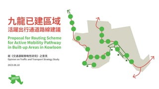
九⿓已建區域活躍出⾏通道路線建議 Proposal for Routing Scheme for Active Mobility Pathway in Built-up Areas in Kowloon 就2023年施政報告公眾諮詢及《交通運輸策略性研究》之意⾒ Opinion on 2023 Policy Address Public Consultation and Traffic and Transport Strategy Study 2023.08.18 九龍綠色通道 - 爭取九龍單車徑/單車通道/綠道網絡 Kowloon Greenway - Demand a Cycleway / Greenway Network in Kowloon

Recommended
Recommended
More Related Content
Similar to 九龍綠色通道建議 Kowloon Greenway Proposal
Similar to 九龍綠色通道建議 Kowloon Greenway Proposal (20)
Recently uploaded
Recently uploaded (20)
九龍綠色通道建議 Kowloon Greenway Proposal
- 1. 九⿓已建區域 活躍出⾏通道路線建議 Proposal for Routing Scheme for Active Mobility Pathway in Built-up Areas in Kowloon 就《交通運輸策略性研究》之意⾒ Opinion on Traffic and Transport Strategy Study 2023.08.18
- 2. 建議摘要 Suggestion Digest ● 已建市區仍有空間和機會引⼊活躍出⾏通道! There are still spaces and opportunities in built-up urban areas to introduce active mobility pathway! ● 只需四條主線,即可與新市鎮及新發展區組成全港網絡,完成終極的缺環! Only 4 main routes are needed to join the regional network with New Towns and NDAs, to complete the ultimate missing link! ● 只需佔⽤少量現有道路空間,對道路交通影響甚微。 There is minimum need to convert existing road space, making negligible effect to road traffic. ● 主要善⽤休憩⽤地、政府⼟地及公共設施⽤地,能夠影響最少私⼈⼟地。 Mainly open space, government land and land for public facilities can be utilised, with minimal impact on private land. ● 建議將已建市區活躍出⾏政策納⼊於《交通運輸策略性研究》等研究。 It is suggested to incorporate active mobility policy framework in built-up areas into Traffic and Transport Strategy Study and other study projects. 2
- 4. 釋義 Definitions 本建議中個別⽤辭將以斜體表⽰,並蘊涵以下解釋: ● 「活躍出⾏」依靠可由⼈⼒有效推動的移動⼯具在城市內以普遍的速度移 動,作為⽇常⽣活的⼀部分。例⼦主要包括步⾏、跑步、單⾞、滑板⾞等 ,並包括主流速度的電動移動⼯具。 ● 「活躍出⾏通道」或「通道」 主要讓活躍出⾏專⽤的路線,並須合乎個別設計要求。 ● 「單⾞通道」 所有指定容許單⾞使⽤的路徑。 ● 「單⾞徑」 與官⽅及法律定義⼤致相同,並唯不包括與⾏⼈或機動⾞輛共⽤的路徑。 ● 「單⾞線」 與⾺路只作劃線分隔的單⾞專⽤空間。 ● 「⾏⼈路」 ⾏⼈專⽤的路徑。 ● 「共享徑」 除單⾞徑及⾏⼈路之外,容許單⾞及⾏⼈全⾯共⽤的路徑。如有劃線分隔 路權,即不符此定義。 4 Specific terms used in this proposal will be in italics and are explained as follows: ● “Active mobility” Movement within a city as part of daily life, at a common speed, relying on a moving tool that can be efficiently propelled by human power. Examples cover mainly walking, running, cycling, scooters, etc., and include electric powered moving tool at common speeds. ● “Active mobility pathway” or “pathway” Routes that are primarily dedicated to active mobility and are subject to particular design requirements. ● “Cycleway” All the paths designated to allow cycling. ● “Cycle track” Broadly the same as the official and legal definitions and does not include paths shared with pedestrians or motorised vehicles. ● “Cycle lane” A dedicated space for cycling separated from the carriageway by lines only. ● “Footpath” Dedicated path for pedestrians. ● “Shared path” A path, other than cycle tracks and footpaths, which is fully shared by cyclists and pedestrians. Where there are delineated rights of way, they do not meet this definition.
- 5. 背景及現況 Background and Current Situations ● 新界及部分新市鎮均設有單⾞徑及相關設施,⽽作為例外的荃灣亦已在海 濱建設單⾞徑 There are cycle tracks and related facilities in New Territories and some of the New Towns, and Tsuen Wan as one of the exceptions also had included a cycle track along the waterfront ● 新發展區將繼續提供單⾞友善設施及網絡 There will be bicycle-friendly facilities and network in New Development Areas ● 港島北岸、⻄九⽂化區及啟德共享徑正陸續開放,但未研究如何接通 HK Island North shore, West Kowloon Cultural District and Kai Tak will have shared paths, but interconnections have not been studied ● 不少街道均可踏單⾞,除單⾞禁區或路邊有單⾞徑的⾺路外 Cycling is allowed on streets, unless it is explicitly banned or a cycle track exists alongside the road 圖⽚來源 Image source https://gia.info.gov.hk/general/202009/28/P2020092800322_photo_1182019.jpg 5
- 6. 建議的理由 Reasons behind Proposal 市區過去的發展模式以效率為⽬標⽏庸置疑,但隨著社會愈趨重視環保交通、 公共健康、城市交通韌性及單⾞旅遊,當新市鎮及新發展區陸續採⽤及改善活 躍∕動態出⾏模式的基建配套,把全港各區分割的單⾞網絡貫通,將成為本年 代運輸規劃其中⼀個最重要的議題。 現時道路及公共交通只要遇上意外及繁忙時間,就要⾯對擠塞。步⾏能避開擠 塞,但並不適合1公⾥以上的中∕⻑距離⾏程。以單⾞為主的動態出⾏模式反⽽ 能補⾜這缺憾,成為⼀個具吸引⼒的後備交通⽅案。 以下兩類⾏程適合使⽤單⾞作⽇常出⾏: 1. 點對點⾏程,路程不⻑於10公⾥ 2. 公共交通前後的⾸尾程,即「駁腳」,路程通常較短(約3公⾥內) 事實上,單⾞出⾏有潛⼒成為⽇常交通出⾏模式,因為它能容許市⺠靈活選擇 路程及⽬的地。縱然與駕駛私家⾞的優點相似,但佔⽤較少空間。活躍出⾏⼯ 具以約時速⼆⼗公⾥的速度在城市核⼼移動,在繁忙時間更與汽⾞的市區平均 ⾞速相若。如有⾜夠配套確保安全,使⽤單⾞在⾼密度市區穿梭將⽐任何汽⾞ 更加靈活快捷。 6 While there is no doubt that the past development pattern in the urban areas has been geared towards efficiency, with the increasing emphasis on green transport, public health, urban transport resilience and cycling tourism, linking up the fragmented cycling network in Hong Kong will be one of the most crucial issues in transport planning in the current era when the infrastructure for active mobility is being adopted and improved in the New Towns and New Development Areas. Currently, roads and public transport are subject to congestion during accidents and peak hours. Walking seems to be able to avoid congestion, but not suitable for medium/long distances of more than 1 km, while active mobility including cycling as a key mode can complement this disadvantage and become an attractive backup mode of transport. The following two types of journeys are suitable for cycling for daily trips: 1. Point-to-point journeys, which may exceed 10 km in distance 2. The first and last journeys before and after public transport, i.e. "last-mile" journeys, which are usually shorter in distance (within around 3 km) In fact, cycling has the potential to become a daily transport mode as it allows flexibility in choosing the journey and destinations. Although it has similar advantages to driving a car, it takes up less space. Active mobility travels around the urban core at speeds of about 20 km/h, which is comparable to the average urban speed of a car during peak hours. With adequate support to ensure safety, cycling through dense urban areas is more flexible and faster than any car.
- 7. 建議的理由 Reasons behind Proposal 運輸署現正進⾏的《交通運輸策略性研究》其中⼀個⽅針,包括發展活躍出⾏ 模式作為健康⽣活的⽅式。若能執⾏整全的政策,除可滿⾜以上研究⽬標,更 可達致以下各部⾨的政策及⽴法會動議,包括: ● 規劃署在2021年10⽉發佈的 《⾹港2030+:跨越2030年的規劃遠景與策略》願景; ● 規劃署在2023年5⽉草擬的 《動態設計指引》; ● 衛⽣署在2018年5⽉發佈的 《邁向2025⾹港⾮傳染病防控策略及⾏動計劃》公共衛⽣⽬標; ● 環境及⽣態局在2021年10⽉發佈的 《⾹港氣候⾏動藍圖》,爭取2050年前實現碳中和;及 ● ⽴法會在2022年7⽉13⽇通過的 「加快實踐『健康城市』⽬標」無約束⼒議案 7 One of the objectives of the Traffic and Transport Strategy Study (TTSS) being conducted by the Transport Department (TD) is to develop active mobility as a mode for healthy living. If a comprehensive policy is implemented, it will not only meet the above objectives of the study, but also achieve the policies of the following departments and the motion of the Legislative Council, including: ● “Hong Kong 2030+: Towards a Planning Vision and Strategy Transcending 2030” by the Planning Department in October 2021; ● The draft Active Design Guidelines by the Planning Department in May 2023; ● "Towards 2025: Strategy and Action Plan to Prevent and Control NCD in Hong Kong" by the Department of Health in May 2018; ● "Hong Kong's Climate Action Plan" released by Environmental Protection Department in October 2021 to achieve carbon neutrality before 2050; and ● A LegCo motion called "Expediting the achievement of the 'healthy city' target" passed on 13 July 2022
- 8. 構思過程及⽅法 Idea Formulation and Methodology 1. 搜集資料 ● 檢視過往規劃研究於荃葵及九⿓的城市佈局,⽐較異同 ● 檢視現有交通⾛廊的⾛線與空間形態 ● 檢視單⾞熱度地圖 2. ⽐較資料 ● 疊加有關地圖資料 ● 評價各種路線是否適⽤於活躍出⾏ ● 列出活躍出⾏通道⾛線⼤綱 3. 識別城市發展情況 ● 識別現有已規劃⼟地⽤途、現有及擬議公共設施 ● ⽐較⾛線⼤綱,分析每段強弱危機 ● 提出興建活躍出⾏通道的模式 4. 設計路線 ● 套⽤基本設計要求,例如闊度、斜度、⾼度、彎度 ● 提出其他設施及基建的配合⽅法 因屬於多年探索過程,為跟隨城市發展計劃的變化,以及加⼊更多資料,以上 ⽅法時常局部重新開始,證明過程不能⼀蹴⽽就,⽽研究⽅法及內容都可以影 響結果,並⾮只有唯⼀⽅案。 8 1. Collect Information ● Review the urban layout of Tsuen Wan-Kwai Chung and Kowloon in previous planning studies and compare the similarities and differences ● Review the alignment and spatial form of existing transport corridors ● Review cycling heat maps 2. Compare and contrast information ● Overlay relevant map information ● Evaluate the suitability of various routes for active mobility ● Outline active mobility pathway alignments 3. Identify urban development ● Identify existing planned land uses, and existing and proposed public facilities ● Compare alignment outlines and analyse the SWOT of each section ● Propose modes of construction for active mobility pathway 4. Design Routes ● Apply basic design requirements, e.g. width, gradient, height, curvature ● Propose integration of other facilities and infrastructures As this is a process of exploration over the years, in order to keep up with the changes in the urban development scheme and to incorporate more information, the above approaches have been partially revisited from time to time - proving that the process cannot be completed in one go, and that the methodology and the details of the study can affect the outcome, instead of offering only one option.
- 9. 建議路線 Suggested Routes 九⿓、荃灣及葵涌應參考港島北岸,提供⼀組四條的活躍出⾏通道主線,連接 各區主要地點、交通樞紐及渡輪碼頭,補⾜城市交通韌性及有效⿎勵活躍出 ⾏。新界單⾞徑網絡正逐步推展,計劃所餘下的實際缺⼝尚有沙⽥⾄荃灣⼀段 ,⽽此建議將為其完璧。同時,此建議亦會處理將軍澳對市區的連接,發揮九 ⿓作為核⼼地區四通⼋達的優勢,讓全港各區互相接通。活躍出⾏有助促進公 眾健康及⿎勵市⺠接觸和欣賞城市。這組主線開放使⽤後,可以嵬集使⽤者資 料及數據以供研究,以便探討⻑遠擴展及改善⽅案。 Kowloon, Tsuen Wan and Kwai Chung should make reference to the north shore of Hong Kong Island and provide a set of 4 main routes of active mobility pathway, linking up major locations, transport hubs and ferry piers in each district, to enhance urban transport resilience and effectively encourage active mobility. The New Territories Cycle Track Network is being progressively implemented and this proposal will complete the remaining actual gap in the cycle track network from Sha Tin to Tsuen Wan. Meanwhile, this proposal also addresses connectivity from Tseung Kwan O to the urban areas, taking advantage of Kowloon's position as a core location with excellent connectivity to all parts of Hong Kong. Active mobility contributes to public health and encourages public interaction and appreciation of the city. Once this set of main routes is open for use, user information and data can be collected for research, so that long-term expansion and improvement options can be explored. 9 啟德 Kai Tak 主線 Route 1 主線 Route 2 主線 Route 3 主線 Route 4 ⻄九⿓ West Kowloon 荃灣 Tsuen Wan 沙⽥ Sha Tin 將軍澳 Tseung Kwan O
- 10. 建議設計質素 Suggested Design Quality 宏觀的規劃及適當的政策⾮常重要,以主導活躍出⾏通道每⼀分段的可⾏性研 究及詳細設計。主線容量和質素應兼顧不同使⽤者的需要,讓⾏⼈、單⾞使⽤ 者、滑板⾞、電動載具等均能安全享⽤。故此,單⾞徑的部分應如《⾹港規劃 標準與準則》所⽰不少於四⽶闊。⾏⼈路亦應⾄少兩⽶闊,並設⽴準則決定是 否使⽤與單⾞徑⼀致的鋪⾯,⿎勵⾏⼈舒適使⽤⾏⼈路。縱然⾹港予⼈⼀個⼭ 多平地少的城市印象,但只要深⼊理解地勢提供妥善連接,⾼度差距其實不成 難題。⾹港對上下坡⾏⼈運輸系統早有豐富經驗,只⽋⼀套為活躍出⾏友善的 政策及設計。⽽設計⼀條斜度低於百分之四的通道,加上每⼀百⽶內提供平台 作休息處,亦⾮難事。 Macro-planning and appropriate policies are important to guide the feasibility studies and detailed design of each sub-section of the active mobility pathway. The capacity and quality of the main route should cater for the needs of different users so that pedestrians, cyclists, scooters, electric carriers, etc. can enjoy safely. Therefore, the cycle track should be no less than 4m wide as shown in the Hong Kong Planning Standards and Guidelines (HKPSG). Footpaths should also be at least 2m wide, with criteria for determining whether or not to use paving consistent with cycle tracks, to encourage pedestrians to use footpaths comfortably. Although Hong Kong presents an image of a hilly city, the difference in heights is not a problem as long as there is a good understanding of the terrain and proper connections are provided. Hong Kong has plenty of experience with uphill and downhill pedestrian transport system, but lacks a policy and design that is friendly to active mobility. It is not difficult to design an access route with a gradient under 4% and provide resting places on platforms every 100 metres. 10
- 11. 建議配套 Suggested Auxiliary Provisions 1. 建築物 Buildings 建議加強對建築物活躍出⾏配套的要求及評分標準,例如⿎勵設置泊位及 更⾐室,吸引市⺠投⾝活躍出⾏。 It is suggested that the requirements and scoring criteria for active mobility ancillary facilities in buildings should be strengthened, for example, by encouraging the provision of parking spaces and changing rooms, so as to attract members of the public to take up active mobility. 2. 匯合中⼼及休息處 Hubs and Rest Areas 應在交通樞紐、渡輪碼頭及主要公園附近增設配套設施,⿎勵轉乘及將活 躍出⾏融⼊⽣活。設施應包括遮蔭、泊位、更⾐室、維修站、商店等。 Additional ancillary facilities should be provided in the vicinity of transport hubs, ferry piers and major parks to encourage interchange and integration of active mobility into daily life. Facilities should include shelters, parking spaces, changing rooms, repair stations, shops, etc. 圖⽚來源 Image source https://gia.info.gov.hk/general/202107/19/P2021071600366_photo_1196661.jpg 11
- 12. 路線詳情 Details of the Routes 12 地圖上的圖案 Icons on the maps 匯合中⼼,包括泊位、休息處、遮蔭、基本維修⼯具或維修站、更⾐室、洗⼿間等(善⽤現有設施或新建) Hub, including parking, rest areas, shading, repair tools or stations, changing rooms, lavatory, etc. (utilize the existing or newly build) 斜道系統(部分應與升降機⼀同配置,以提供最佳選擇) Ramp system (some should be configured with elevators to provide best options) 升降機(善⽤現有設施或新建) 電梯或運輸帶(善⽤現有設施或新建) Elevators (utilize the existing or newly build) Escalators or travelators (utilize the existing or newly build) 隧道 與⾺路的路⼝ Tunnel Crossing with road 鐵路站 渡輪碼頭 道路公共交通轉乘站(善⽤現有設施或新建) Railway station Ferry pier Stations for road transit (utilize the existing or newly build)
- 13. 主線 荃灣—⻄九⽂化區 Route Tsuen Wan ‒ West Kowloon Cultural District 1 13 概覽 Overview 荃灣、葵⻘區均為城市規劃層⾯上的「都會區」部分,過往發展 模式及地貌與九⿓及⾹港島接近。故荃灣海濱單⾞徑項⽬是⼀⼤ 突破,展現已建區域內拓展單⾞徑網絡的意志,值得繼續向前。 荃灣與⻄九⿓有重要⽽集中的道路及鐵路交通主軸,對⾏⼈及單 ⾞同樣適合,應設置活躍出⾏的專⽤通道。 Tsuen Wan and Kwai Tsing districts are part of the "Metro Area" at the town planning level, and their past development patterns and landscapes are similar to those of Kowloon and Hong Kong Island. Tsuen Wan harbourfront cycle track project was a major breakthrough, demonstrating the will to expand cycle track network in the built-up areas, and it is worthwhile to move forward. The north-south transport axes between Tsuen Wan and West Kowloon is essential and intense for road and rails, and also suitable for pedestrians and cyclists, who should be provided a dedicated access for active mobility. 葵涌 Kwai Chung 荃灣 Tsuen Wan ⻑沙灣 Cheung Sha Wan 油⿇地 Yau Ma Tei ⻄九⿓ West Kowloon
- 14. 主線 荃灣—⻄九⽂化區 Route Tsuen Wan ‒ West Kowloon Cultural District 1 概念路線 Conceptual Routing 將活躍出⾏通道由荃灣向南延伸⾄九⿓,並⾮困難之舉,因葵涌 及⻄九⿓在九⼗年代填海發展後,並沒以建築物⽤盡所有⼟地, 反⽽只需要妥善設計此通道即可。荃灣海濱與⻄九⽂化區相距⼗ 公⾥,可配合海濱⻑廊、板道、斜坡、天橋底空間等,以新的通 道創造別緻的城市空間。因與公園和交通中軸重疊,多個休憩⽤ 地及交通樞紐均可提供例如單⾞匯合中⼼的設施。 Extending the active mobility pathway from Tsuen Wan southwards to Kowloon is not a difficult task as Kwai Chung and West Kowloon, after reclamation in 1990s, have not used up all the land with buildings, but only need to have the pathway properly designed. The 10-km stretch from Tsuen Wan harbourfront to West Kowloon Cultural District can be complemented by waterfront promenades, boardwalks, slopes, spaces under flyovers, etc. to create a chic urban space with new links. Being overlapped with parks and transport axes, numerous open spaces and transport hubs can also work as facilities such as cycling hubs. 14 結構類型及⻑度 Lengths per Construction 地⾯ On-grade 隧道 Tunnel 架空 Elevated 4.89 km (48%) 5.11 km (50%) 0.18 km (2%) 總⻑度 Total Length 10.18 km 移動需時 Time of movement 33m 55s (18 km/h) 與道路路⼝數量 Nos. of Road Crossings 4 ⻄九⽂化區 WKCD 旺⾓ Mong Kok 葵涌 Kwai Chung 荃灣段 Tsuen Wan Section ⻘⾐ Tsing Yi 1-01 葵涌公園 Kwai Chung Park 1-02 荔景⼭空中⻑廊 Lai King Hill Sky Promenade 1-03 荔枝⾓段 Lai Chi Kok Section 1-04 ⻑沙灣段 Cheung Sha Wan Section 1-05 ⼤⾓咀段 Tai Kok Tsui Section 1-06 油⿇地空中⻑廊 Yau Ma Tei Sky Promenade 1-07
- 15. 主線 荃灣—⻄九⽂化區 Route Tsuen Wan ‒ West Kowloon Cultural District 1 1-01 荃灣段 Tsuen Wan Section ⻘荃路路邊屬⼈⼯斜坡,空間充⾜,可以善⽤;擬議荃⻘交匯處 及荃灣路改善⼯程亦將改造沿路的⼈⼯斜坡,均屬好機會提供活 躍出⾏通道,以延伸現有荃灣單⾞徑⾄葵涌。 The artificial slopes along the roadside of Tsing Tsuen Road are sufficiently spacious and can be utilized. The proposed Tsuen Tsing Interchange and Tsuen Wan Road Improvement Project, which will also modify the artificial slopes along the roadside, offer good chance to provide active mobility pathway to extend the existing Tsuen Wan Cycle Track to Kwai Chung. * 其他:與鐵路有關設施 * OU: Railway Related Facilities 15 現時已規劃⼟地⽤途 Current Zoned Land Use 結構類型及⻑度 Lengths per Construction 所需的⼯程 Works Needed 橋 Bridge 地⾯ On-grade 隧道 Tunnel 架空 Elevated 0.37 km 0.84 km 0.00 km 與道路路⼝數量 Nos. of Road Crossings 總⻑度 Total Length 1.21 km 移動需時 Time of movement 4m 2s (18 km/h) 0 ⽔平⾼度範圍 Height Range 21 mPD 5 mPD 斜坡 Slope 改造公園 Modify parks 搬遷公共設施 Relocate public facilities 預留公共空間 Reserve public space 善⽤天橋底空間 Utilize space under flyover 道路 Roads 休憩 O 綠化 GB 其他* OU* ⼯業 I 荃 灣 路 T s u e n W a n R o a d
- 16. 主線 荃灣—⻄九⽂化區 Route Tsuen Wan ‒ West Kowloon Cultural District 1 1-01 荃灣段 Tsuen Wan Section 16 效果圖來⾃Google街景圖並作修改 Rendering as modified from image from Google Streetview
- 17. 主線 荃灣—⻄九⽂化區 Route Tsuen Wan ‒ West Kowloon Cultural District 1 1-02 葵涌公園 Kwai Chung Park 改造現有⼈造斜坡,即可開闢通道。通道與公路保持相當距離, 情況⽐荃灣路優勝,⽏須如新⽥段單⾞徑與公路之間興建分隔 牆。通道可連接現有花式單⾞公園,甚⾄組成環迴公園網絡 The pathway can be created by modifying the existing artificial slopes. Maintaining a good distance from the highway, the access road enjoys an advantage over Tsuen Wan Road as there is no need to build a partition wall between the cycle track and the highway, as in the case of the San Tin section. The pathway can connect to the existing BMX Cycle Park and even form a loop network around the park. 17 現時已規劃⼟地⽤途 Current Zoned Land Use 結構類型及⻑度 Lengths per Construction 所需的⼯程 Works Needed 地⾯ On-grade 隧道 Tunnel 架空 Elevated 0.00 km 0.68 km 0.00 km 與道路路⼝數量 Nos. of Road Crossings 總⻑度 Total Length 0.68 km 移動需時 Time of movement 2m 16s (18 km/h) 0 ⽔平⾼度範圍 Height Range 19 mPD 15 mPD 斜坡 Slope 改造公園 Modify parks 善⽤前堆填區 Utilize closed landfill 休憩 O 葵涌公園 Kwai Chung Park 荃灣路 Tsuen Wan Road 可 能 ⽀ 線 P o s s i b l e b r a n c h r o u t e s
- 18. 主線 荃灣—⻄九⽂化區 Route Tsuen Wan ‒ West Kowloon Cultural District 1 1-02 葵涌公園 Kwai Chung Park 18 效果圖 Rendering
- 19. 主線 荃灣—⻄九⽂化區 Route Tsuen Wan ‒ West Kowloon Cultural District 1 1-03 荔景⼭空中⻑廊 Lai King Hill Sky Promenade 架空路段分為兩種,分別位於天橋旁及⼭坡上。前者的挑戰是橋 躉必須依隨⻘葵公路⽀柱佈局,⽽不影響橋下貨櫃⾞停⾞場運作 ;後者須掌握地勢。路線應避開架空鐵路帶來的空間限制,並應 盡量使⽤預製標準化橋樑組件,以提⾼效率。 Two types of viaducts are involved. One type needs to follow the highway column layout without affecting container vehicle park operations underneath, while the other has to take advantage of the terrain. Structures should avoid the spatial constraints imposed by the railroad, and maximize prefabrication. * 其他:污⽔處理廠、貨櫃碼頭、通⾵⼤樓 * OU: Sewage Treatment Plant, Container Terminal, Vent Building 19 現時已規劃⼟地⽤途 Current Zoned Land Use 結構類型及⻑度 Lengths per Construction 所需的⼯程 Works Needed 橋 Bridge 地⾯ On-grade 隧道 Tunnel 架空 Elevated 2.98 km 0.00 km 0.00 km 與道路路⼝數量 Nos. of Road Crossings 總⻑度 Total Length 2.98 km 移動需時 Time of movement 9m 57s (18 km/h) 0 ⽔平⾼度範圍 Height Range 22 mPD 7.5 mPD 斜坡 Slope 改造公園 Modify parks 善⽤天橋底空間 Utilize space under flyover 道路 Roads 綠化 GB 其他* OU* 政社 G/IC ⼯業 I 住(甲) R(A)
- 20. 主線 荃灣—⻄九⽂化區 Route Tsuen Wan ‒ West Kowloon Cultural District 1 1-03 荔景⼭空中⻑廊 Lai King Hill Sky Promenade 20 效果圖來⾃Google街景圖並作修改 Rendering as modified from image from Google Streetview
- 21. 主線 荃灣—⻄九⽂化區 Route Tsuen Wan ‒ West Kowloon Cultural District 1 1-04 荔枝⾓段 Lai Chi Kok Section 荔枝⾓公園⻄南⽅的天橋底空間,值得善⽤以提供活躍出⾏通道 ,並連接公園作⽀援設施。⽽連翔道及興華街⻄旁仍有剩餘空間 及露天設施的空間,可作連貫。 The space underneath the flyover at the south-western side of Lai Chi Kok Park is worth utilizing to provide active mobility access and to connect to the park for ancillary facilities. There is still spare space and open space for open-air facilities along Lin Cheung Road and the western side of Hing Wah Street which can be used as a linkage. * 其他:與貨櫃有關⽤途、地下污⽔處理廠連附屬地⾯設施 * OU: Container Related Uses, Underground Sewage Treatment Works with Ancillary Above Ground Facilities 21 現時已規劃⼟地⽤途 Current Zoned Land Use 結構類型及⻑度 Lengths per Construction 所需的⼯程 Works Needed 地⾯ On-grade 隧道 Tunnel 架空 Elevated 0.00 km 1.32 km 0.13 km 與道路路⼝數量 Nos. of Road Crossings 總⻑度 Total Length 1.45 km 移動需時 Time of movement 4m 51s (18 km/h) 2 ⽔平⾼度範圍 Height Range 7.5 mPD 3 mPD 斜坡 Slope 隧道 Tunnel 更改設施地界 Modify facility lot boundary 善⽤天橋底空間 Utilize space under flyover 道路 Roads 其他* OU* ⼯業 I 荔枝⾓公園 Lai Chi Kok Park
- 22. 主線 荃灣—⻄九⽂化區 Route Tsuen Wan ‒ West Kowloon Cultural District 1 1-04 荔枝⾓段 Lai Chi Kok Section 22 效果圖 Rendering
- 23. 主線 荃灣—⻄九⽂化區 Route Tsuen Wan ‒ West Kowloon Cultural District 1 1-05 ⻑沙灣段 Cheung Sha Wan Section 可善⽤⻑沙灣海濱花園及連接南昌站的⾏⼈通道,⽤⼼改造。海 濱花園可按情況考慮使⽤共享徑模式。 The Cheung Sha Wan Promenade and the pedestrian link to Nam Cheong Station can be utilized for transformation with care. The Promenade can be considered for use in a shared-use mode as appropriate. * 其他:批發市場 * OU: Wholesale Market 23 現時已規劃⼟地⽤途 Current Zoned Land Use 結構類型及⻑度 Lengths per Construction 所需的⼯程 Works Needed 地⾯ On-grade 隧道 Tunnel 架空 Elevated 0.00 km 1.12 km 0.00 km 與道路路⼝數量 Nos. of Road Crossings 總⻑度 Total Length 1.12 km 移動需時 Time of movement 3m 43s (18 km/h) 1 ⽔平⾼度範圍 Height Range 6 mPD 5 mPD 斜坡 Slope 改造海濱⻑廊 Modify waterfront 道路 Roads 其他* OU* 政社 G/IC 休憩 O 改造⾏⼈路 Modify footpath 改造公園 Modify parks
- 24. 主線 荃灣—⻄九⽂化區 Route Tsuen Wan ‒ West Kowloon Cultural District 1 1-05 ⻑沙灣段 Cheung Sha Wan Section 圖⽚來源 Image source https://www.info.gov.hk/gia/general/202307/14/P2023071400283.htm https://www.info.gov.hk/gia/general/202307/14/P2023071400284.htm 24 效果圖來⾃⾹港政府新聞公報並作修改 Rendering as modified from image from HKSAR Government Press Release
- 25. 主線 荃灣—⻄九⽂化區 Route Tsuen Wan ‒ West Kowloon Cultural District 1 1-06 ⼤⾓咀段 Tai Kok Tsui Section 連翔道旁的⾏⼈路是最佳選擇,只需作少量擴闊。奧海城對開有 天橋⽀柱,通道只會略為收窄,理應不成障礙。 The footpath alongside Lin Cheung Road is the best option and only requires slight widening. There is a footbridge support column adjacent to Olympian City and the pathway will only be slightly narrowed, and should not be an obstacle. 25 現時已規劃⼟地⽤途 Current Zoned Land Use 結構類型及⻑度 Lengths per Construction 所需的⼯程 Works Needed 地⾯ On-grade 隧道 Tunnel 架空 Elevated 0.00 km 0.90 km 0.05 km 與道路路⼝數量 Nos. of Road Crossings 總⻑度 Total Length 0.95 km 移動需時 Time of movement 3m 11s (18 km/h) 1 ⽔平⾼度範圍 Height Range 6 mPD 5 mPD 斜坡 Slope 隧道 Tunnel 道路 Roads 政社 G/IC 休憩 O 改造⾏⼈路 Modify footpath 南昌公園 Nam Cheong Park
- 26. 主線 荃灣—⻄九⽂化區 Route Tsuen Wan ‒ West Kowloon Cultural District 1 1-06 ⼤⾓咀段 Tai Kok Tsui Section 26 效果圖 Rendering
- 27. 主線 荃灣—⻄九⽂化區 Route Tsuen Wan ‒ West Kowloon Cultural District 1 1-07 油⿇地空中⻑廊 Yau Ma Tei Sky Promenade 油⿇地交匯處包含數⽚⼈⼯植林,⾼架橋可穿越其中,並讓使⽤ 者於⾼處望向⻄邊的海景。這可減少對貨物裝卸區營運的影響, 但仍需更改貨物裝卸區的範圍及縮短海輝道,才可興建橋樑。 Yau Ma Tei Interchange contains several patches of woodlands through which the bridges can pass and provide users with elevated views of the sea to the west. This will minimize the impact on the operation of the PCWA, but the PCWA boundary will still need to be altered and Hoi Fai Road will need to be shortened before the bridge can be constructed. * 其他:公眾貨物裝卸區 * OU: Public Cargo Working Area 27 現時已規劃⼟地⽤途 Current Zoned Land Use 結構類型及⻑度 Lengths per Construction 所需的⼯程 Works Needed 地⾯ On-grade 隧道 Tunnel 架空 Elevated 1.59 km 0.25 km 0.00 km 與道路路⼝數量 Nos. of Road Crossings 總⻑度 Total Length 1.78 km 移動需時 Time of movement 5m 55s (18 km/h) 0 ⽔平⾼度範圍 Height Range 17 mPD 5 mPD 道路 Roads 改造⾏⼈路 Modify footpath 橋 Bridge 改造隧道收費廣場 Modify tunnel toll plaza 其他* OU* ⻄九 WKCD ⻄九⽂化區 WKCD ⼤⾓咀 Tai Kok Tsui 更改設施地界 Modify facility lot boundary 改造⾺路 Modify road 搬遷公共設施 Relocate public facilities
- 28. 主線 荃灣—⻄九⽂化區 Route Tsuen Wan ‒ West Kowloon Cultural District 1 1-07 油⿇地空中⻑廊 Yau Ma Tei Sky Promenade 28 效果圖來⾃Google街景圖並作修改 Rendering as modified from image from Google Streetview
- 29. 主線 油⿇地—啟德 Route Yau Ma Tei ‒ Kai Tak 2 29 概覽 Overview 橫貫九⿓半島,是活躍出⾏通道的重要策略主線,接通九⿓東⻄ 部,跟現有公路及鐵路具相同意義。油⿇地、京⼠柏、紅磡及⼟ ⽠灣各⾃蘊含豐富的地區發展歷史,將其串連,⿎勵市⺠與城市 接觸,激發地景潛⼒。善⽤橋樑、隧道及⽀援設施,讓各個部分 擔當地標⾓⾊,緊扣社區⽣活,彰顯地區⽂化。 It is a strategic route for active mobility pathway across the Kowloon Peninsula, connecting East and West Kowloon in the same way as the existing highways and railways. Yau Ma Tei, King's Park, Hung Hom and To Kwa Wan each contain a rich history of local development, and by linking them together, the public will be encouraged to engage with the city, unlocking the potential of urban landscape. Bridges, tunnels and supporting facilities can be utilized and well designed to play the role of landmarks, making use of the close relations to community life and local culture. 京⼠柏 King’s Park 油⿇地 Yau Ma Tei ⼟⽠灣 To Kwa Wan 紅磡 Hung Hom 啟德 Kai Tak
- 30. 主線 油⿇地—啟德 Route Yau Ma Tei ‒ Kai Tak 2 30 概念路線 Conceptual Routing 九⿓半島海濱曲折但海景多元化,亦是節慶時的公共場所,與橫 貫半島的內陸路線反能各司其職,故兩者並無衝突,亦應同時發 揮功能。應善⽤不同⽅⾯的市區重建機會,包括私⼈發展、公共 房屋、政府設施、街道改善、斜坡維修等,提供合適空間開設活 躍出⾏通道主線。如有可能,應研究開設⽀線⾄⻄九⿓站及紅磡 站,⿎勵轉乘公共交通。 There is no conflict between the harbourfront and any inland route running through Kowloon Peninsula. The former has a winding alignment but diverse seascape, and is the popular public space for festivals, and should serve different respective purposes from the latter. Opportunities for different aspects of urban renewal, including private development, public housing, government facilities, street improvements, slope maintenance, etc., should be utilised to provide suitable space for the main route for active mobility. If possible, branch pathway to West Kowloon Station and Hung Hom Station should be studied to encourage public transit integrations. 結構類型及⻑度 Lengths per Construction 地⾯ On-grade 隧道 Tunnel 架空 Elevated 2.45 km (42%) 2.92 km (48%) 0.61 km (10%) 總⻑度 Total Length 5.97 km 移動需時 Time of movement 19m 55s (18 km/h) 與道路路⼝數量 Nos. of Road Crossings 14 啟德 Kai Tak ⻄九⽂化區 WKCD ⼤⾓咀 Tai Kok Tsui 旺⾓ Mong Kok 何⽂⽥ Ho Man Tin 尖沙咀 Tsim Sha Tsui 油⿇地空中⻑廊 Yau Ma Tei Sky Promenade 2-01 油⿇地段 Yau Ma Tei Section 2-02 京⼠柏隧道 King’s Park Tunnel 2-03 加⼠居道空中⻑廊 Gascoigne Rd. Sky Promenade 2-13 替代⽅案 Alternative Scheme 京⼠柏公共⽤地 Public Sites in King’s Park 2-04 紅磡⼭空中⻑廊 Hung Hom Hill Sky Promenade 2-05 ⽼⿓坑空中⻑廊 Lo Lung Hang Sky Promenade 2-06 鶴園段 Hok Yuen Section 2-07 ⼟⽠灣海濱⻑廊 To Kwa Wan Waterfront Promenade 2-08
- 31. 主線 油⿇地—啟德 Route Yau Ma Tei ‒ Kai Tak 2 31 2-01 油⿇地空中⻑廊 Yau Ma Tei Sky Promenade 中九⿓幹線於油⿇地⼊⼝上蓋將建造⼀個園景平台,其範圍頗為 廣闊,可加⼊活躍出⾏通道,並連接建議的空中⻑廊。 A landscaped deck will be constructed above the Yau Ma Tei entrance of the Central Kowloon Route, which is large enough to incorporate an active mobility pathway and connect to the proposed sky promenade. 現時已規劃⼟地⽤途 Current Zoned Land Use 結構類型及⻑度 Lengths per Construction 所需的⼯程 Works Needed 地⾯ On-grade 隧道 Tunnel 架空 Elevated 0.92 km 0.07 km 0.00 km 與道路路⼝數量 Nos. of Road Crossings 總⻑度 Total Length 0.98 km 移動需時 Time of movement 3m 16s (18 km/h) 0 ⽔平⾼度範圍 Height Range 19 mPD 4.5 mPD 道路 Roads 橋 Bridge 改造公園 Modify parks 政社 G/IC 休憩 O 搬遷臨時公共設施 Relocate temporary public facilities
- 32. 主線 油⿇地—啟德 Route Yau Ma Tei ‒ Kai Tak 2 32 2-01 油⿇地空中⻑廊 Yau Ma Tei Sky Promenade 效果圖來⾃Google街景圖並作修改 Rendering as modified from image from Google Streetview
- 33. 主線 油⿇地—啟德 Route Yau Ma Tei ‒ Kai Tak 2 33 2-02 油⿇地段 Yau Ma Tei Section 中九⿓幹線建成及加⼠居道天橋重建完⼯後,地⾯設施及⼟地⽤ 途將重新規劃,是活躍出⾏通道的契機。路線與⽢肅街平⾏,活 化天橋底及街道空間,配合各類重置的公共設施。 With the completion of the Central Kowloon Route and the reconstruction of the Gascoigne Road Flyover, there will be re-planning of ground level facilities and land use, which is an opportunity for the introduction of an active mobility pathway. The alignment runs parallel to Kansu Street, revitalizing the space underneath the flyover and the street space to complement various reprovisioned public facilities. 現時已規劃⼟地⽤途 Current Zoned Land Use 結構類型及⻑度 Lengths per Construction 所需的⼯程 Works Needed 地⾯ On-grade 隧道 Tunnel 架空 Elevated 0.00 km 0.40 km 0.00 km 與道路路⼝數量 Nos. of Road Crossings 總⻑度 Total Length 0.40 km 移動需時 Time of movement 1m 20s (18 km/h) 5 ⽔平⾼度範圍 Height Range 5 mPD 4.5 mPD 道路 Roads 政社 G/IC 休憩 O 改造⾏⼈路 Modify footpath 善⽤天橋底空間 Utilize space under flyover
- 34. 主線 油⿇地—啟德 Route Yau Ma Tei ‒ Kai Tak 2 34 2-02 油⿇地段 Yau Ma Tei Section 效果圖來⾃Google街景圖並作修改 Rendering as modified from image from Google Streetview
- 35. 主線 油⿇地—啟德 Route Yau Ma Tei ‒ Kai Tak 2 35 2-03 京⼠柏隧道 King’s Park Tunnel 若選擇以隧道⽅式接通油⿇地及京⼠柏,可選⽤眾坊街靠⼭⼀段 作為⼊⼝,並於京⼠柏開闢地庫、斜道、升降機及單⾞泊位,成 為未來醫院重建後加設的出⼊⼝。為連接⻄⾯的活躍出⾏通道, ⼀段彌敦道值得改道並騰出空間。 If the tunnel option is adopted to connect Yau Ma Tei and King's Park, a section of Public Square Street leaning against the hill can be selected as the portal, while basement, ramps, lifts and bike parking spaces can be provided in King's Park to serve as the additional gateway to the future hospital after redevelopment. In order to connect with the active mobility pathway to the west, a section of Nathan Road shall be realigned to make adequate space available. 現時已規劃⼟地⽤途 Current Zoned Land Use 結構類型及⻑度 Lengths per Construction 所需的⼯程 Works Needed 地⾯ On-grade 隧道 Tunnel 架空 Elevated 0.00 km 0.18 km 0.61 km 與道路路⼝數量 Nos. of Road Crossings 總⻑度 Total Length 0.79 km 移動需時 Time of movement 2m 38s (18 km/h) 1 ⽔平⾼度範圍 Height Range 20 mPD 5 mPD 道路 Roads 政社 G/IC 休憩 O 京⼠柏醫院⽤地 King’s Park Hospital Site 改造⾏⼈路 Modify footpath 善⽤天橋底空間 Utilize space under flyover 更改設施地界 Modify facility lot boundary 改造⾺路 Modify road 隧道 Tunnel 重建醫院 Redevelop hospital 可能休憩空間 Potential open space
- 36. 主線 油⿇地—啟德 Route Yau Ma Tei ‒ Kai Tak 2 36 2-03 京⼠柏隧道 King’s Park Tunnel 效果圖來⾃Google街景圖並作修改 Rendering as modified from image from Google Streetview
- 37. 主線 油⿇地—啟德 Route Yau Ma Tei ‒ Kai Tak 2 37 2-13 加⼠居道空中⻑廊 Gascoigne Rd. Sky Promenade 另⼀種模式是以天橋⽅式接通油⿇地及京⼠柏。九⿓政府合署可 按樓宇結構健康狀況,安排拆除或改建,提供斜道及升降機⾄新 建的活躍出⾏天橋。此天橋雖然在現有⾏⾞天橋上空穿越,貌似 ⾼聳⼊雲,但⾼度其實與京⼠柏的醫院⽤地地⾯相若,亦可成為 新出⼊⼝。 Another mode is to connect Yau Ma Tei and King's Park by means of a viaduct. Depending on the structural condition the Kowloon Government Offices could be demolished or altered to provide ramps and lifts to a new bridge for active mobility. This bridge, although crossing over the existing flyover, is in fact at a similar height to the ground level of the hospital site in King's Park, and could also serve as a new gateway. 現時已規劃⼟地⽤途 Current Zoned Land Use 結構類型及⻑度 Lengths per Construction 所需的⼯程 Works Needed 地⾯ On-grade 隧道 Tunnel 架空 Elevated 0.77 km 0.15 km 0.00 km 與道路路⼝數量 Nos. of Road Crossings 總⻑度 Total Length 0.92 km 移動需時 Time of movement 3m 04s (18 km/h) 0 ⽔平⾼度範圍 Height Range 21 mPD 5 mPD 道路 Roads 橋 Bridge 政社 G/IC 休憩 O 替代⽅案 Alternative Scheme 京⼠柏醫院⽤地 King’s Park Hospital Site 重建醫院 Redevelop hospital 更改設施地界 Modify facility lot boundary 搬遷公共設施 Relocate public facilities 可能休憩空間 Potential open space
- 38. 主線 油⿇地—啟德 Route Yau Ma Tei ‒ Kai Tak 2 38 2-13 加⼠居道空中⻑廊 Gascoigne Rd. Sky Promenade 效果圖來⾃Google街景圖並作修改 Rendering as modified from image from Google Streetview
- 39. 主線 油⿇地—啟德 Route Yau Ma Tei ‒ Kai Tak 2 39 2-04 京⼠柏公共⽤地 Public Sites in King’s Park 此醫院重建時可劃出⼀列休憩地帶,以實踐對公眾健康的承擔。 另⼀⽅⾯,未來規劃⼯作可包括交換周邊康樂設施與醫院部分⽤ 地,以便重建及更新。應同時更改地界,提供有關通道。 This hospital can be redeveloped with a strip of open space to fulfill its commitment to public health. Alternatively, future planning may include exchanging the surrounding recreational facilities with part of the hospital site for redevelopment and renewal. Land lot boundary modifications should also be made in the mean time to provide the connections. * 其他:體育及康樂會 * OU: Sports & Recreation Club 現時已規劃⼟地⽤途 Current Zoned Land Use 結構類型及⻑度 Lengths per Construction 所需的⼯程 Works Needed 地⾯ On-grade 隧道 Tunnel 架空 Elevated 0.00 km 0.29 km 0.00 km 與道路路⼝數量 Nos. of Road Crossings 總⻑度 Total Length 0.29 km 移動需時 Time of movement 0m 58s (18 km/h) 0 ⽔平⾼度範圍 Height Range 26 mPD 20 mPD 道路 Roads 政社 G/IC 休憩 O 其他* OU* 京⼠柏醫院⽤地 King’s Park Hospital Site 重建醫院 Redevelop hospital 更改設施地界 Modify facility lot boundary 可能休憩空間 Potential open space
- 40. 主線 油⿇地—啟德 Route Yau Ma Tei ‒ Kai Tak 2 40 2-04 京⼠柏公共⽤地 Public Sites in King’s Park 效果圖 Rendering
- 41. 主線 油⿇地—啟德 Route Yau Ma Tei ‒ Kai Tak 2 41 2-05 紅磡⼭空中⻑廊 Hung Hom Hill Sky Promenade 借助現有⼭坡,及適當運⽤橋樑,活躍出⾏通道即可跨越公主道 ,再沿紅磡⼭腰直達何⽂⽥鐵路站⼀帶。部分路段可靠擴闊愛晨 徑或加建板道處理。 With the help of existing slopes and appropriate use of bridges, active mobility pathway can pass over Princess Margaret Road and then run along the hillside of Hung Hom to Ho Man Tin Railway Station and its vicinity. Some parts of the pathway can be handled by widening Oi Sen Path or constructing additional boardwalks. * 其他:鐵路 * OU: Railway 現時已規劃⼟地⽤途 Current Zoned Land Use 結構類型及⻑度 Lengths per Construction 所需的⼯程 Works Needed 地⾯ On-grade 隧道 Tunnel 架空 Elevated 0.56 km 0.30 km 0.00 km 與道路路⼝數量 Nos. of Road Crossings 總⻑度 Total Length 0.86 km 移動需時 Time of movement 2m 53s (18 km/h) 1 ⽔平⾼度範圍 Height Range 17 mPD 26 mPD 道路 Roads 橋 Bridge 政社 G/IC 休憩 O 其他* OU* 愛⺠邨 Oi Man Estate 斜坡 Slope 改造⾏⼈路 Modify footpath 隧道 Tunnel 搬遷公共設施 Relocate public facilities 善⽤天橋底空間 Utilize space under flyover
- 42. 主線 油⿇地—啟德 Route Yau Ma Tei ‒ Kai Tak 2 42 2-05 紅磡⼭空中⻑廊 Hung Hom Hill Sky Promenade 效果圖來⾃Google街景圖並作修改 Rendering as modified from image from Google Streetview
- 43. 主線 油⿇地—啟德 Route Yau Ma Tei ‒ Kai Tak 2 43 2-06 ⽼⿓坑空中⻑廊 Lo Lung Hang Sky Promenade 如欲跨越何⽂⽥鐵路站對開的⼀段漆咸道北,以及在鶴園⼭的佛 光街,均需要相當跨度的橋樑,可詳細探討最佳設計。此通道可 擔當「公園連接道」,接通區內公園,包括佛光街遊樂場及花 園。 The optimum design can be explored in detail as a considerable span of bridge would be required to cross a section of Chatham Road North adjacent to Ho Man Tin Railway Station, as well as Fat Kwong Street at Hok Yuen Hill. The link could act as a "park connector" to the parks in the area, including Fat Kwong Street Playground and Fat Kwong Street Garden. 現時已規劃⼟地⽤途 Current Zoned Land Use 結構類型及⻑度 Lengths per Construction 所需的⼯程 Works Needed 地⾯ On-grade 隧道 Tunnel 架空 Elevated 0.09 km 0.04 km 0.00 km 與道路路⼝數量 Nos. of Road Crossings 總⻑度 Total Length 1.02 km 移動需時 Time of movement 3m 24s (18 km/h) 0 ⽔平⾼度範圍 Height Range 24 mPD 11 mPD 道路 Roads 橋 Bridge 改造公園 Modify parks 政社 G/IC 休憩 O 佛光街公園 Fat Kwong Park 搬遷公共設施 Relocate public facilities 斜坡 Slope 可能⽀線 Possible branch routes
- 44. 主線 油⿇地—啟德 Route Yau Ma Tei ‒ Kai Tak 2 44 2-06 ⽼⿓坑空中⻑廊 Lo Lung Hang Sky Promenade 效果圖來⾃Google街景圖並作修改 Rendering as modified from image from Google Streetview
- 45. 主線 油⿇地—啟德 Route Yau Ma Tei ‒ Kai Tak 2 45 2-07 鶴園段 Hok Yuen Section 此段屬少有需要改造⾏⾞路的例⼦,涉及鶴園街、機利⼠北路及 庇利街,⾞流量低於設計⽔平,沿路亦設有學校,本來具有條件 設⽴低速區。⽽劃設專⽤單⾞徑,適合主線使⽤,亦理應對⾞輛 交通影響不⼤,反⽽能成善⽤街道空間的優秀案例。 This section is one of the rare cases where a carriageway has to be converted. 3 streets including Hok Yuen St., Gillies Ave. N. and Bailey St. are involved, with lower-than-designed traffic flow and schools on the way, which should have given grounds for establishing low-speed zones. The designated cycle track, which is suitable for main routes, should have little impact on vehicular traffic, and instead is an excellent example of optimizing street space. 現時已規劃⼟地⽤途 Current Zoned Land Use 結構類型及⻑度 Lengths per Construction 所需的⼯程 Works Needed 地⾯ On-grade 隧道 Tunnel 架空 Elevated 0.00 km 0.65 km 0.00 km 與道路路⼝數量 Nos. of Road Crossings 總⻑度 Total Length 0.65 km 移動需時 Time of movement 2m 09s (18 km/h) 7 ⽔平⾼度範圍 Height Range 12 mPD 4 mPD 道路 Roads 政社 G/IC 庇利街 Bailey Street 改造⾺路 Modify road
- 46. 主線 油⿇地—啟德 Route Yau Ma Tei ‒ Kai Tak 2 46 2-07 鶴園段 Hok Yuen Section 效果圖來⾃Google街景圖並作修改 Rendering as modified from image from Google Streetview
- 47. 主線 油⿇地—啟德 Route Yau Ma Tei ‒ Kai Tak 2 47 2-08 ⼟⽠灣海濱⻑廊 To Kwa Wan Waterfront Promenade 只要⼟⽠灣海濱按照規劃⼤綱圖改造,並跟隨啟德發展區提供單 ⾞徑或共享徑,活躍出⾏通道即告接通。海⼼公園需要進⾏適量 改造以提供⾜夠通道空間。 As long as the To Kwa Wan waterfront is modified in accordance with the OZP and follows the provision of cycle tracks or shared-use paths in the Kai Tak Development, active mobility pathway connections will be achieved. Suitable modifications to Hoi Sham Park will be required to provide adequate space for the pathway. * 其他:污⽔處理廠 * OU: Sewage Treatment Plant 現時已規劃⼟地⽤途 Current Zoned Land Use 結構類型及⻑度 Lengths per Construction 所需的⼯程 Works Needed 地⾯ On-grade 隧道 Tunnel 架空 Elevated 0.00 km 0.98 km 0.00 km 與道路路⼝數量 Nos. of Road Crossings 總⻑度 Total Length 0.98 km 移動需時 Time of movement 3m 16s (18 km/h) 0 ⽔平⾼度範圍 Height Range 5 mPD 4 mPD 改造公園 Modify parks 政社 G/IC 休憩 O 海⼼公園 Hoi Sham Park 啟德 Kai Tak 改造海濱⻑廊 Modify waterfront 改造⾏⼈路 Modify footpath 其他* OU*
- 48. 主線 油⿇地—啟德 Route Yau Ma Tei ‒ Kai Tak 2 48 2-08 ⼟⽠灣海濱⻑廊 To Kwa Wan Waterfront Promenade 效果圖來⾃Google街景圖並作修改 Rendering as modified from image from Google Streetview
- 49. 主線 ⼤圍—啟德 Route Tai Wai ‒ Kai Tak 3 49 概覽 Overview 沙⽥新市鎮單⾞徑網絡完善,屬於經典成功例⼦。若能向九⿓延 伸,將讓更多市區市⺠享受單⾞⽣活。⼤圍⾄啟德的路線,騎單 ⾞只需半⼩時,適合⽇常使⽤。跨區騎⾏旅程可由九⿓開始,全 程⼈⾞分隔直達新界東,接通著名的吐露港路段。技術⾨檻較⾼ 的⼤埔公路將不再是跨越⼭丘的唯⼀選項。 The Sha Tin New Town is a classic example of a well-developed cycle track network. If extended to Kowloon, it would enable more people in the urban areas to enjoy cycling. The route from Tai Wai to Kai Tak takes only half an hour to cycle and is suitable for daily use. Cross-district cycling journeys can be made from Kowloon to the East of New Territories, with the whole journey being very well separated from carriageway and connected to the famous section surrounding Tolo Harbour. The more technically challenging Tai Po Road will no longer be the only option to pass through the hills. 顯徑 Hin Keng ⽥⼼ Tin Sam 九⿓城 Kowloon City 九⿓仔 Kowloon Tsai 獅隧 Lion Rock Tunnel 啟德 Kai Tak
- 50. 主線 ⼤圍—啟德 Route Tai Wai ‒ Kai Tak 3 50 概念路線 Conceptual Routing 路線重點是善⽤規劃⼤綱圖中的⼟地⽤途,串連公園及公共設施 ⽤地,以及改善街道和市區重建。掌握地形,以及海拔⼀百⽶的 獅⼦⼭隧道備⽤管道,當然需要⼩⼼規劃設計路線,⿎勵市⺠使 ⽤斜道落⼭、使⽤升降機上⼭,並把握機會沿路接通不同地⾯⾼ 度的社區及設施。 The focus of the alignment is to make the best use of the planned land uses in the Outline Zoning Plan to link up parks and sites of public facilities, as well as to improve streets and work on urban renewal. Mastering the terrain and the spare tube for the Lion Rock Tunnel, which is 100 metres above sea level, will of course require careful planning and design of the route to encourage the public to use ramps for downhill journey and elevators for the uphill, as well as to take advantage from the ground levels to link up with neighbourhoods and facilities along the route. 結構類型及⻑度 Lengths per Construction 地⾯ On-grade 隧道 Tunnel 架空 Elevated 4.30 km (50%) 2.79 km (33%) 1.41 km (17%) 總⻑度 Total Length 8.50 km 移動需時 Time of movement 28m 19s (18 km/h) 與道路路⼝數量 Nos. of Road Crossings 6 啟德 Kai Tak ⼤圍 Tai Wai ⿈⼤仙 Wong Tai Sin ⽜池灣 Ngau Chi Wan 九⿓塘 Kowloon Tong 新蒲崗 San Po Kong 富健街空中⻑廊 Fu Kin St. Sky Promenade 3-01 獅隧公路橋底 Covered Area Under LRT Rd. 3-02 顯徑邨旁登⼭電梯 Travelators near Hin Keng Est. 3-12 原第⼆獅⼦⼭隧道 Original Second Lion Rock Tunnel 3-03 獅⼦⼭公園空中⻑廊 Lion Rock Park Sky Promenade 3-04 九⿓仔空中⻑廊 Kowloon Tsai Sky Promenade 3-05 九⿓城段 Kowloon City Section 3-06 九⿓灣 Kowloon Bay 慈雲⼭ Tsz Wan Shan
- 51. 主線 ⼤圍—啟德 Route Tai Wai ‒ Kai Tak 3 51 3-01 富健街空中⻑廊 Fu Kin St. Sky Promenade 由⼤圍鐵路站出發,按現有單⾞徑已可到達⽥⼼村。之後就能經 新設的單⾞橋、沿富健街登上獅隧公路。此路段需要爬升五⼗餘 ⽶,建議同時提供斜道及升降機兩種選擇。斜道的設計可以配合 規劃⼤綱圖中的道路範圍,以園景通道接通顯泰街及松柏路。 From Tai Wai Railway Station, Tin Sam Village can be reached by the existing cycle track. After that, it is possible to climb up to LRT Road via the new bridge along Fu Kin Street. This is a 50m-plus climb and it is recommended that both ramps and lifts be provided. The design of the ramp can be adapted to fit in with the existing road zones in the OZP by providing a landscaped access to join Hin Tai Street and Chung Pak Road. 現時已規劃⼟地⽤途 Current Zoned Land Use 結構類型及⻑度 Lengths per Construction 所需的⼯程 Works Needed 地⾯ On-grade 隧道 Tunnel 架空 Elevated 1.42 km 0.17 km 0.00 km 與道路路⼝數量 Nos. of Road Crossings 總⻑度 Total Length 1.59 km 移動需時 Time of movement 5m 17s (18 km/h) 1 ⽔平⾼度範圍 Height Range 60 mPD 10 mPD 改造公園 Modify parks 政社 G/IC 休憩 O 住(甲) R(A) 鄉村 V 住(⼄) R(B) 道路 Roads 隆亨邨 Lung Hang Estate 改造⾺路 Modify road 更改設施地界 Modify facility lot boundary 橋 Bridge 斜坡 Slope
- 52. 主線 ⼤圍—啟德 Route Tai Wai ‒ Kai Tak 3 3-01 富健街空中⻑廊 Fu Kin St. Sky Promenade 52 效果圖來⾃Google地球並作修改 Rendering as modified from image from Google Earth
- 53. 主線 ⼤圍—啟德 Route Tai Wai ‒ Kai Tak 3 53 3-02 獅隧公路橋底 Covered Area Under LRT Rd. 應借助獅⼦⼭隧道公路擴闊⼯程,在公路下的⼭坡保留空間,以 減少擋⼟牆規模。此舉可順道加設新通道,讓市⺠緩坡直上接近 海拔⼀百⽶⾼的獅⼦⼭隧道出⼊⼝。為求加強連接,可考慮加設 更多出⼊⼝,包括升降機到仁安醫院、顯徑邨旁的登⼭電梯等。 With the widening of the Lion Rock Tunnel Highway, space should be retained on the slope below the highway to reduce the scale of retaining walls. This will enable new access routes to allow the public to ascend gently to the Lion Rock Tunnel portal, which is about 100 meters above sea level. To enhance connectivity, more access points could be considered, including an elevator to Union Hospital, a travelator next to Hin Keng Estate, etc. 現時已規劃⼟地⽤途 Current Zoned Land Use 結構類型及⻑度 Lengths per Construction 所需的⼯程 Works Needed 地⾯ On-grade 隧道 Tunnel 架空 Elevated 0.21 km 0.82 km 0.00 km 與道路路⼝數量 Nos. of Road Crossings 總⻑度 Total Length 1.04 km 移動需時 Time of movement 3m 27s (18 km/h) 0 ⽔平⾼度範圍 Height Range 97 mPD 60 mPD 休憩 O 住(⼄) R(B) 道路 Roads 橋 Bridge 斜坡 Slope 善⽤公路底空間 Utilize space under highway
- 54. 主線 ⼤圍—啟德 Route Tai Wai ‒ Kai Tak 3 3-02 獅隧公路橋底 Covered Area Under LRT Rd. 54 效果圖來⾃Google街景圖並作修改 Rendering as modified from image from Google Streetview
- 55. 主線 ⼤圍—啟德 Route Tai Wai ‒ Kai Tak 3 55 3-12 顯徑邨旁登⼭電梯 Travelators near Hin Keng Est. 善⽤現有地勢,此系統可提供連接⼭下的捷徑,再以⾏⼈路及單 ⾞徑延伸⾄顯徑鐵路站。 Making good use of the existing topography, this system will provide a shortcut to the downhill area, followed by footpaths and cycle tracks to the Hin Keng Railway Station. * 其他:鐵路 * OU: Railway 現時已規劃⼟地⽤途 Current Zoned Land Use 結構類型及⻑度 Lengths per Construction 所需的⼯程 Works Needed 地⾯ On-grade 隧道 Tunnel 架空 Elevated 0.33 km 0.51 km 0.00 km 與道路路⼝數量 Nos. of Road Crossings 總⻑度 Total Length 0.84 km 移動需時 Time of movement N/A 0 ⽔平⾼度範圍 Height Range 90 mPD 14 mPD 政社 G/IC 休憩 O 其他* OU* 道路 Roads 顯徑邨 Hin Keng Estate 橋 Bridge 斜坡 Slope 更改設施地界 Modify facility lot boundary
- 56. 主線 ⼤圍—啟德 Route Tai Wai ‒ Kai Tak 3 3-12 顯徑邨旁登⼭電梯 Travelators near Hin Keng Est. 56 效果圖 Rendering
- 57. 主線 ⼤圍—啟德 Route Tai Wai ‒ Kai Tak 3 57 3-03 原第⼆獅⼦⼭隧道 Original Second Lion Rock Tunnel 政府擬議改為備⽤的公路北⾏隧道,⾒證逾半世紀的供⽔歷史及 新市鎮發展。改造成公共⽤途,能夠賦予新的意義,釋放觀賞潛 ⼒。在不阻礙逃⽣安排、緊急⾞輛通⾏、消防裝置和輸⽔管維修 的前提下,隧道可加⼊展覽及多媒體效果,成為特⾊地標。 This is a government-proposed backup tunnel, originally as a northbound highway, that has been a witness to the history of water supply and New Town developments for over half a century. Converting the tunnel to public use can give it a new meaning and unleash its viewing potential. Without obstructing means of escape, emergency vehicle access, fire service installations and water mains maintenance, the tunnel can become a distinctive landmark by incorporating exhibitions and multi-media effects. 現時已規劃⼟地⽤途 Current Zoned Land Use 結構類型及⻑度 Lengths per Construction 所需的⼯程 Works Needed 地⾯ On-grade 隧道 Tunnel 架空 Elevated 0.00 km 0.00 km 1.41 km 與道路路⼝數量 Nos. of Road Crossings 總⻑度 Total Length 1.41 km 移動需時 Time of movement 4m 42s (18 km/h) 0 ⽔平⾼度範圍 Height Range 97 mPD 97 mPD 綠化 GB 無* N/A* * 隧道於郊野公園下通過 * Tunnel passes underneath Country Park 隧道 Tunnel
- 58. 主線 ⼤圍—啟德 Route Tai Wai ‒ Kai Tak 3 3-03 原第⼆獅⼦⼭隧道 Original Second Lion Rock Tunnel 58 效果圖來⾃Google街景圖並作修改 Rendering as modified from image from Google Streetview
- 59. 主線 ⼤圍—啟德 Route Tai Wai ‒ Kai Tak 3 59 3-04 獅⼦⼭公園空中⻑廊 Lion Rock Park Sky Promenade 獅⼦⼭隧道可與獅⼦⼭公園及聯合道公園串連,配以斜道、升降 機和橫跨⿓翔道的架空板道,為活躍出⾏⼈⼠提供⼀組連貫的專 ⽤通道。同時可加強連接⾄廣播道及天⾺苑⼀帶,因這些屋苑及 設施都在⼭腰,地⾯⾼度其實跟獅⼦⼭隧道相距不遠。 Lion Rock Tunnel can be linked up with Lion Rock Park and Junction Road Park with ramps, lifts and an elevated boardwalk across Lung Cheung Road, to provide a continuous dedicated set of pathway for active mobility users. Connections can also be strengthened to the area around Broadcast Drive and Tin Ma Court, as these residential estates and facilities are located on the hillside and their ground level is in fact not too distant from that of the Tunnel. 現時已規劃⼟地⽤途 Current Zoned Land Use 結構類型及⻑度 Lengths per Construction 所需的⼯程 Works Needed 地⾯ On-grade 隧道 Tunnel 架空 Elevated 1.12 km 0.48 km 0.00 km 與道路路⼝數量 Nos. of Road Crossings 總⻑度 Total Length 1.59 km 移動需時 Time of movement 5m 19s (18 km/h) 0 ⽔平⾼度範圍 Height Range 97 mPD 50 mPD 改造公園 Modify parks 政社 G/IC 休憩 O 道路 Roads 綠化 GB 獅⼦⼭公園 Lion Rock Park 橋 Bridge 斜坡 Slope
- 60. 主線 ⼤圍—啟德 Route Tai Wai ‒ Kai Tak 3 3-04 獅⼦⼭公園空中⻑廊 Lion Rock Park Sky Promenade 60 效果圖來⾃Google地球並作修改 Rendering as modified from image from Google Earth
- 61. 主線 ⼤圍—啟德 Route Tai Wai ‒ Kai Tak 3 61 3-05 九⿓仔空中⻑廊 Kowloon Tsai Sky Promenade 聯合道公園和九⿓仔公園可以透過架空板道串連,更可加⼊⽀路 連接毗鄰⼤學設施。應善⽤以上兩個公園現存的空間,加⼊通 道、配套設施、斜道及升降機進出公園。 Junction Road Park and Kowloon Tsai Park can be interconnected through elevated boardwalks, and slip roads can be added to link up with the adjacent university facilities. The space available in these two parks should be utilized for the inclusion of pathway, ancillary facilities, as well as ramps and elevators at the park entrance. 現時已規劃⼟地⽤途 Current Zoned Land Use 結構類型及⻑度 Lengths per Construction 所需的⼯程 Works Needed 地⾯ On-grade 隧道 Tunnel 架空 Elevated 0.91 km 0.53 km 0.00 km 與道路路⼝數量 Nos. of Road Crossings 總⻑度 Total Length 1.45 km 移動需時 Time of movement 5m 49s (18 km/h) 2 ⽔平⾼度範圍 Height Range 50 mPD 22 mPD 政社 G/IC 休憩 O 道路 Roads 綠化 GB 九⿓仔公園 Kowloon Tsai Park 聯合道公園 Junction Road Park 改造公園 Modify parks 橋 Bridge 斜坡 Slope 可能⽀線 Possible branch routes 改造公共設施 Modify public facilities
- 62. 主線 ⼤圍—啟德 Route Tai Wai ‒ Kai Tak 3 3-05 九⿓仔空中⻑廊 Kowloon Tsai Sky Promenade 62 效果圖來⾃Google街景圖並作修改 Rendering as modified from image from Google Streetview
- 63. 主線 ⼤圍—啟德 Route Tai Wai ‒ Kai Tak 3 63 3-06 九⿓城段 Kowloon City Section 需要改造⾏⾞路即東寶庭道,沿路有學校,已有條件設低速區。 ⽽作為主線,同樣建議設⽴分隔單⾞徑。⽽九⿓城⼀帶應把握市 區重建的機會,改造公園及街道,再以天橋或隧道連接啟德。 This section requires carriageway modification and involves Dumbarton Road, along which there are schools giving conditions to potential low-speed zones. As a main route, a segregated cycle track is also recommended. Kowloon City and its vicinity should take advantage of urban renewal to transform parks and streets, followed by flyovers or tunnels to connect to Kai Tak. * 其他:與藝術及演藝有關的⽤途 * OU: Arts and Performance Related Uses 現時已規劃⼟地⽤途 Current Zoned Land Use 結構類型及⻑度 Lengths per Construction 所需的⼯程 Works Needed 地⾯ On-grade 隧道 Tunnel 架空 Elevated 0.64 km 0.78 km 0.00 km 與道路路⼝數量 Nos. of Road Crossings 總⻑度 Total Length 1.42 km 移動需時 Time of movement 4m 44s (18 km/h) 3 ⽔平⾼度範圍 Height Range 22 mPD 6 mPD 政社 G/IC 休憩 O 道路 Roads 市建 URA 綜合 CDA 賈炳達道公園 Carpenter Road Park 啟德 Kai Tak 改造公園 Modify parks 橋 Bridge 斜坡 Slope 改造⾺路 Modify road 善⽤公共設施 Utilize public facilities 其他* OU* 其他概念路線 Other conceptual routes 連接單⾞公園 Connect to cycling park
- 64. 主線 ⼤圍—啟德 Route Tai Wai ‒ Kai Tak 3 3-06 九⿓城段 Kowloon City Section 64 效果圖來⾃Google街景圖並作修改 Rendering as modified from image from Google Streetview
- 65. 主線 將軍澳—啟德 Route Tseung Kwan O ‒ Kai Tak 4 65 概覽 Overview 「健康城市」將軍澳與啟德發展區,分別擁有單⾞徑及共享徑網 絡。⽽兩者相距不遠,茶果嶺⾄調景嶺直線距離只有三公⾥,值 得研究如何相連,⽅便活躍出⾏⼈⼠克服地勢,補⾜現時運輸系 統的不完美之處,滿⾜交通韌性。 Tseung Kwan O as a "Healthy City" and Kai Tak Development Areas contain cycle tracks and shared-use path networks respectively. They are not far apart, with a straight line from Cha Kwo Ling to Tiu Keng Leng only 3 kilometres away. It is worthwhile to study how to connect them, so that activity mobility users can overcome the topography, and make up for the imperfections in the existing transport systems to meet the needs of traffic resilience. 油塘 Yau Tong 鯉⿂⾨ Lei Yue Mun 啟德 Kai Tak 將軍澳 Tseung Kwan O
- 66. 主線 將軍澳—啟德 Route Tseung Kwan O ‒ Kai Tak 4 66 概念路線 Conceptual Routing 東九⿓與將軍澳之間的活躍出⾏通道,固然以接近海岸最理想, 因⾛線地勢最低,爬坡需求最少,但油塘海濱的使⽤安排將成關 鍵。如能與其他⼤眾運輸⼀併規劃研究,例如將其納⼊「將軍 澳—油塘隧道」或其他平⾏路線,活躍出⾏通道更可選⽤內陸板 道及隧道⽅案,甚⾄接通安達⾂道⽯礦場發展區的單⾞徑。有關 概念亦於圖中標⽰。 For the active mobility access between East Kowloon and Tseung Kwan O, while the proximity to coastline is the most desirable as the alignment has the lowest topography and requires the least amount of climbing, the access along the Yau Tong harbourfront will be a key issue. If this can be planned and studied in conjunction with other public transport modes, in the studies such as the "Tseung Kwan O - Yau Tong Tunnel" or other parallel routes, inland boardwalks and tunnels can be chosen for the active mobility pathway, or even connecting to the cycle track in the Anderson Road Quarry Development Area. The concepts are also shown on the plan. 結構類型及⻑度 Lengths per Construction 地⾯ On-grade 隧道 Tunnel 架空 Elevated 3.98 km (64%) 2.25 km (36%) 0.00 km (0%) 總⻑度 Total Length 6.23 km 移動需時 Time of movement 20m 46s (18 km/h) 與道路路⼝數量 Nos. of Road Crossings 4 油塘 Yau Tong 將軍澳 Tseung Kwan O 觀塘 Kwun Tong 北⾓ North Point 啟德 Kai Tak 安達⾂道⽯礦場發展區 ARQ Development Area 筲箕灣 Shau Kei Wan 調景嶺 Tiu Keng Leng 九⿓灣 Kowloon Bay 油塘海濱⻑廊 Yau Tong Waterfront Promenade 4-02 魔⿁⼭空中⻑廊 Devil’s Peak Sky Promenade 4-01 其他概念路線 Other conceptual routes
- 67. 主線 將軍澳—啟德 Route Tseung Kwan O ‒ Kai Tak 4 4-01 魔⿁⼭空中⻑廊 Devil’s Peak Sky Promenade 沿天然⼭坡及棕地建造板道,可讓活躍出⾏⼈⼠享受海景之餘, 更避免惡劣天氣時的海浪侵襲帶來的危險。板道⾼度應在海拔六 ⼗⽶左右,即在墳場與前鯉⿂⾨⽯礦場⽯壁之間的⾼度。若將軍 澳132區落實發展,更應加⼊通道接通鯉⿂⾨海濱。 A boardwalk along the natural hillside and brownfield sites would enable active mobility users to enjoy the sea view while avoiding the danger of wave attack in inclement weather. The boardwalk should be around 60 metres above sea level, i.e. between the cemetery and the stone cliffs of the former quarry. If development would happen in Tseung Kwan O Area 132, connections to the Lei Yue Mun harbourfront should be included. 67 現時已規劃⼟地⽤途 Current Zoned Land Use 結構類型及⻑度 Lengths per Construction 所需的⼯程 Works Needed 地⾯ On-grade 隧道 Tunnel 架空 Elevated 3.98 km 0.10 km 0.00 km 與道路路⼝數量 Nos. of Road Crossings 總⻑度 Total Length 4.08 km 移動需時 Time of movement 13m 36s (18 km/h) 0 ⽔平⾼度範圍 Height Range 60 mPD 6 mPD 道路 Roads 綠化 GB 調景嶺 Tiu Keng Leng 橋 Bridge 斜坡 Slope 鄉村 V 政社 G/IC
- 68. 主線 將軍澳—啟德 Route Tseung Kwan O ‒ Kai Tak 4 4-01 魔⿁⼭空中⻑廊 Devil’s Peak Sky Promenade 68 效果圖來⾃Google街景圖並作修改 Rendering as modified from image from Google Streetview
- 69. 主線 將軍澳—啟德 Route Tseung Kwan O ‒ Kai Tak 4 4-02 油塘海濱⻑廊 Yau Tong Waterfront Promenade 油塘海濱⻑廊將配合私⼈發展逐步推展。如能跟隨啟德發展區發 展共享徑,將⽅便使⽤者直達油塘鐵路站及鄰近社區。 Yau Tong harbourfront promenade will be implemented progressively with private developments. If the shared-use path can be developed following the Kai Tak Development, it will facilitate users to have direct access to the Yau Tong Railway Station and the neighbouring communities. * 其他:污⽔處理廠 * OU: Sewage Treatment Plant 69 現時已規劃⼟地⽤途 Current Zoned Land Use 結構類型及⻑度 Lengths per Construction 所需的⼯程 Works Needed 地⾯ On-grade 隧道 Tunnel 架空 Elevated 0.00 km 2.15 km 0.00 km 與道路路⼝數量 Nos. of Road Crossings 總⻑度 Total Length 2.15 km 移動需時 Time of movement 7m 10s (10 km/h) 4 ⽔平⾼度範圍 Height Range 6 mPD 4 mPD 休憩 O 道路 Roads 綜合 CDA 茶果嶺 Cha Kwo Ling 改造海濱⻑廊 Modify waterfront 其他* OU* 住(戊) R(E)
- 70. 主線 將軍澳—啟德 Route Tseung Kwan O ‒ Kai Tak 4 4-02 油塘海濱⻑廊 Yau Tong Waterfront Promenade 圖⽚來源 Image source https://www.hfc.org.hk/tc/task_forces/kowloon/meeting_20230629.html https://www.hfc.org.hk/en/task_forces/kowloon/meeting_20230629.html 70 效果圖來⾃海濱事務委員會討論⽂件 Rendering image in a paper for Harbourfront Commission
- 72. 街道的潛⼒ Potentials of Streets 街道能否取⽽代之? Can streets work instead? 能!只要符合以下條件: YES! As long as the following criteria are met: ● 將活躍出⾏視為交通及康樂並重的⽤途 Consider active mobility as both a transport and recreational function ● 搜集出⾏數字與需求數據,及進⾏街道活動調查 Collect travel and demand data and conduct street activity surveys ● 檢討街道設計及規則,並涉及公眾參與 Review street design and regulations, with public participation ● 採⽤對活躍出⾏友善的道路標準,顧及所有道路使⽤者需要 Adopt road standards that are friendly to active mobility users and take into account the needs of all road users ● 推廣公眾教育,讓市⺠了解道路使⽤權分配及交通規則 Promote public education on road use rights allocations and traffic rules 72
- 73. 街道的潛⼒ Potentials of Streets 以下路段可以改由活躍出⾏友善街道擔當: The following sections may be taken by the active mobility-friendly streets as an alternative: 1-01 1-05 1-06 1-07 2-01 2-02 2-06 2-07# 3-03# 3-06# 4-02 # 原建議為單⾞徑,不屬右表縮減的範圍 Cycle track as originally suggested, not accounted for the reduction in the table on the right 73 新建路段總⻑度將可縮減: The lengths of new construction may be reduced: 架空 Elevated 地⾯ On-grade 隧道 Tunnel 總⻑度 Total 主線⼀ Route 1 縮減前: Before reduction: 4.89 km 5.11 km 0.18 km 10.18 km 縮減後: After reduction: 2.98 km 2.00 km 0.13 km 5.12 km (-49%) 主線⼆ Route 2 縮減前: Before reduction: 2.45 km 2.92 km 0.61 km 5.97 km 縮減後: After reduction: 0.56 km 2.40 km 0.61 km 3.57 km (-40%) 主線四 Route 4 縮減前: Before reduction: 3.98 km 2.25 km 0.00 km 6.23 km 縮減後: After reduction: 3.98 km 0.10 km 0.00 km 4.08 km (-34%)
- 74. 街道的潛⼒ Potentials of Streets 應從出⾏需求數據取得期望路徑,尋找更多善⽤街道的策略路線,例如: Further study on desire paths is recommended based on traffic demand data, to search for more strategic routes utilizing the streets, for instance: ● 荔枝⾓—啟德,與通州街、界限街∕太⼦道⻄平⾏ Lai Chi Kok‒Kai Tak, parallel to Tung Chau St., and Boundary St. / Prince Edward Rd. W. ● 荔枝⾓—尖沙咀,與⾹港鐵路荃灣綫平⾏ Lai Chi Kok‒Tsim Sha Tsui, parallel to MTR Tsuen Wan Line ● ⻄九⿓—鶴園,與柯⼠甸道、紅磡道平⾏ West Kowloon‒Hok Yuen, parallel to Austin Rd. and Hung Hom Rd. ● 深⽔埗—茶果嶺,與⾹港鐵路觀塘綫平⾏ Sham Shui Po‒Cha Kwo Ling, parallel to MTR Kwun Tong Line ● 九⿓仔—尖東,與聯合道、⾺頭圍道、機利⼠南路、漆咸道南平⾏ Kowloon Tsai‒East TST, parallel to Junction Rd., Ma Tau Wai Rd., Gillies Ave. S., & Chatham Rd. S. ● 港島北岸內陸:⻄環—⼩⻄灣及跑⾺地 Inland Hong Kong Island North: Western to Siu Sai Wan & Happy Valley 74
- 75. 街道以外的潛⼒ Potentials out of Streets 同樣應從出⾏需求數據取得期望路徑,尋找街道以外的策略路線,例如: Further study on desire paths is recommended based on traffic demand data, to also search for more strategic routes out of the streets, for instance: ● 港島北岸海濱,堅尼地城⾄柴灣 Hong Kong Island north shore, from Kennedy Town to Chai Wan ● 跨越鯉⿂⾨的⼤橋 Long-span bridge across Lei Yue Mun ● 東九⿓半⼭段,連接前安達⾂道⽯礦場發展區 Mid-level section of East Kowloon, linking the Former Anderson Quarry development site ● 何⽂⽥半⼭段 Mid-level section of Ho Man Tin ● ⿈⼤仙—啟德,與啟德河平⾏ Wong Tsi Sin‒Kai Tak, parallel to Kai Tak River ● 荃灣及葵⻘內陸、⻘⾐海濱 Inland Tsuen Wan, Kwai Chung and Tsing Yi, Tsing Yi Waterfront 75
- 76. 建議延伸研究 Suggested Extended Studies 如欲釐清闢設活躍出⾏通道的需求,不能依靠⽬前使⽤⾏⾞路段的運動單⾞⼿ 數⽬來預測,只因使⽤者多寡與活躍出⾏基建的存缺具有直接關係。希望局⽅ 能參考眾多活躍出⾏友善城市的做法,有系統地記錄及分析現有單⾞徑使⽤⼈ 次及分佈(如廣設單⾞流量計),並且以交通習慣調查數據建⽴潛在單⾞使⽤ 量模型、公開數據予公眾參照。此舉將有助討論活躍出⾏友善的政策的框架及 細節。 現在是時候更新活躍出⾏設施、單⾞徑及道路設計標準,檢視現有路段質素, 引⼊活躍出⾏通道、單⾞線、更安全的道路及路⼝設計等。應從使⽤者的⾓度 出發,提供直接、連貫、舒適、安全和具吸引⼒的優質活躍出⾏通道網絡。共 享單⾞能否在市區使⽤,亦關乎市區有否相關基建設施。政策與基建是相輔相 成,⽽機會和空間處處,⽏須擔⼼市區缺乏空間推動活躍出⾏模式⽽卻步。 以上是懷著促進公眾討論的期盼,希望加快有關政策及研究。 76 To determine the need for active mobility pathway, it is not possible to rely on the number of sports cyclists currently using a carriageway to make predictions, as there is a direct correlation between the number of users and the presence or absence of active mobility infrastructure. It is hoped that the Bureaux can make reference to the practices of many active mobility-friendly cities to systematically record and analyse the number and distribution of existing cycling trips (e.g. by installing cycle counting meters), and to build a cycling potential model with the data from the traffic habit surveys, and make the data available to the public for reference. It is time to update the design standards for active mobility facilities, cycle tracks and roads, review the quality of existing road sections, introduce active mobility pathway, cycle lanes, safer road and junction design, etc. A quality network of active mobility pathway that is direct, connected, comfortable, safe and attractive should be provided from the perspective of the users. Whether bicycle sharing can be utilised in urban areas also depends on the availability of relevant infrastructure in urban areas. Policy and infrastructure go hand in hand, and with opportunities and space everywhere, we need not be deterred by a lack of space to promote active mobility modes in urban areas. The above is in the hope of facilitating public discussion and expediting the relevant policy-making and research.